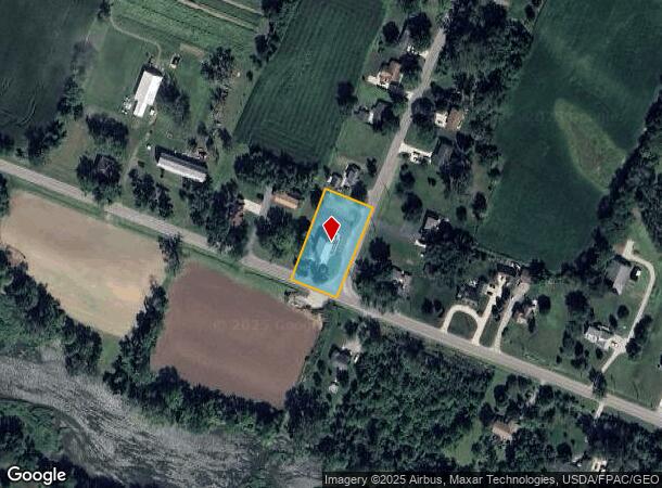
Property Record
4010 N Custer Rd, Monroe, MI 48162

NEARBY LISTINGS FOR SALE OR LEASE
-
-
View all Monroe listings for lease on LoopNet.com
Property Detail
4010 N Custer Rd
Monroe, MI
Suprvrs 1 - Raisinville Townsh
13-460-090-00
R1 SUPERVISORS PLAT NO 1 T6S R8E 1.50 A LD BD N & W BY LD OF MILTON BATHGATE E & S BY HWY.
Commercialnec
Monroe
X
Michigan
26115C0237E
0.42 AC
0
Monroe County
2025
Detroit
830900
DEMOGRAPHICS near 4010 N Custer Rd
1 Mile
3 Mile
5 Mile
2024 Total Population
2,269
15,762
48,488
2029 Population
2,323
16,093
49,232
Pop Growth 2024-2029
+ 2.38%
+ 2.10%
+ 1.53%
Average Age
44
42
42
2024 Total Households
891
6,365
19,851
HH Growth 2024-2029
+ 2.36%
+ 2.04%
+ 1.46%
Median Household Inc
$75,906
$61,267
$60,102
Avg Household Size
2.50
2.40
2.30
2024 Avg HH Vehicles
2.00
2.00
2.00
Median Home Value
$205,476
$186,102
$174,371
Median Year Built
1995
1976
1969
Nearby Places
Map Layers
Map Styles
 Street
 Aerial
- Restaurants
- Banks
- Shops
- Fitness
- Groceries
PUBLIC TRANSPORTATION
AIRPORT
Detroit Metro Wayne County
DRIVE
WALK
Distance
Detroit Metro Wayne County
35 min
26.1 mi
Eugene F Kranz Toledo Express
DRIVE
WALK
Distance
Eugene F Kranz Toledo Express
65 min
44.6 mi
Freight Ports
Port of Toledo
DRIVE
WALK
Distance
Port of Toledo
43 min
27.5 mi
SALE & LEASE HISTORY
LISTING DATE
SALE/LEASE

Nov 17, 2020
For Lease
Nov 17, 2020
For Sale
Nearby Properties
Address
Land Use
TOTAL SIZE
Lot Size
Zoning
Address
Land Use
TOTAL SIZE
Lot Size
Zoning
317,482 SF
20.53 AC
Address
Land Use
TOTAL SIZE
Lot Size
Zoning
3,822 SF
16.60 AC
R-1A
Address
Land Use
TOTAL SIZE
Lot Size
Zoning
41 AC
MHP
Address
Land Use
TOTAL SIZE
Lot Size
Zoning
149,282 SF
7.57 AC
R-1A
Address
Land Use
TOTAL SIZE
Lot Size
Zoning
85,062 SF
9.32 AC
Address
Land Use
TOTAL SIZE
Lot Size
Zoning
59,326 SF
6.21 AC
Address
Land Use
TOTAL SIZE
Lot Size
Zoning
88,131 SF
10.18 AC
R-1A
Address
Land Use
TOTAL SIZE
Lot Size
Zoning
48,117 SF
8.13 AC
R-1A
Address
Land Use
TOTAL SIZE
Lot Size
Zoning
780.27 AC
Address
Land Use
TOTAL SIZE
Lot Size
Zoning
38,011 SF
4.02 AC
R-1A
Address
Land Use
TOTAL SIZE
Lot Size
Zoning
57,022 SF
4 AC
R-1A
Address
Land Use
TOTAL SIZE
Lot Size
Zoning
29,100 SF
2.74 AC
Address
Land Use
TOTAL SIZE
Lot Size
Zoning
69,457 SF
30.30 AC
Address
Land Use
TOTAL SIZE
Lot Size
Zoning
26,864 SF
7.57 AC
Address
Land Use
TOTAL SIZE
Lot Size
Zoning
3,739 SF
64.10 AC
Address
Land Use
TOTAL SIZE
Lot Size
Zoning
29.94 AC
Address
Land Use
TOTAL SIZE
Lot Size
Zoning
55,923 SF
3.12 AC
R-1A
Address
Land Use
TOTAL SIZE
Lot Size
Zoning
9,108 SF
3.47 AC
R-1A
Address
Land Use
TOTAL SIZE
Lot Size
Zoning
63,152 SF
7.45 AC
Address
Land Use
TOTAL SIZE
Lot Size
Zoning
23.07 AC
R-1A
Address
Land Use
TOTAL SIZE
Lot Size
Zoning
4,495 SF
20.93 AC
MHP
Address
Land Use
TOTAL SIZE
Lot Size
Zoning
19,276 SF
3.17 AC
R-1A
Address
Land Use
TOTAL SIZE
Lot Size
Zoning
14,568 SF
141.37 AC
Address
Land Use
TOTAL SIZE
Lot Size
Zoning
11,600 SF
2.36 AC
Address
Land Use
TOTAL SIZE
Lot Size
Zoning
393.82 AC
Address
Land Use
TOTAL SIZE
Lot Size
Zoning
26,725 SF
1.19 AC
R-1A
Address
Land Use
TOTAL SIZE
Lot Size
Zoning
14,045 SF
2.05 AC
Address
Land Use
TOTAL SIZE
Lot Size
Zoning
336 SF
20.93 AC
MHP
Address
Land Use
TOTAL SIZE
Lot Size
Zoning
3,687 SF
3.59 AC
Address
Land Use
TOTAL SIZE
Lot Size
Zoning
6,384 SF
1.45 AC
The World's #1 Commercial Real Estate Marketplace
Connect with us
© 2025 CoStar Group
The information above has been obtained from sources believed reliable. While we do not doubt its accuracy we have not verified it and make no guarantee, warranty or representation about it. It is your responsibility to independently confirm its accuracy and completeness. Any projections, opinions, assumptions, or estimates used are for example only and do not represent the current or future performance of the property. The value of this transaction to you depends on tax and other factors which should be evaluated by your tax, financial, and legal advisors. You and your advisors should conduct a careful, independent investigation of the property to determine to your satisfaction the suitability of the property for your needs.