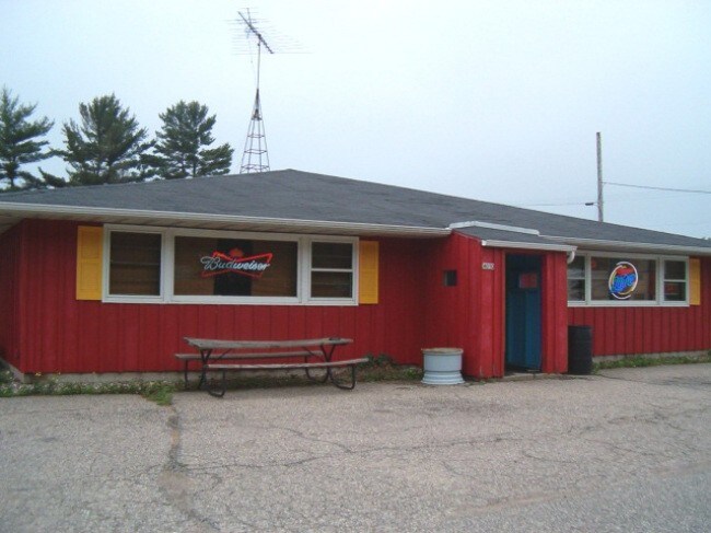
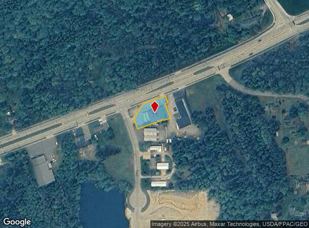
Property Record
4010 Plover Rd, Wisconsin Rapids, WI 54494
NEARBY LISTINGS FOR SALE OR LEASE
Property Detail
4010 Plover Rd
Wisconsin Rapids-Marshfield, WI
S3 T22 R6E LOT 1, WCCSM #10493, BNG LOT 2, WCCSM #7512, & PRT LOT 1, WCCSM #1793, BNG PRT OF SW SE & PRT OF SE SW
0700071D
Wood
Commercialnec
Wisconsin
X
1,2
55141C0392G
0.50 AC
2024
Wausau/Stevens Point
2024
Other Market Areas
011000
DEMOGRAPHICS near 4010 Plover Rd
1 mile
3 mile
5 mile
2024 Total Population
1,065
11,091
28,649
2029 Population
1,063
10,997
28,504
Pop Growth 2024-2029
(0.19%)
(0.85%)
(0.51%)
Average Age
43
41
43
2024 Total Households
503
4,951
12,647
HH Growth 2024-2029
(0.40%)
(0.87%)
(0.54%)
Median Household Inc
$44,564
$52,271
$50,660
Avg Household Size
2.00
2.10
2.20
2024 Avg HH Vehicles
2.00
2.00
2.00
Median Home Value
$174,137
$128,710
$144,839
Median Year Built
1978
1965
1971
Nearby Places
Map Layers
Map Styles
 Street
 Aerial
Transit
 Traffic
 Biking
Places
Listings with unknown addresses are not visible on the map
- Restaurants
- Banks
- Shops
- Fitness
- Groceries
PUBLIC TRANSPORTATION
AIRPORT
Central Wisconsin
Drive
Walk
Distance
Central Wisconsin
49 min
40.1 mi
Nearby Properties
Address
Land Use
TOTAL SIZE
Lot Size
Zoning
Address
Land Use
TOTAL SIZE
Lot Size
Zoning
75.85 AC
Address
Land Use
TOTAL SIZE
Lot Size
Zoning
65.77 AC
Address
Land Use
TOTAL SIZE
Lot Size
Zoning
10.73 AC
Address
Land Use
TOTAL SIZE
Lot Size
Zoning
Address
Land Use
TOTAL SIZE
Lot Size
Zoning
43.73 AC
Address
Land Use
TOTAL SIZE
Lot Size
Zoning
10.08 AC
Address
Land Use
TOTAL SIZE
Lot Size
Zoning
207.12 AC
Address
Land Use
TOTAL SIZE
Lot Size
Zoning
Address
Land Use
TOTAL SIZE
Lot Size
Zoning
Address
Land Use
TOTAL SIZE
Lot Size
Zoning
18.39 AC
Address
Land Use
TOTAL SIZE
Lot Size
Zoning
Address
Land Use
TOTAL SIZE
Lot Size
Zoning
11.02 AC
Address
Land Use
TOTAL SIZE
Lot Size
Zoning
Address
Land Use
TOTAL SIZE
Lot Size
Zoning
Address
Land Use
TOTAL SIZE
Lot Size
Zoning
Address
Land Use
TOTAL SIZE
Lot Size
Zoning
11.08 AC
Address
Land Use
TOTAL SIZE
Lot Size
Zoning
Address
Land Use
TOTAL SIZE
Lot Size
Zoning
Address
Land Use
TOTAL SIZE
Lot Size
Zoning
Address
Land Use
TOTAL SIZE
Lot Size
Zoning
Address
Land Use
TOTAL SIZE
Lot Size
Zoning
Address
Land Use
TOTAL SIZE
Lot Size
Zoning
Address
Land Use
TOTAL SIZE
Lot Size
Zoning
Address
Land Use
TOTAL SIZE
Lot Size
Zoning
Address
Land Use
TOTAL SIZE
Lot Size
Zoning
Address
Land Use
TOTAL SIZE
Lot Size
Zoning
Address
Land Use
TOTAL SIZE
Lot Size
Zoning
Address
Land Use
TOTAL SIZE
Lot Size
Zoning
Address
Land Use
TOTAL SIZE
Lot Size
Zoning
Address
Land Use
TOTAL SIZE
Lot Size
Zoning
The World's #1 Commercial Real Estate Marketplace
Connect with us
© 2026 CoStar Group
The information above has been obtained from sources believed reliable. While we do not doubt its accuracy we have not verified it and make no guarantee, warranty or representation about it. It is your responsibility to independently confirm its accuracy and completeness. Any projections, opinions, assumptions, or estimates used are for example only and do not represent the current or future performance of the property. The value of this transaction to you depends on tax and other factors which should be evaluated by your tax, financial, and legal advisors. You and your advisors should conduct a careful, independent investigation of the property to determine to your satisfaction the suitability of the property for your needs.