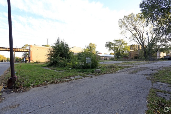
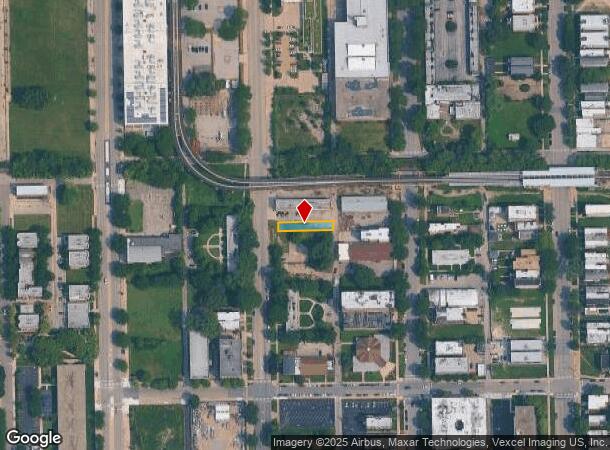
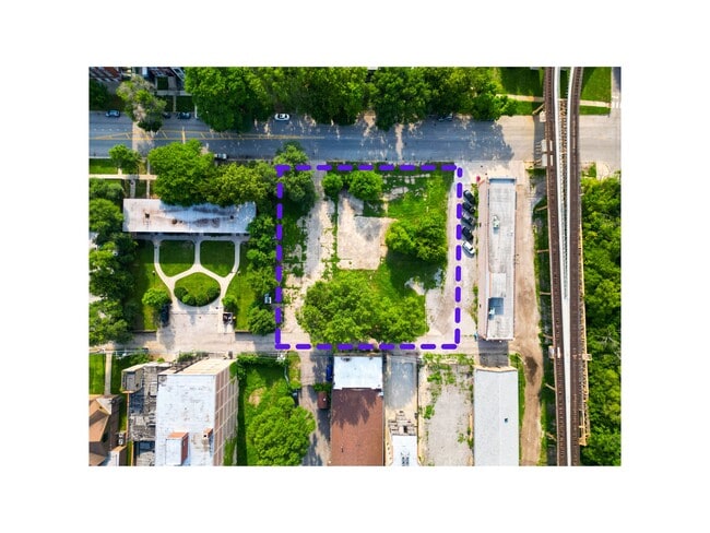
Property Record
4011 S Wabash Ave, Chicago, IL 60653
NEARBY LISTINGS FOR SALE OR LEASE
Property Detail
4011 S Wabash Ave
Chicago-Naperville-Elgin, IL-IN-WI
Pryor & Hopkins
20-03-107-002-0000
Cook
Vacantlandnec
Illinois
X
18-22
17031C0528K
0.92 AC
2023
South Chicago
2024
Chicago
380600
DEMOGRAPHICS near 4011 S Wabash Ave
1 Mile
3 Mile
5 Mile
2024 Total Population
33,381
245,441
692,813
2029 Population
32,406
235,200
665,186
Pop Growth 2024-2029
(2.92%)
(4.17%)
(3.99%)
Average Age
39
38
37
2024 Total Households
14,977
106,729
297,748
HH Growth 2024-2029
(3.17%)
(4.15%)
(3.60%)
Median Household Inc
$33,829
$50,304
$59,504
Avg Household Size
2.10
2.20
2.20
2024 Avg HH Vehicles
1.00
1.00
1.00
Median Home Value
$313,527
$332,193
$312,086
Median Year Built
1971
1956
1962
Nearby Places
Map Layers
Map Styles
 Street
 Aerial
- Restaurants
- Banks
- Shops
- Fitness
- Groceries
PUBLIC TRANSPORTATION
TRANSIT/SUBWAY
Indiana Station (Green Line - Chicago Transit Authority "L" Trains (The "L"))
DRIVE
WALK
Distance
Indiana Station (Green Line - Chicago Transit Authority "L" Trains (The "L"))
1 min
4 min
0.2 mi
43rd Street Station (Green Line - Chicago Transit Authority "L" Trains (The "L"))
DRIVE
WALK
Distance
43rd Street Station (Green Line - Chicago Transit Authority "L" Trains (The "L"))
2 min
12 min
0.6 mi
35th-Bronzeville-IIT Station (Green Line - Chicago Transit Authority "L" Trains (The "L"))
DRIVE
WALK
Distance
35th-Bronzeville-IIT Station (Green Line - Chicago Transit Authority "L" Trains (The "L"))
3 min
18 min
0.9 mi
Sox/35th Street Station (Red Line - Chicago Transit Authority "L" Trains (The "L"))
DRIVE
WALK
Distance
Sox/35th Street Station (Red Line - Chicago Transit Authority "L" Trains (The "L"))
8 min
20 min
1.1 mi
COMMUTER RAIL
DRIVE
WALK
Distance
2 min
17 min
0.9 mi
27th Street Station (Metra Electric Line - Northeast Illinois Regional Commuter Railroad (Metra))
DRIVE
WALK
Distance
27th Street Station (Metra Electric Line - Northeast Illinois Regional Commuter Railroad (Metra))
7 min
2.5 mi
AIRPORT
Chicago Midway International
DRIVE
WALK
Distance
Chicago Midway International
16 min
7.8 mi
Chicago O'Hare International
DRIVE
WALK
Distance
Chicago O'Hare International
34 min
21.8 mi
SALE & LEASE HISTORY
LISTING DATE
SALE/LEASE

Sep 13, 2024
For Sale
Mar 16, 2020
For Sale
Jun 05, 2023
For Sale
Jul 13, 2022
For Sale
Nearby Properties
Address
Land Use
TOTAL SIZE
Lot Size
Zoning
Address
Land Use
TOTAL SIZE
Lot Size
Zoning
1,215,367 SF
3.76 AC
PD 675
Address
Land Use
TOTAL SIZE
Lot Size
Zoning
474,979 SF
29.67 AC
PD 553
Address
Land Use
TOTAL SIZE
Lot Size
Zoning
590,844 SF
0.80 AC
PD 26
Address
Land Use
TOTAL SIZE
Lot Size
Zoning
0.85 AC
DS-3
Address
Land Use
TOTAL SIZE
Lot Size
Zoning
4.11 AC
M2-3
Address
Land Use
TOTAL SIZE
Lot Size
Zoning
1,302,463 SF
3.14 AC
PD 1211
Address
Land Use
TOTAL SIZE
Lot Size
Zoning
3.14 AC
PD 1211
Address
Land Use
TOTAL SIZE
Lot Size
Zoning
548,210 SF
1.11 AC
PD 681
Address
Land Use
TOTAL SIZE
Lot Size
Zoning
111,322 SF
1 AC
DS-5
Address
Land Use
TOTAL SIZE
Lot Size
Zoning
250,040 SF
15.70 AC
PD 1169
Address
Land Use
TOTAL SIZE
Lot Size
Zoning
13.54 AC
Address
Land Use
TOTAL SIZE
Lot Size
Zoning
136,720 SF
0.54 AC
PD 1
Address
Land Use
TOTAL SIZE
Lot Size
Zoning
225,784 SF
0.69 AC
DS-3
Address
Land Use
TOTAL SIZE
Lot Size
Zoning
264,800 SF
0.61 AC
DX-7
Address
Land Use
TOTAL SIZE
Lot Size
Zoning
169,435 SF
11.35 AC
PD 307
Address
Land Use
TOTAL SIZE
Lot Size
Zoning
313,559 SF
PD 1318
Address
Land Use
TOTAL SIZE
Lot Size
Zoning
2.65 AC
PD 38
Address
Land Use
TOTAL SIZE
Lot Size
Zoning
10 AC
PD 1169
Address
Land Use
TOTAL SIZE
Lot Size
Zoning
213,289 SF
0.65 AC
DX-7
Address
Land Use
TOTAL SIZE
Lot Size
Zoning
8.54 AC
PD 1169
Address
Land Use
TOTAL SIZE
Lot Size
Zoning
1,687,020 SF
10.25 AC
PD 1169
Address
Land Use
TOTAL SIZE
Lot Size
Zoning
475,000 SF
14.01 AC
PMD 8
Address
Land Use
TOTAL SIZE
Lot Size
Zoning
304,685 SF
1.11 AC
PD 1218
Address
Land Use
TOTAL SIZE
Lot Size
Zoning
Address
Land Use
TOTAL SIZE
Lot Size
Zoning
633,057 SF
34.96 AC
PMD 8
Address
Land Use
TOTAL SIZE
Lot Size
Zoning
240,400 SF
1.34 AC
PMD 11
Address
Land Use
TOTAL SIZE
Lot Size
Zoning
478,260 SF
2.91 AC
DX-5
Address
Land Use
TOTAL SIZE
Lot Size
Zoning
Address
Land Use
TOTAL SIZE
Lot Size
Zoning
38,214 SF
0.92 AC
C2-3
Address
Land Use
TOTAL SIZE
Lot Size
Zoning
0.51 AC
PD 1002
The World's #1 Commercial Real Estate Marketplace
Connect with us
© 2025 CoStar Group
The information above has been obtained from sources believed reliable. While we do not doubt its accuracy we have not verified it and make no guarantee, warranty or representation about it. It is your responsibility to independently confirm its accuracy and completeness. Any projections, opinions, assumptions, or estimates used are for example only and do not represent the current or future performance of the property. The value of this transaction to you depends on tax and other factors which should be evaluated by your tax, financial, and legal advisors. You and your advisors should conduct a careful, independent investigation of the property to determine to your satisfaction the suitability of the property for your needs.