Property Record
4011 W Pierson Rd, Flint, MI 48504
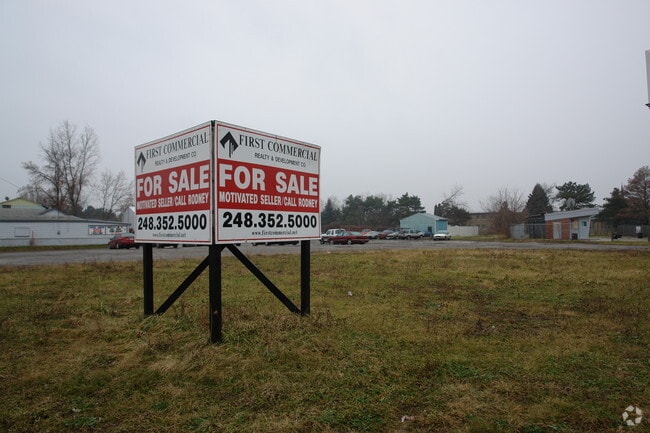

Property Detail
4011 W Pierson Rd
Flint, MI
N 180 FT OF A PARCEL OF LAND BEG AT INTERSECTION OF S LINE OF PIERSON RD AND W LINE OF JENNINGS RD TH S 610 FT TH W 137.5 FT
14-33-200-026
GENESEE
Commercialacreage
Michigan
B and X Area of moderate flood hazard, usually the area between the limits of the 100-year and 500-year floods.
0.98 AC
2024
Flint
2025
Detroit
010501
NEARBY LISTINGS FOR SALE OR LEASE
DEMOGRAPHICS near 4011 W Pierson Rd
1 mile
3 mile
5 mile
2025 Total Population
2,522
47,120
112,390
2030 Population
2,586
48,071
113,739
Pop Growth 2025-2030
+ 2.54%
+ 2.02%
+ 1.20%
Average Age
38
40
40
2025 Total Households
1,014
19,433
46,391
HH Growth 2025-2030
+ 2.47%
+ 2.03%
+ 1.20%
Median Household Inc
$39,914
$38,649
$43,230
Avg Household Size
2.30
2.30
2.30
2025 Avg HH Vehicles
1.00
1.00
1.00
Median Home Value
$61,928
$75,267
$91,549
Median Year Built
1969
1959
1960
Nearby Places
Map Layers
Map Styles
 Street
 Aerial
Layers
 Traffic
 Biking
Places
Listings with unknown addresses are not visible on the map
- Restaurants
- Banks
- Shops
- Fitness
- Groceries
PUBLIC TRANSPORTATION
COMMUTER RAIL
Drive
Walk
Distance
17 min
8.0 mi
AIRPORT
Bishop International
Drive
Walk
Distance
Bishop International
23 min
10.9 mi
MBS International
Drive
Walk
Distance
MBS International
59 min
45.7 mi
Nearby Properties
Address
Land Use
TOTAL SIZE
Lot Size
Zoning
Address
Land Use
TOTAL SIZE
Lot Size
Zoning
571,389 SF
584 AC
Address
Land Use
TOTAL SIZE
Lot Size
Zoning
247,555 SF
198 AC
Address
Land Use
TOTAL SIZE
Lot Size
Zoning
290,502 SF
272.83 AC
Address
Land Use
TOTAL SIZE
Lot Size
Zoning
157,068 SF
160 AC
Address
Land Use
TOTAL SIZE
Lot Size
Zoning
11.97 AC
Address
Land Use
TOTAL SIZE
Lot Size
Zoning
10.30 AC
Address
Land Use
TOTAL SIZE
Lot Size
Zoning
Address
Land Use
TOTAL SIZE
Lot Size
Zoning
59,173 SF
11.43 AC
Address
Land Use
TOTAL SIZE
Lot Size
Zoning
Address
Land Use
TOTAL SIZE
Lot Size
Zoning
224,263 SF
24.98 AC
CC
Address
Land Use
TOTAL SIZE
Lot Size
Zoning
11.12 AC
Address
Land Use
TOTAL SIZE
Lot Size
Zoning
101,744 SF
4.90 AC
TN-2
Address
Land Use
TOTAL SIZE
Lot Size
Zoning
33.39 AC
Address
Land Use
TOTAL SIZE
Lot Size
Zoning
26,106 SF
2.53 AC
Address
Land Use
TOTAL SIZE
Lot Size
Zoning
9.46 AC
Address
Land Use
TOTAL SIZE
Lot Size
Zoning
13.20 AC
Address
Land Use
TOTAL SIZE
Lot Size
Zoning
Address
Land Use
TOTAL SIZE
Lot Size
Zoning
2.45 AC
Address
Land Use
TOTAL SIZE
Lot Size
Zoning
5.10 AC
Address
Land Use
TOTAL SIZE
Lot Size
Zoning
104.81 AC
Address
Land Use
TOTAL SIZE
Lot Size
Zoning
Address
Land Use
TOTAL SIZE
Lot Size
Zoning
5.70 AC
Address
Land Use
TOTAL SIZE
Lot Size
Zoning
2.02 AC
Address
Land Use
TOTAL SIZE
Lot Size
Zoning
70,344 SF
72 AC
Address
Land Use
TOTAL SIZE
Lot Size
Zoning
1.41 AC
Address
Land Use
TOTAL SIZE
Lot Size
Zoning
19.75 AC
Address
Land Use
TOTAL SIZE
Lot Size
Zoning
3.32 AC
Address
Land Use
TOTAL SIZE
Lot Size
Zoning
100,022 SF
92 AC
Address
Land Use
TOTAL SIZE
Lot Size
Zoning
18.66 AC
Address
Land Use
TOTAL SIZE
Lot Size
Zoning
3.52 AC
The World's #1 Commercial Real Estate Marketplace
Connect with us
© 2026 CoStar Group
The information above has been obtained from sources believed reliable. While we do not doubt its accuracy we have not verified it and make no guarantee, warranty or representation about it. It is your responsibility to independently confirm its accuracy and completeness. Any projections, opinions, assumptions, or estimates used are for example only and do not represent the current or future performance of the property. The value of this transaction to you depends on tax and other factors which should be evaluated by your tax, financial, and legal advisors. You and your advisors should conduct a careful, independent investigation of the property to determine to your satisfaction the suitability of the property for your needs.