Property Record
4017 W 42Nd St, Odessa, TX 79764
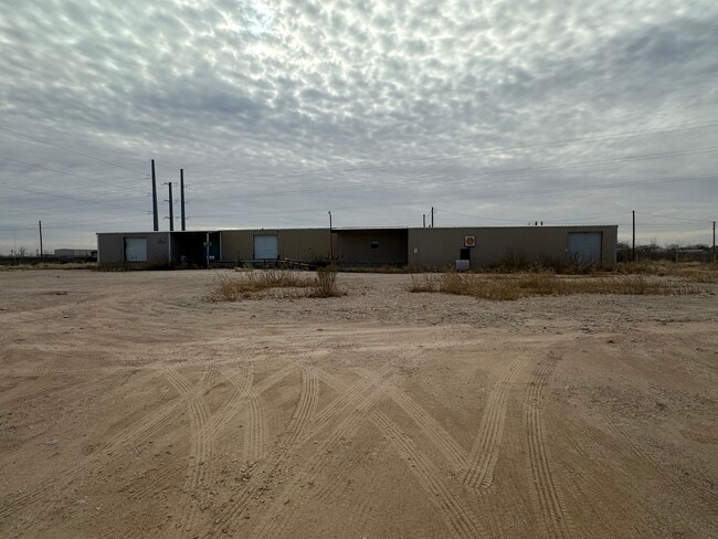
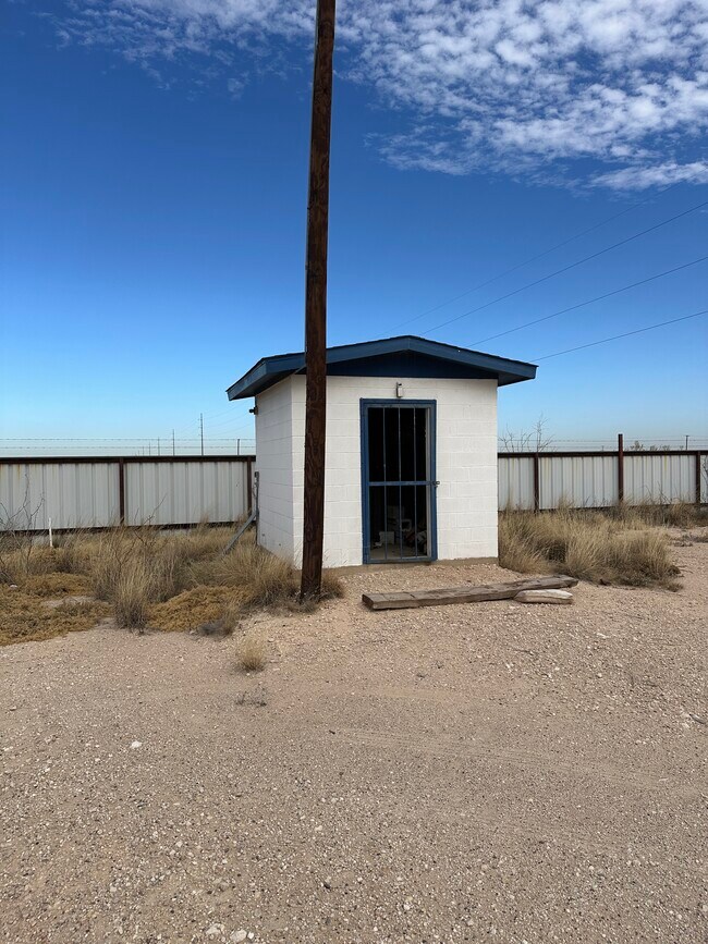
This Property Is For Sale
NEARBY LISTINGS FOR SALE OR LEASE
Property Detail
4017 W 42Nd St
42240-00660-00000
T 2 S T & P Ry Co Survey
Commercialnec
T-2-S BLK 42 SEC 18 (CARD #55)
X
Ector
48135C0335E
Texas
2025
0.66 AC
2025
Midland & Odessa
002701
Other Market Areas
360 SF
Odessa, TX
DEMOGRAPHICS near 4017 W 42Nd St
1 Mile
3 Mile
5 Mile
2024 Total Population
901
30,115
92,793
2029 Population
863
29,345
90,618
Pop Growth 2024-2029
(4.22%)
(2.56%)
(2.34%)
Average Age
34
35
35
2024 Total Households
295
10,556
32,084
HH Growth 2024-2029
(4.75%)
(2.92%)
(2.71%)
Median Household Inc
$39,264
$46,246
$54,327
Avg Household Size
2.90
2.80
2.80
2024 Avg HH Vehicles
3.00
2.00
2.00
Median Home Value
$216,667
$121,465
$134,798
Median Year Built
1979
1975
1973
Nearby Places
- Restaurants
- Banks
- Shops
- Fitness
- Groceries
PUBLIC TRANSPORTATION
AIRPORT
Midland International Air And Space Port
DRIVE
WALK
Distance
Midland International Air And Space Port
26 min
17.7 mi
Freight Ports
Port of Corpus Christi
DRIVE
WALK
Distance
Port of Corpus Christi
507 min
488.3 mi
Nearby Properties
Address
Land Use
TOTAL SIZE
Lot Size
Zoning
Address
Land Use
TOTAL SIZE
Lot Size
Zoning
22,304 SF
67.42 AC
EB4
Address
Land Use
TOTAL SIZE
Lot Size
Zoning
2,268 SF
15.91 AC
EB2
Address
Land Use
TOTAL SIZE
Lot Size
Zoning
155,744 SF
49.20 AC
EA7
Address
Land Use
TOTAL SIZE
Lot Size
Zoning
214,832 SF
10.42 AC
EB5
Address
Land Use
TOTAL SIZE
Lot Size
Zoning
109,381 SF
16.74 AC
EB3
Address
Land Use
TOTAL SIZE
Lot Size
Zoning
Address
Land Use
TOTAL SIZE
Lot Size
Zoning
186,791 SF
20.40 AC
EB3
Address
Land Use
TOTAL SIZE
Lot Size
Zoning
16,800 SF
91.80 AC
EA7
Address
Land Use
TOTAL SIZE
Lot Size
Zoning
70,997 SF
11.08 AC
EB1
Address
Land Use
TOTAL SIZE
Lot Size
Zoning
119,772 SF
9.62 AC
EB4
Address
Land Use
TOTAL SIZE
Lot Size
Zoning
73,170 SF
7.02 AC
EB3
Address
Land Use
TOTAL SIZE
Lot Size
Zoning
61,292 SF
13.59 AC
EB3
Address
Land Use
TOTAL SIZE
Lot Size
Zoning
3,039 SF
6.02 AC
EB2
Address
Land Use
TOTAL SIZE
Lot Size
Zoning
91,263 SF
9.18 AC
EB3
Address
Land Use
TOTAL SIZE
Lot Size
Zoning
10,509 SF
7.74 AC
EB2
Address
Land Use
TOTAL SIZE
Lot Size
Zoning
Address
Land Use
TOTAL SIZE
Lot Size
Zoning
31,200 SF
2.44 AC
EA6
Address
Land Use
TOTAL SIZE
Lot Size
Zoning
61,730 SF
12.03 AC
EB3
Address
Land Use
TOTAL SIZE
Lot Size
Zoning
6,696 SF
9.25 AC
EW1
Address
Land Use
TOTAL SIZE
Lot Size
Zoning
4,485 SF
4.78 AC
EB3
Address
Land Use
TOTAL SIZE
Lot Size
Zoning
64,008 SF
3.71 AC
EB3
Address
Land Use
TOTAL SIZE
Lot Size
Zoning
51,302 SF
2.94 AC
EB2
Address
Land Use
TOTAL SIZE
Lot Size
Zoning
74,637 SF
10.13 AC
EB5
Address
Land Use
TOTAL SIZE
Lot Size
Zoning
56,526 SF
5.10 AC
EB4
Address
Land Use
TOTAL SIZE
Lot Size
Zoning
129,895 SF
10.05 AC
ED4
Address
Land Use
TOTAL SIZE
Lot Size
Zoning
12,487 SF
2.96 AC
EB1
Address
Land Use
TOTAL SIZE
Lot Size
Zoning
44,576 SF
4.48 AC
ED1
Address
Land Use
TOTAL SIZE
Lot Size
Zoning
24,386 SF
9.99 AC
EB5
Address
Land Use
TOTAL SIZE
Lot Size
Zoning
8,266 SF
8.91 AC
ES2
Address
Land Use
TOTAL SIZE
Lot Size
Zoning
57,485 SF
7.64 AC
EB3
The World's #1 Commercial Real Estate Marketplace
Connect with us
© 2025 CoStar Group
The information above has been obtained from sources believed reliable. While we do not doubt its accuracy we have not verified it and make no guarantee, warranty or representation about it. It is your responsibility to independently confirm its accuracy and completeness. Any projections, opinions, assumptions, or estimates used are for example only and do not represent the current or future performance of the property. The value of this transaction to you depends on tax and other factors which should be evaluated by your tax, financial, and legal advisors. You and your advisors should conduct a careful, independent investigation of the property to determine to your satisfaction the suitability of the property for your needs.