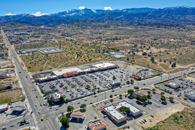
Property Record
4013 Phelan Rd, Phelan, CA 92371
NEARBY LISTINGS FOR SALE OR LEASE
Property Detail
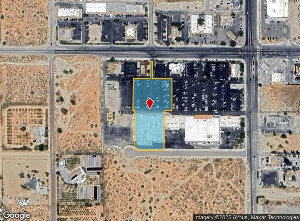
4013 Phelan Rd
3066-221-20
Pm 12741
Storebuilding
PARCEL MAP 12741 PARCEL 3
AO
San Bernardino
06071C6450H
California
2024
2.41 AC
2025
Mojave River Valley
009109
Inland Empire (California)
31,680 SF
Riverside-San Bernardino-Ontario, CA
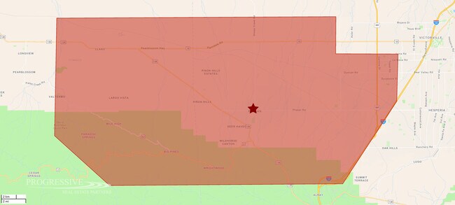
DEMOGRAPHICS near 4013 Phelan Rd
1 Mile
3 Mile
5 Mile
2024 Total Population
1,094
7,338
14,774
2029 Population
1,076
7,129
14,364
Pop Growth 2024-2029
(1.65%)
(2.85%)
(2.78%)
Average Age
41
41
41
2024 Total Households
391
2,562
5,055
HH Growth 2024-2029
(1.53%)
(2.89%)
(2.83%)
Median Household Inc
$55,564
$62,735
$66,581
Avg Household Size
2.80
2.80
2.90
2024 Avg HH Vehicles
2.00
2.00
3.00
Median Home Value
$363,809
$368,749
$362,134
Median Year Built
1979
1986
1987
Nearby Places
Map Layers
Map Styles
 Street
 Aerial
- Restaurants
- Banks
- Shops
- Fitness
- Groceries
PUBLIC TRANSPORTATION
AIRPORT
Ontario International
DRIVE
WALK
Distance
Ontario International
49 min
37.6 mi
Freight Ports
Port of Long Beach
DRIVE
WALK
Distance
Port of Long Beach
111 min
89.7 mi
SALE & LEASE HISTORY
LISTING DATE
SALE/LEASE

Mar 25, 2024
For Sale
Jun 15, 2018
For Lease
Nearby Properties
Address
Land Use
TOTAL SIZE
Lot Size
Zoning
Address
Land Use
TOTAL SIZE
Lot Size
Zoning
74,347 SF
5.09 AC
PHCG
Address
Land Use
TOTAL SIZE
Lot Size
Zoning
17,215 SF
1.78 AC
Address
Land Use
TOTAL SIZE
Lot Size
Zoning
37,358 SF
5.64 AC
PHCG
Address
Land Use
TOTAL SIZE
Lot Size
Zoning
36,198 SF
3.24 AC
PHCG
Address
Land Use
TOTAL SIZE
Lot Size
Zoning
2,952 SF
0.96 AC
PHCG
Address
Land Use
TOTAL SIZE
Lot Size
Zoning
25,538 SF
4.61 AC
PHCG
Address
Land Use
TOTAL SIZE
Lot Size
Zoning
9,015 SF
1.86 AC
PHCG
Address
Land Use
TOTAL SIZE
Lot Size
Zoning
3,107 SF
0.80 AC
PHCG
Address
Land Use
TOTAL SIZE
Lot Size
Zoning
12,960 SF
1.16 AC
PHCG
Address
Land Use
TOTAL SIZE
Lot Size
Zoning
22,965 SF
2.92 AC
PHCS
Address
Land Use
TOTAL SIZE
Lot Size
Zoning
4,998 SF
3.01 AC
PHSDRES
Address
Land Use
TOTAL SIZE
Lot Size
Zoning
9,543 SF
1.04 AC
PHCG
Address
Land Use
TOTAL SIZE
Lot Size
Zoning
14,433 SF
2.04 AC
PHCG
Address
Land Use
TOTAL SIZE
Lot Size
Zoning
2,450 SF
0.85 AC
PHCG
Address
Land Use
TOTAL SIZE
Lot Size
Zoning
4,842 SF
1.26 AC
PHCG
Address
Land Use
TOTAL SIZE
Lot Size
Zoning
10,282 SF
5 AC
PHCG
Address
Land Use
TOTAL SIZE
Lot Size
Zoning
12,608 SF
1.76 AC
PHCG
Address
Land Use
TOTAL SIZE
Lot Size
Zoning
8,466 SF
0.90 AC
PHCG
Address
Land Use
TOTAL SIZE
Lot Size
Zoning
4,130 SF
1.04 AC
PHCG
Address
Land Use
TOTAL SIZE
Lot Size
Zoning
11,429 SF
4.52 AC
PHRS1
Address
Land Use
TOTAL SIZE
Lot Size
Zoning
1,740 SF
0.48 AC
PHCG
Address
Land Use
TOTAL SIZE
Lot Size
Zoning
1,222 SF
53.12 AC
PHRL
Address
Land Use
TOTAL SIZE
Lot Size
Zoning
5,360 SF
0.84 AC
PHCG
Address
Land Use
TOTAL SIZE
Lot Size
Zoning
3,176 SF
0.42 AC
PHCG
Address
Land Use
TOTAL SIZE
Lot Size
Zoning
8.43 AC
PHCG
Address
Land Use
TOTAL SIZE
Lot Size
Zoning
864 SF
2.50 AC
PHRL
Address
Land Use
TOTAL SIZE
Lot Size
Zoning
11,831 SF
25.27 AC
PHCS
Address
Land Use
TOTAL SIZE
Lot Size
Zoning
9.43 AC
PHCG
The World's #1 Commercial Real Estate Marketplace
Connect with us
© 2026 CoStar Group
The information above has been obtained from sources believed reliable. While we do not doubt its accuracy we have not verified it and make no guarantee, warranty or representation about it. It is your responsibility to independently confirm its accuracy and completeness. Any projections, opinions, assumptions, or estimates used are for example only and do not represent the current or future performance of the property. The value of this transaction to you depends on tax and other factors which should be evaluated by your tax, financial, and legal advisors. You and your advisors should conduct a careful, independent investigation of the property to determine to your satisfaction the suitability of the property for your needs.