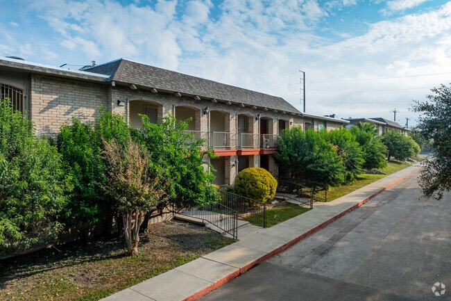
Property Record
4015 Callaghan Rd, San Antonio, TX 78228

Property Detail
4015 Callaghan Rd
San Antonio-New Braunfels, TX
NCB 14538 BLK 8 LOT 31 (TOWN VIEW ESTATES UT-2A)
14538-008-0310
BEXAR
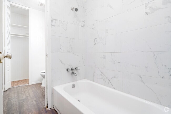
Multifamilydwelling
Texas
B and X Area of moderate flood hazard, usually the area between the limits of the 100-year and 500-year floods.
31
2024
5.80 AC
2025
Thunderbird Hills
181602
San Antonio
69,648 SF
NEARBY LISTINGS FOR SALE OR LEASE
DEMOGRAPHICS near 4015 Callaghan Rd
1 mile
3 mile
5 mile
2025 Total Population
15,938
118,082
365,841
2030 Population
16,576
123,148
382,550
Pop Growth 2025-2030
+ 4.00%
+ 4.29%
+ 4.57%
Average Age
40
37
37
2025 Total Households
5,780
44,189
139,951
HH Growth 2025-2030
+ 4.24%
+ 4.49%
+ 4.80%
Median Household Inc
$47,230
$51,738
$54,560
Avg Household Size
2.70
2.60
2.50
2025 Avg HH Vehicles
2.00
2.00
2.00
Median Home Value
$185,596
$203,260
$212,557
Median Year Built
1976
1977
1981
Nearby Places
Map Layers
Map Styles
 Street
 Aerial
Layers
 Traffic
 Biking
Places
Listings with unknown addresses are not visible on the map
- Restaurants
- Banks
- Shops
- Fitness
- Groceries
PUBLIC TRANSPORTATION
COMMUTER RAIL
San Antonio Amtrak Station (Sunset Limited - Amtrak, Texas Eagle - Amtrak)
Drive
Walk
Distance
San Antonio Amtrak Station (Sunset Limited - Amtrak, Texas Eagle - Amtrak)
18 min
9.7 mi
AIRPORT
San Antonio International
Drive
Walk
Distance
San Antonio International
15 min
10.0 mi
Freight Ports
Calhoun Port
Drive
Walk
Distance
Calhoun Port
192 min
155.7 mi
Nearby Properties
Address
Land Use
TOTAL SIZE
Lot Size
Zoning
Address
Land Use
TOTAL SIZE
Lot Size
Zoning
593,760 SF
69.28 AC
Address
Land Use
TOTAL SIZE
Lot Size
Zoning
370,870 SF
27.27 AC
Address
Land Use
TOTAL SIZE
Lot Size
Zoning
541,776 SF
22.15 AC
Address
Land Use
TOTAL SIZE
Lot Size
Zoning
118,393 SF
28.05 AC
Address
Land Use
TOTAL SIZE
Lot Size
Zoning
109,425 SF
30.63 AC
Address
Land Use
TOTAL SIZE
Lot Size
Zoning
324,044 SF
16.87 AC
Address
Land Use
TOTAL SIZE
Lot Size
Zoning
326,820 SF
12.57 AC
Address
Land Use
TOTAL SIZE
Lot Size
Zoning
284,359 SF
21.53 AC
Address
Land Use
TOTAL SIZE
Lot Size
Zoning
213,968 SF
21.30 AC
Address
Land Use
TOTAL SIZE
Lot Size
Zoning
253,862 SF
14.78 AC
Address
Land Use
TOTAL SIZE
Lot Size
Zoning
285,150 SF
13.62 AC
Address
Land Use
TOTAL SIZE
Lot Size
Zoning
228,973 SF
11.23 AC
Address
Land Use
TOTAL SIZE
Lot Size
Zoning
340,653 SF
19.27 AC
Address
Land Use
TOTAL SIZE
Lot Size
Zoning
243,251 SF
10 AC
Address
Land Use
TOTAL SIZE
Lot Size
Zoning
161,000 SF
10.32 AC
Address
Land Use
TOTAL SIZE
Lot Size
Zoning
536,162 SF
25.11 AC
Address
Land Use
TOTAL SIZE
Lot Size
Zoning
291,385 SF
16.19 AC
Address
Land Use
TOTAL SIZE
Lot Size
Zoning
388,553 SF
29 AC
Address
Land Use
TOTAL SIZE
Lot Size
Zoning
441,830 SF
21.50 AC
Address
Land Use
TOTAL SIZE
Lot Size
Zoning
291,713 SF
14.51 AC
Address
Land Use
TOTAL SIZE
Lot Size
Zoning
66,404 SF
44.45 AC
Address
Land Use
TOTAL SIZE
Lot Size
Zoning
302,836 SF
15.96 AC
Address
Land Use
TOTAL SIZE
Lot Size
Zoning
279,178 SF
14.87 AC
Address
Land Use
TOTAL SIZE
Lot Size
Zoning
72.43 AC
Address
Land Use
TOTAL SIZE
Lot Size
Zoning
125,264 SF
8.81 AC
Address
Land Use
TOTAL SIZE
Lot Size
Zoning
125,264 SF
6.98 AC
Address
Land Use
TOTAL SIZE
Lot Size
Zoning
240,269 SF
11.62 AC
Address
Land Use
TOTAL SIZE
Lot Size
Zoning
252,361 SF
14.35 AC
Address
Land Use
TOTAL SIZE
Lot Size
Zoning
Address
Land Use
TOTAL SIZE
Lot Size
Zoning
211,255 SF
12.36 AC
The World's #1 Commercial Real Estate Marketplace
Connect with us
© 2026 CoStar Group
The information above has been obtained from sources believed reliable. While we do not doubt its accuracy we have not verified it and make no guarantee, warranty or representation about it. It is your responsibility to independently confirm its accuracy and completeness. Any projections, opinions, assumptions, or estimates used are for example only and do not represent the current or future performance of the property. The value of this transaction to you depends on tax and other factors which should be evaluated by your tax, financial, and legal advisors. You and your advisors should conduct a careful, independent investigation of the property to determine to your satisfaction the suitability of the property for your needs.