Property Record
4015 Capitola Rd, Capitola, CA 95010
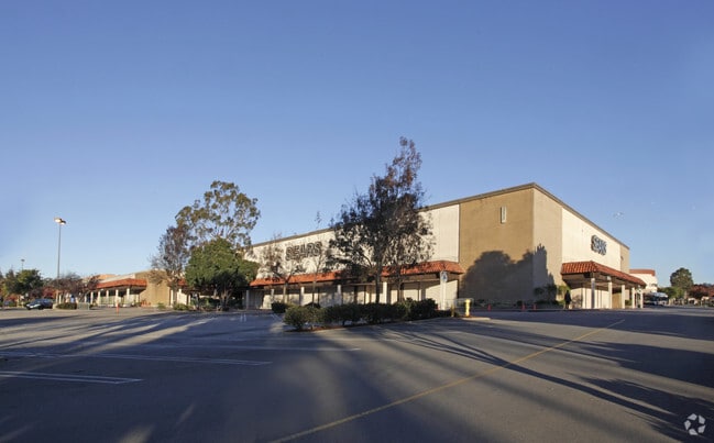

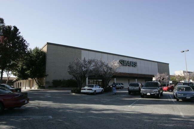
Property Detail
4015 Capitola Rd
034-261-40-000
SANTA CRUZ
Regionalshoppingcenterormallwithanchorstore
California
B and X Area of moderate flood hazard, usually the area between the limits of the 100-year and 500-year floods.
10.05 AC
2024
Mid-County
2025
Santa Cruz/Watsonville
121802
Santa Cruz-Watsonville, CA
NEARBY LISTINGS FOR SALE OR LEASE
DEMOGRAPHICS near 4015 Capitola Rd
1 mile
3 mile
5 mile
2025 Total Population
22,113
73,092
124,077
2030 Population
21,991
72,348
122,833
Pop Growth 2025-2030
(0.55%)
(1.02%)
(1.00%)
Average Age
44
44
43
2025 Total Households
9,240
30,330
50,114
HH Growth 2025-2030
(0.73%)
(1.18%)
(1.20%)
Median Household Inc
$98,288
$107,498
$110,270
Avg Household Size
2.30
2.30
2.30
2025 Avg HH Vehicles
2.00
2.00
2.00
Median Home Value
$923,912
$1,029,339
$1,057,369
Median Year Built
1974
1972
1972
Nearby Places
Map Layers
Map Styles
 Street
 Aerial
Layers
 Traffic
 Biking
Places
Listings with unknown addresses are not visible on the map
- Restaurants
- Banks
- Shops
- Fitness
- Groceries
PUBLIC TRANSPORTATION
AIRPORT
Norman Y Mineta San Jose International
Drive
Walk
Distance
Norman Y Mineta San Jose International
48 min
35.0 mi
Monterey Regional
Drive
Walk
Distance
Monterey Regional
49 min
39.6 mi
Freight Ports
Port of Redwood City
Drive
Walk
Distance
Port of Redwood City
68 min
50.8 mi
SALE & LEASE HISTORY
LISTING DATE
SALE/LEASE

May 09, 2018
For Lease
Dec 01, 2016
For Lease
Aug 13, 2019
For Lease
Nearby Properties
Address
Land Use
TOTAL SIZE
Lot Size
Zoning
Address
Land Use
TOTAL SIZE
Lot Size
Zoning
18.67 AC
PF
Address
Land Use
TOTAL SIZE
Lot Size
Zoning
135,803 SF
56.45 AC
PR
Address
Land Use
TOTAL SIZE
Lot Size
Zoning
3.46 AC
PF
Address
Land Use
TOTAL SIZE
Lot Size
Zoning
82,820 SF
4.64 AC
RM-3
Address
Land Use
TOTAL SIZE
Lot Size
Zoning
53,988 SF
2.36 AC
C-1
Address
Land Use
TOTAL SIZE
Lot Size
Zoning
76,552 SF
3.34 AC
Address
Land Use
TOTAL SIZE
Lot Size
Zoning
133,825 SF
8.22 AC
Address
Land Use
TOTAL SIZE
Lot Size
Zoning
84,533 SF
2.62 AC
RM-2.5
Address
Land Use
TOTAL SIZE
Lot Size
Zoning
Address
Land Use
TOTAL SIZE
Lot Size
Zoning
50,511 SF
2.54 AC
RM-3-H
Address
Land Use
TOTAL SIZE
Lot Size
Zoning
1.46 AC
Address
Land Use
TOTAL SIZE
Lot Size
Zoning
2,571 SF
14.40 AC
C-2
Address
Land Use
TOTAL SIZE
Lot Size
Zoning
128,853 SF
3.54 AC
Address
Land Use
TOTAL SIZE
Lot Size
Zoning
5,434 SF
0.42 AC
Address
Land Use
TOTAL SIZE
Lot Size
Zoning
1,535 SF
10.11 AC
C-2
Address
Land Use
TOTAL SIZE
Lot Size
Zoning
75,000 SF
5.99 AC
Address
Land Use
TOTAL SIZE
Lot Size
Zoning
55,012 SF
6.77 AC
Address
Land Use
TOTAL SIZE
Lot Size
Zoning
19,652 SF
2.53 AC
PA
Address
Land Use
TOTAL SIZE
Lot Size
Zoning
59,950 SF
1.16 AC
Address
Land Use
TOTAL SIZE
Lot Size
Zoning
66,513 SF
5.53 AC
RM-3-MH
Address
Land Use
TOTAL SIZE
Lot Size
Zoning
72,679 SF
0.93 AC
Address
Land Use
TOTAL SIZE
Lot Size
Zoning
102,976 SF
2.06 AC
C-4
Address
Land Use
TOTAL SIZE
Lot Size
Zoning
0.83 AC
Address
Land Use
TOTAL SIZE
Lot Size
Zoning
82,075 SF
4.59 AC
Address
Land Use
TOTAL SIZE
Lot Size
Zoning
174,153 SF
3.72 AC
RM-2.5
Address
Land Use
TOTAL SIZE
Lot Size
Zoning
2.59 AC
Address
Land Use
TOTAL SIZE
Lot Size
Zoning
41,289 SF
4.11 AC
C-4
Address
Land Use
TOTAL SIZE
Lot Size
Zoning
52,118 SF
2.18 AC
Address
Land Use
TOTAL SIZE
Lot Size
Zoning
13,793 SF
7.42 AC
The World's #1 Commercial Real Estate Marketplace
Connect with us
© 2026 CoStar Group
The information above has been obtained from sources believed reliable. While we do not doubt its accuracy we have not verified it and make no guarantee, warranty or representation about it. It is your responsibility to independently confirm its accuracy and completeness. Any projections, opinions, assumptions, or estimates used are for example only and do not represent the current or future performance of the property. The value of this transaction to you depends on tax and other factors which should be evaluated by your tax, financial, and legal advisors. You and your advisors should conduct a careful, independent investigation of the property to determine to your satisfaction the suitability of the property for your needs.