Property Record
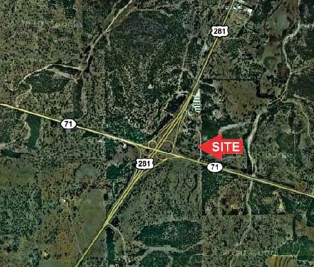
4015 S Us Highway 281, Marble Falls, TX 78654
Property Detail
4015 S Us Highway 281
50436
ABS A0304 GUADALUPE FLORES, 7.67 ACRES
Commercialnec
BURNET
B and X Area of moderate flood hazard, usually the area between the limits of the 100-year and 500-year floods.
Texas
2024
7.67 AC
2025
Marble Falls
960802
Other Market Areas
7,496 SF
NEARBY LISTINGS FOR SALE OR LEASE
DEMOGRAPHICS near 4015 S Us Highway 281
1 mile
3 mile
5 mile
2025 Total Population
249
1,310
12,218
2030 Population
277
1,461
13,484
Pop Growth 2025-2030
+ 11.24%
+ 11.53%
+ 10.36%
Average Age
42
44
45
2025 Total Households
101
533
5,204
HH Growth 2025-2030
+ 11.88%
+ 11.63%
+ 10.30%
Median Household Inc
$77,143
$80,016
$73,963
Avg Household Size
2.40
2.40
2.30
2025 Avg HH Vehicles
2.00
2.00
2.00
Median Home Value
$383,333
$467,142
$381,381
Median Year Built
2008
2010
1999
Nearby Places
Map Layers
Map Styles
 Street
 Aerial
Layers
 Traffic
 Biking
Places
Listings with unknown addresses are not visible on the map
- Restaurants
- Banks
- Shops
- Fitness
- Groceries
Nearby Properties
Address
Land Use
TOTAL SIZE
Lot Size
Zoning
Address
Land Use
TOTAL SIZE
Lot Size
Zoning
430,494 SF
20.19 AC
Address
Land Use
TOTAL SIZE
Lot Size
Zoning
180,558 SF
25.18 AC
Address
Land Use
TOTAL SIZE
Lot Size
Zoning
265,088 SF
13.23 AC
Address
Land Use
TOTAL SIZE
Lot Size
Zoning
152,379 SF
7.57 AC
Address
Land Use
TOTAL SIZE
Lot Size
Zoning
67,050 SF
Address
Land Use
TOTAL SIZE
Lot Size
Zoning
727.66 AC
Address
Land Use
TOTAL SIZE
Lot Size
Zoning
211.16 AC
Address
Land Use
TOTAL SIZE
Lot Size
Zoning
26.55 AC
Address
Land Use
TOTAL SIZE
Lot Size
Zoning
21.16 AC
Address
Land Use
TOTAL SIZE
Lot Size
Zoning
17,275 SF
10.30 AC
Address
Land Use
TOTAL SIZE
Lot Size
Zoning
10,748 SF
2.45 AC
Address
Land Use
TOTAL SIZE
Lot Size
Zoning
11,010 SF
1.44 AC
Address
Land Use
TOTAL SIZE
Lot Size
Zoning
71,413 SF
5 AC
Address
Land Use
TOTAL SIZE
Lot Size
Zoning
Address
Land Use
TOTAL SIZE
Lot Size
Zoning
10,236 SF
6.50 AC
Address
Land Use
TOTAL SIZE
Lot Size
Zoning
2,305 SF
4.60 AC
Address
Land Use
TOTAL SIZE
Lot Size
Zoning
558 SF
12.12 AC
Address
Land Use
TOTAL SIZE
Lot Size
Zoning
11.71 AC
Address
Land Use
TOTAL SIZE
Lot Size
Zoning
134.62 AC
Address
Land Use
TOTAL SIZE
Lot Size
Zoning
2,494 SF
9.62 AC
Address
Land Use
TOTAL SIZE
Lot Size
Zoning
6,829 SF
10 AC
Address
Land Use
TOTAL SIZE
Lot Size
Zoning
4,609 SF
10.67 AC
Address
Land Use
TOTAL SIZE
Lot Size
Zoning
6,687 SF
2.27 AC
Address
Land Use
TOTAL SIZE
Lot Size
Zoning
Address
Land Use
TOTAL SIZE
Lot Size
Zoning
4,944 SF
14.98 AC
Address
Land Use
TOTAL SIZE
Lot Size
Zoning
300 SF
24.49 AC
Address
Land Use
TOTAL SIZE
Lot Size
Zoning
20,073 SF
4.54 AC
Address
Land Use
TOTAL SIZE
Lot Size
Zoning
4,300 SF
1.28 AC
The World's #1 Commercial Real Estate Marketplace
Connect with us
© 2026 CoStar Group
The information above has been obtained from sources believed reliable. While we do not doubt its accuracy we have not verified it and make no guarantee, warranty or representation about it. It is your responsibility to independently confirm its accuracy and completeness. Any projections, opinions, assumptions, or estimates used are for example only and do not represent the current or future performance of the property. The value of this transaction to you depends on tax and other factors which should be evaluated by your tax, financial, and legal advisors. You and your advisors should conduct a careful, independent investigation of the property to determine to your satisfaction the suitability of the property for your needs.