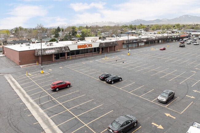
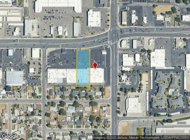
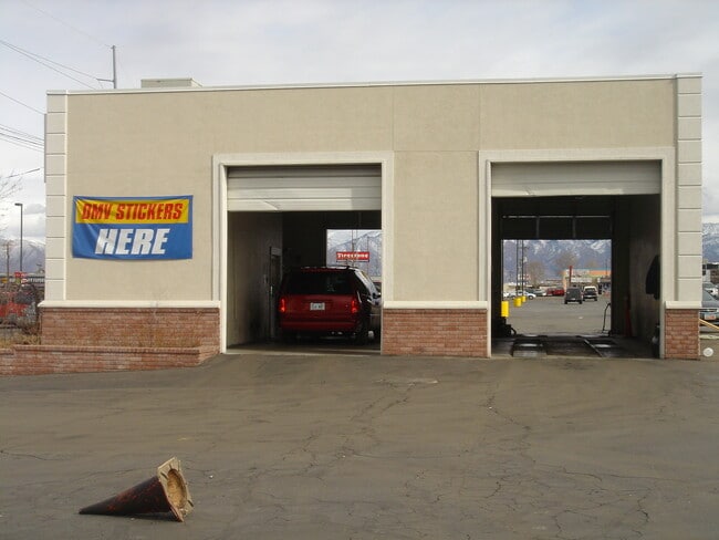
Property Record
4041 W 5415 S, Salt Lake City, UT 84118
Current Lease Availabilities
NEARBY LISTINGS FOR SALE OR LEASE
Property Detail
4041 W 5415 S
21-18-229-014-0000
Radius Curve
Regionalshoppingcenterormallwithanchorstore
BEG N 895904 W 147.1 FT & S 00530 W 139.8 FT & N 895430 W 199.65 FT FR NE COR SEC 18, T2S, R1W, SLM; N 895430 W 125.84 FT; S 00530 W 375 FT; N 895430 E 125.84 FT; N 00530 E 375 FT TO BEG. LESS & EXCEPT BEG N 895904 W 147.10 FT & S 00530 W 159.80 FT &
X
Salt Lake
49035C0290G
Utah
2024
1.01 AC
2025
Central Valley West
113701
Salt Lake City
9,100 SF
Salt Lake City, UT
DEMOGRAPHICS near 4041 W 5415 S
1 Mile
3 Mile
5 Mile
2024 Total Population
22,938
167,743
366,739
2029 Population
23,512
170,141
370,989
Pop Growth 2024-2029
+ 2.50%
+ 1.43%
+ 1.16%
Average Age
36
36
36
2024 Total Households
6,774
49,234
111,186
HH Growth 2024-2029
+ 2.36%
+ 1.38%
+ 1.12%
Median Household Inc
$68,702
$80,981
$79,468
Avg Household Size
3.30
3.30
3.20
2024 Avg HH Vehicles
2.00
2.00
2.00
Median Home Value
$305,607
$357,615
$366,791
Median Year Built
1976
1982
1987
Nearby Places
- Restaurants
- Banks
- Shops
- Fitness
- Groceries
PUBLIC TRANSPORTATION
AIRPORT
Salt Lake City International
DRIVE
WALK
Distance
Salt Lake City International
16 min
9.9 mi
Freight Ports
Port of Stockton
DRIVE
WALK
Distance
Port of Stockton
716 min
696.4 mi
Nearby Properties
Address
Land Use
TOTAL SIZE
Lot Size
Zoning
Address
Land Use
TOTAL SIZE
Lot Size
Zoning
895,175 SF
28.95 AC
SSD-X
Address
Land Use
TOTAL SIZE
Lot Size
Zoning
187.81 AC
P-F
Address
Land Use
TOTAL SIZE
Lot Size
Zoning
329,306 SF
14.67 AC
5005
Address
Land Use
TOTAL SIZE
Lot Size
Zoning
382,335 SF
63.87 AC
OS
Address
Land Use
TOTAL SIZE
Lot Size
Zoning
123,864 SF
6.75 AC
C-2
Address
Land Use
TOTAL SIZE
Lot Size
Zoning
178,102 SF
15.95 AC
C-3
Address
Land Use
TOTAL SIZE
Lot Size
Zoning
114.79 AC
PF
Address
Land Use
TOTAL SIZE
Lot Size
Zoning
187,717 SF
15.02 AC
R-M
Address
Land Use
TOTAL SIZE
Lot Size
Zoning
63,758 SF
13.93 AC
RM
Address
Land Use
TOTAL SIZE
Lot Size
Zoning
40,042 SF
15.43 AC
R-3-16
Address
Land Use
TOTAL SIZE
Lot Size
Zoning
250,027 SF
8.46 AC
PF
Address
Land Use
TOTAL SIZE
Lot Size
Zoning
57,772 SF
8.09 AC
MU
Address
Land Use
TOTAL SIZE
Lot Size
Zoning
186,337 SF
20 AC
1107
Address
Land Use
TOTAL SIZE
Lot Size
Zoning
603,730 SF
31.77 AC
PO
Address
Land Use
TOTAL SIZE
Lot Size
Zoning
314,994 SF
10 AC
R-3
Address
Land Use
TOTAL SIZE
Lot Size
Zoning
330,834 SF
7.60 AC
R-1-8
Address
Land Use
TOTAL SIZE
Lot Size
Zoning
80 AC
PF
Address
Land Use
TOTAL SIZE
Lot Size
Zoning
297,972 SF
45.67 AC
M
Address
Land Use
TOTAL SIZE
Lot Size
Zoning
72 AC
2000
Address
Land Use
TOTAL SIZE
Lot Size
Zoning
65,853 SF
13.26 AC
R-M
Address
Land Use
TOTAL SIZE
Lot Size
Zoning
72,730 SF
8.34 AC
C-3
Address
Land Use
TOTAL SIZE
Lot Size
Zoning
71,093 SF
29.58 AC
PF
Address
Land Use
TOTAL SIZE
Lot Size
Zoning
67,552 SF
7.76 AC
R-M
Address
Land Use
TOTAL SIZE
Lot Size
Zoning
205,091 SF
15.71 AC
R-3-16
Address
Land Use
TOTAL SIZE
Lot Size
Zoning
281,172 SF
12.91 AC
MI
Address
Land Use
TOTAL SIZE
Lot Size
Zoning
244,871 SF
14.53 AC
4144
Address
Land Use
TOTAL SIZE
Lot Size
Zoning
110,889 SF
14.51 AC
PO
Address
Land Use
TOTAL SIZE
Lot Size
Zoning
162,248 SF
29.60 AC
PO
Address
Land Use
TOTAL SIZE
Lot Size
Zoning
350,675 SF
36.41 AC
M
Address
Land Use
TOTAL SIZE
Lot Size
Zoning
136,162 SF
10.45 AC
SC-3
The World's #1 Commercial Real Estate Marketplace
Connect with us
© 2025 CoStar Group
The information above has been obtained from sources believed reliable. While we do not doubt its accuracy we have not verified it and make no guarantee, warranty or representation about it. It is your responsibility to independently confirm its accuracy and completeness. Any projections, opinions, assumptions, or estimates used are for example only and do not represent the current or future performance of the property. The value of this transaction to you depends on tax and other factors which should be evaluated by your tax, financial, and legal advisors. You and your advisors should conduct a careful, independent investigation of the property to determine to your satisfaction the suitability of the property for your needs.