Property Record
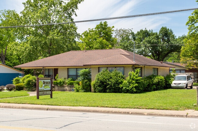
2802 Primwood Path, Cedar Park, TX 78613

NEARBY LISTINGS FOR SALE OR LEASE
Property Detail
2802 Primwood Path
Austin-Round Rock, TX
Anderson Mill West Sec 18
367949
Travis
Sfr
Texas
X
0.17 AC
48453C0230K
South
2,058 SF
Austin
DEMOGRAPHICS near 2802 Primwood Path
1 Mile
3 Mile
5 Mile
2024 Total Population
17,617
121,712
353,363
2029 Population
19,142
132,300
383,451
Pop Growth 2024-2029
+ 8.66%
+ 8.70%
+ 8.51%
Average Age
37
38
36
2024 Total Households
9,295
59,716
158,996
HH Growth 2024-2029
+ 9.34%
+ 9.39%
+ 9.53%
Median Household Inc
$74,849
$81,367
$78,653
Avg Household Size
1.80
1.90
2.10
2024 Avg HH Vehicles
1.00
2.00
2.00
Median Home Value
$624,759
$592,829
$523,359
Median Year Built
1984
1986
1993
Nearby Places
Map Layers
Map Styles
 Street
 Aerial
- Restaurants
- Banks
- Shops
- Fitness
- Groceries
PUBLIC TRANSPORTATION
AIRPORT
Austin-Bergstrom International
DRIVE
WALK
Distance
Austin-Bergstrom International
44 min
29.7 mi
Freight Ports
Calhoun Port
DRIVE
WALK
Distance
Calhoun Port
209 min
173.2 mi
SALE & LEASE HISTORY
LISTING DATE
SALE/LEASE

Jun 23, 2023
For Sale
Nearby Properties
Address
Land Use
TOTAL SIZE
Lot Size
Zoning
Address
Land Use
TOTAL SIZE
Lot Size
Zoning
676,868 SF
13.54 AC
3-PD
Address
Land Use
TOTAL SIZE
Lot Size
Zoning
557,037 SF
29.48 AC
Address
Land Use
TOTAL SIZE
Lot Size
Zoning
256,338 SF
26.47 AC
Address
Land Use
TOTAL SIZE
Lot Size
Zoning
423,057 SF
21.90 AC
4-GRMUCO
Address
Land Use
TOTAL SIZE
Lot Size
Zoning
369,192 SF
78.87 AC
Address
Land Use
TOTAL SIZE
Lot Size
Zoning
411,288 SF
27.68 AC
Address
Land Use
TOTAL SIZE
Lot Size
Zoning
576,996 SF
38.77 AC
Address
Land Use
TOTAL SIZE
Lot Size
Zoning
610,326 SF
43.30 AC
Address
Land Use
TOTAL SIZE
Lot Size
Zoning
557,037 SF
32.48 AC
Address
Land Use
TOTAL SIZE
Lot Size
Zoning
468,870 SF
22 AC
4-GRMUCO
Address
Land Use
TOTAL SIZE
Lot Size
Zoning
306,900 SF
34.50 AC
Address
Land Use
TOTAL SIZE
Lot Size
Zoning
320,454 SF
19.56 AC
Address
Land Use
TOTAL SIZE
Lot Size
Zoning
324,508 SF
24.08 AC
Address
Land Use
TOTAL SIZE
Lot Size
Zoning
338,434 SF
40.57 AC
3-PD
Address
Land Use
TOTAL SIZE
Lot Size
Zoning
365,955 SF
22.84 AC
Address
Land Use
TOTAL SIZE
Lot Size
Zoning
172,975 SF
33.88 AC
Address
Land Use
TOTAL SIZE
Lot Size
Zoning
395,632 SF
20.25 AC
Address
Land Use
TOTAL SIZE
Lot Size
Zoning
306,445 SF
23.59 AC
Address
Land Use
TOTAL SIZE
Lot Size
Zoning
349,200 SF
28.91 AC
Address
Land Use
TOTAL SIZE
Lot Size
Zoning
275,271 SF
14.14 AC
Address
Land Use
TOTAL SIZE
Lot Size
Zoning
264,559 SF
12.23 AC
Address
Land Use
TOTAL SIZE
Lot Size
Zoning
474,472 SF
9.22 AC
Address
Land Use
TOTAL SIZE
Lot Size
Zoning
289,330 SF
25.35 AC
Address
Land Use
TOTAL SIZE
Lot Size
Zoning
299,893 SF
23.10 AC
Address
Land Use
TOTAL SIZE
Lot Size
Zoning
341,389 SF
12.19 AC
4-GRMUCO
Address
Land Use
TOTAL SIZE
Lot Size
Zoning
320,712 SF
35.56 AC
Address
Land Use
TOTAL SIZE
Lot Size
Zoning
285,768 SF
23.77 AC
Address
Land Use
TOTAL SIZE
Lot Size
Zoning
253,387 SF
12.87 AC
4-GRMUCO
Address
Land Use
TOTAL SIZE
Lot Size
Zoning
262,480 SF
27.52 AC
Address
Land Use
TOTAL SIZE
Lot Size
Zoning
288,994 SF
13.58 AC
The World's #1 Commercial Real Estate Marketplace
Connect with us
© 2025 CoStar Group
The information above has been obtained from sources believed reliable. While we do not doubt its accuracy we have not verified it and make no guarantee, warranty or representation about it. It is your responsibility to independently confirm its accuracy and completeness. Any projections, opinions, assumptions, or estimates used are for example only and do not represent the current or future performance of the property. The value of this transaction to you depends on tax and other factors which should be evaluated by your tax, financial, and legal advisors. You and your advisors should conduct a careful, independent investigation of the property to determine to your satisfaction the suitability of the property for your needs.