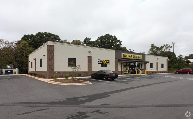
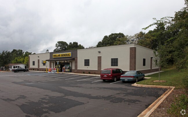
Property Record
4016 York Hwy, Dallas, NC 28034

NEARBY LISTINGS FOR SALE OR LEASE
-
-
View all Dallas listings for sale on LoopNet.com
Property Detail
4016 York Hwy
220491
Minor Subdivision For Dana J Turner
Departmentstoremultistory
DANA J TURNER L 3B 10 076 005 00 000
X
Gaston
3710354300J
North Carolina
2025
1.11 AC
2025
Gaston County
0334001010
Charlotte
9,301 SF
Charlotte-Concord-Gastonia, NC-SC
DEMOGRAPHICS near 4016 York Hwy
1 Mile
3 Mile
5 Mile
2024 Total Population
3,253
31,406
83,453
2029 Population
3,522
33,613
89,271
Pop Growth 2024-2029
+ 8.27%
+ 7.03%
+ 6.97%
Average Age
39
40
40
2024 Total Households
1,258
12,515
33,221
HH Growth 2024-2029
+ 8.51%
+ 7.19%
+ 7.12%
Median Household Inc
$34,606
$46,989
$48,170
Avg Household Size
2.50
2.40
2.40
2024 Avg HH Vehicles
2.00
2.00
2.00
Median Home Value
$106,066
$166,852
$183,750
Median Year Built
1973
1979
1978
Nearby Places
Map Layers
Map Styles
 Street
 Aerial
- Restaurants
- Banks
- Shops
- Fitness
- Groceries
PUBLIC TRANSPORTATION
COMMUTER RAIL
Gastonia Amtrak Station (Crescent - Amtrak)
DRIVE
WALK
Distance
Gastonia Amtrak Station (Crescent - Amtrak)
10 min
5.7 mi
AIRPORT
Charlotte/Douglas International
DRIVE
WALK
Distance
Charlotte/Douglas International
36 min
21.3 mi
Freight Ports
North Charleston Terminal
DRIVE
WALK
Distance
North Charleston Terminal
241 min
205.7 mi
Nearby Properties
Address
Land Use
TOTAL SIZE
Lot Size
Zoning
Address
Land Use
TOTAL SIZE
Lot Size
Zoning
2,066 SF
16.10 AC
Address
Land Use
TOTAL SIZE
Lot Size
Zoning
1,886 SF
13.27 AC
APT01
Address
Land Use
TOTAL SIZE
Lot Size
Zoning
1,602 SF
14.02 AC
APT02
Address
Land Use
TOTAL SIZE
Lot Size
Zoning
1,170 SF
320.29 AC
OFF01
Address
Land Use
TOTAL SIZE
Lot Size
Zoning
112,513 SF
13.09 AC
PUB01
Address
Land Use
TOTAL SIZE
Lot Size
Zoning
8,412 SF
39.83 AC
PUB01
Address
Land Use
TOTAL SIZE
Lot Size
Zoning
14.51 AC
Address
Land Use
TOTAL SIZE
Lot Size
Zoning
104,144 SF
13.69 AC
OFF04
Address
Land Use
TOTAL SIZE
Lot Size
Zoning
11,676 SF
7.31 AC
Address
Land Use
TOTAL SIZE
Lot Size
Zoning
1,200 SF
7.58 AC
APT02
Address
Land Use
TOTAL SIZE
Lot Size
Zoning
1,471 SF
8.96 AC
OFF01
Address
Land Use
TOTAL SIZE
Lot Size
Zoning
199,200 SF
23.83 AC
INDS1
Address
Land Use
TOTAL SIZE
Lot Size
Zoning
6,608 SF
9.10 AC
Address
Land Use
TOTAL SIZE
Lot Size
Zoning
5,432 SF
7.61 AC
APT02
Address
Land Use
TOTAL SIZE
Lot Size
Zoning
1,746 SF
15.31 AC
Address
Land Use
TOTAL SIZE
Lot Size
Zoning
1,800 SF
11.08 AC
APT01
Address
Land Use
TOTAL SIZE
Lot Size
Zoning
Address
Land Use
TOTAL SIZE
Lot Size
Zoning
39,911 SF
19.28 AC
CHUR1
Address
Land Use
TOTAL SIZE
Lot Size
Zoning
55,588 SF
5.56 AC
HCAR4
Address
Land Use
TOTAL SIZE
Lot Size
Zoning
79,635 SF
4.39 AC
Address
Land Use
TOTAL SIZE
Lot Size
Zoning
19,653 SF
2.31 AC
R1
Address
Land Use
TOTAL SIZE
Lot Size
Zoning
41,155 SF
3.99 AC
HCAR3
Address
Land Use
TOTAL SIZE
Lot Size
Zoning
96,713 SF
44.64 AC
PUB01
Address
Land Use
TOTAL SIZE
Lot Size
Zoning
63,000 SF
4.95 AC
PUB01
Address
Land Use
TOTAL SIZE
Lot Size
Zoning
8,874 SF
24.89 AC
PUB01
Address
Land Use
TOTAL SIZE
Lot Size
Zoning
73,722 SF
8.93 AC
HCAR4
Address
Land Use
TOTAL SIZE
Lot Size
Zoning
73,692 SF
5.12 AC
CHUR5
Address
Land Use
TOTAL SIZE
Lot Size
Zoning
14,752 SF
10 AC
PUB01
Address
Land Use
TOTAL SIZE
Lot Size
Zoning
20,596 SF
11.20 AC
Address
Land Use
TOTAL SIZE
Lot Size
Zoning
82,908 SF
12.01 AC
PUB01
The World's #1 Commercial Real Estate Marketplace
Connect with us
© 2025 CoStar Group
The information above has been obtained from sources believed reliable. While we do not doubt its accuracy we have not verified it and make no guarantee, warranty or representation about it. It is your responsibility to independently confirm its accuracy and completeness. Any projections, opinions, assumptions, or estimates used are for example only and do not represent the current or future performance of the property. The value of this transaction to you depends on tax and other factors which should be evaluated by your tax, financial, and legal advisors. You and your advisors should conduct a careful, independent investigation of the property to determine to your satisfaction the suitability of the property for your needs.