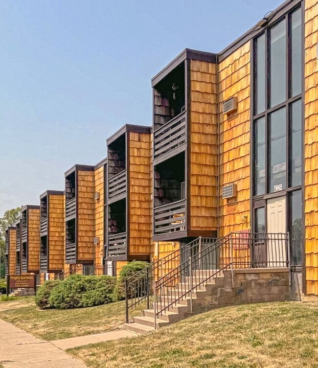
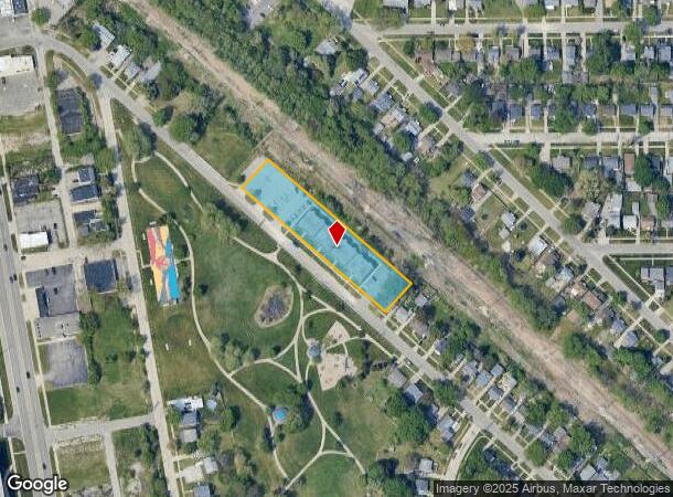
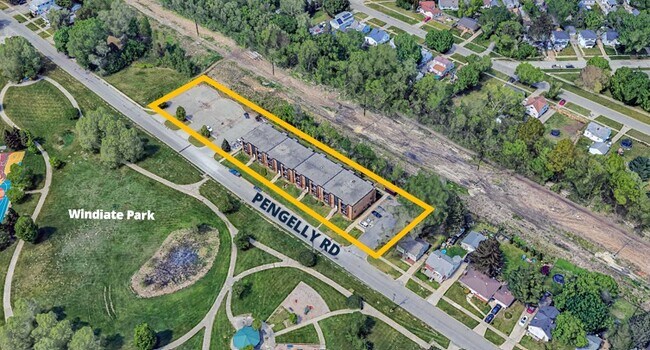
Property Record
4017 Pengelly Rd, Flint, MI 48507
NEARBY LISTINGS FOR SALE OR LEASE
Property Detail
4017 Pengelly Rd
Flint, MI
Dixieland
41-29-151-064
DIXIELAND LOTS 449 THRU 459 INCL.
Commercialnec
Genesee
X
Michigan
26049C0306D
449-459
2024
1.14 AC
2025
South Flint/Grand Blanc
003500
Detroit
32,781 SF
DEMOGRAPHICS near 4017 Pengelly Rd
1 Mile
3 Mile
5 Mile
2024 Total Population
10,516
62,404
144,344
2029 Population
10,430
61,810
144,183
Pop Growth 2024-2029
(0.82%)
(0.95%)
(0.11%)
Average Age
37
39
39
2024 Total Households
4,339
26,213
60,745
HH Growth 2024-2029
(0.88%)
(0.97%)
(0.20%)
Median Household Inc
$35,257
$38,441
$42,044
Avg Household Size
2.30
2.30
2.30
2024 Avg HH Vehicles
2.00
1.00
2.00
Median Home Value
$58,311
$82,942
$93,422
Median Year Built
1953
1959
1961
Nearby Places
Map Layers
Map Styles
 Street
 Aerial
- Restaurants
- Banks
- Shops
- Fitness
- Groceries
PUBLIC TRANSPORTATION
COMMUTER RAIL
DRIVE
WALK
Distance
8 min
3.4 mi
AIRPORT
Bishop International
DRIVE
WALK
Distance
Bishop International
23 min
10.0 mi
SALE & LEASE HISTORY
LISTING DATE
SALE/LEASE

Mar 07, 2025
For Sale
Nearby Properties
Address
Land Use
TOTAL SIZE
Lot Size
Zoning
Address
Land Use
TOTAL SIZE
Lot Size
Zoning
381,509 SF
371.45 AC
PC
Address
Land Use
TOTAL SIZE
Lot Size
Zoning
Address
Land Use
TOTAL SIZE
Lot Size
Zoning
911,140 SF
Address
Land Use
TOTAL SIZE
Lot Size
Zoning
130,291 SF
Address
Land Use
TOTAL SIZE
Lot Size
Zoning
227,755 SF
32.27 AC
C-2
Address
Land Use
TOTAL SIZE
Lot Size
Zoning
354,079 SF
48.41 AC
C-4
Address
Land Use
TOTAL SIZE
Lot Size
Zoning
144,896 SF
0.23 AC
DC
Address
Land Use
TOTAL SIZE
Lot Size
Zoning
115,556 SF
2.50 AC
DE
Address
Land Use
TOTAL SIZE
Lot Size
Zoning
100,000 SF
Address
Land Use
TOTAL SIZE
Lot Size
Zoning
58,648 SF
5.80 AC
OS
Address
Land Use
TOTAL SIZE
Lot Size
Zoning
60,613 SF
12.91 AC
RO
Address
Land Use
TOTAL SIZE
Lot Size
Zoning
100,750 SF
Address
Land Use
TOTAL SIZE
Lot Size
Zoning
9.88 AC
HDM
Address
Land Use
TOTAL SIZE
Lot Size
Zoning
68,571 SF
0.81 AC
DC
Address
Land Use
TOTAL SIZE
Lot Size
Zoning
246,759 SF
19.03 AC
CC
Address
Land Use
TOTAL SIZE
Lot Size
Zoning
24.38 AC
RM
Address
Land Use
TOTAL SIZE
Lot Size
Zoning
91,726 SF
7.28 AC
HDM
Address
Land Use
TOTAL SIZE
Lot Size
Zoning
49,582 SF
25.15 AC
HRM
Address
Land Use
TOTAL SIZE
Lot Size
Zoning
364,289 SF
24.80 AC
GN-1
Address
Land Use
TOTAL SIZE
Lot Size
Zoning
41,508 SF
5.27 AC
OS
Address
Land Use
TOTAL SIZE
Lot Size
Zoning
236,340 SF
25.17 AC
CE
Address
Land Use
TOTAL SIZE
Lot Size
Zoning
11.22 AC
RM
Address
Land Use
TOTAL SIZE
Lot Size
Zoning
10,212 SF
2.60 AC
UC
Address
Land Use
TOTAL SIZE
Lot Size
Zoning
94,280 SF
48.79 AC
Address
Land Use
TOTAL SIZE
Lot Size
Zoning
2,321 SF
18.59 AC
M-1
Address
Land Use
TOTAL SIZE
Lot Size
Zoning
2,829 SF
75.78 AC
RMH
Address
Land Use
TOTAL SIZE
Lot Size
Zoning
85,697 SF
0.30 AC
DC
Address
Land Use
TOTAL SIZE
Lot Size
Zoning
25,496 SF
5.33 AC
Address
Land Use
TOTAL SIZE
Lot Size
Zoning
123,170 SF
3.41 AC
DE
Address
Land Use
TOTAL SIZE
Lot Size
Zoning
62.08 AC
MHP
The World's #1 Commercial Real Estate Marketplace
Connect with us
© 2025 CoStar Group
The information above has been obtained from sources believed reliable. While we do not doubt its accuracy we have not verified it and make no guarantee, warranty or representation about it. It is your responsibility to independently confirm its accuracy and completeness. Any projections, opinions, assumptions, or estimates used are for example only and do not represent the current or future performance of the property. The value of this transaction to you depends on tax and other factors which should be evaluated by your tax, financial, and legal advisors. You and your advisors should conduct a careful, independent investigation of the property to determine to your satisfaction the suitability of the property for your needs.