Property Record
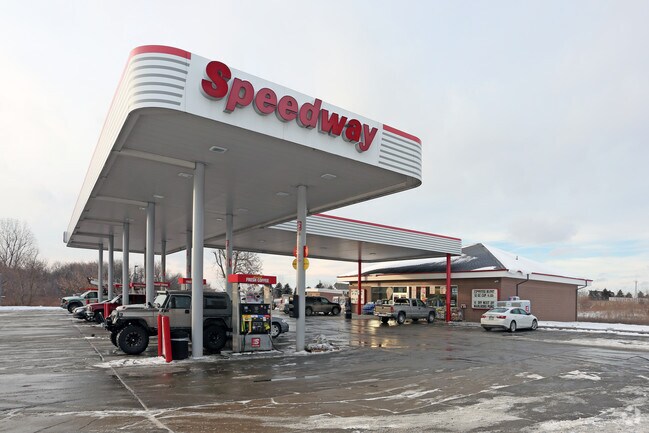
4019 N State Rd, Davison, MI 48423

Property Detail
4019 N State Rd
16-28-400-017
S 314.5 FT OF E 336 FT OF SE 1/4 EXCEPT S 168.3 FT OF E 168.3 FT AND ALL THAT PART OF S 168.3 FT OF E 168.3 FT LYING NWLY OF
Commercialnec
Genesee
CB
Michigan
B and X Area of moderate flood hazard, usually the area between the limits of the 100-year and 500-year floods.
1.79 AC
2024
Flint
2025
Detroit
011800
Flint, MI
3,251 SF
NEARBY LISTINGS FOR SALE OR LEASE
-
-
View all Davison listings for sale on LoopNet.com
DEMOGRAPHICS near 4019 N State Rd
1 mile
3 mile
5 mile
2025 Total Population
2,712
15,604
41,811
2030 Population
2,697
15,496
41,349
Pop Growth 2025-2030
(0.55%)
(0.69%)
(1.10%)
Average Age
39
42
42
2025 Total Households
1,013
6,453
17,590
HH Growth 2025-2030
(0.69%)
(0.76%)
(1.17%)
Median Household Inc
$73,762
$65,858
$67,237
Avg Household Size
2.60
2.40
2.30
2025 Avg HH Vehicles
2.00
2.00
2.00
Median Home Value
$211,003
$207,255
$199,481
Median Year Built
1996
1977
1977
Nearby Places
Map Layers
Map Styles
 Street
 Aerial
Layers
 Traffic
 Biking
Places
Listings with unknown addresses are not visible on the map
- Restaurants
- Banks
- Shops
- Fitness
- Groceries
PUBLIC TRANSPORTATION
AIRPORT
Bishop International
Drive
Walk
Distance
Bishop International
33 min
20.4 mi
Nearby Properties
Address
Land Use
TOTAL SIZE
Lot Size
Zoning
Address
Land Use
TOTAL SIZE
Lot Size
Zoning
34,652 SF
208.43 AC
SRA
Address
Land Use
TOTAL SIZE
Lot Size
Zoning
156,996 SF
NOT AVAILA
Address
Land Use
TOTAL SIZE
Lot Size
Zoning
6,449 SF
90.81 AC
MH
Address
Land Use
TOTAL SIZE
Lot Size
Zoning
44,280 SF
5.48 AC
C-3
Address
Land Use
TOTAL SIZE
Lot Size
Zoning
79,677 SF
13.79 AC
B-1
Address
Land Use
TOTAL SIZE
Lot Size
Zoning
101,648 SF
18.65 AC
I
Address
Land Use
TOTAL SIZE
Lot Size
Zoning
59,420 SF
5.25 AC
C-3
Address
Land Use
TOTAL SIZE
Lot Size
Zoning
49,688 SF
8.79 AC
NOT AVAILA
Address
Land Use
TOTAL SIZE
Lot Size
Zoning
127,708 SF
9.40 AC
B-1
Address
Land Use
TOTAL SIZE
Lot Size
Zoning
28.20 AC
Address
Land Use
TOTAL SIZE
Lot Size
Zoning
2,328 SF
79 AC
RRA
Address
Land Use
TOTAL SIZE
Lot Size
Zoning
2,244 SF
24 AC
Address
Land Use
TOTAL SIZE
Lot Size
Zoning
56.58 AC
Address
Land Use
TOTAL SIZE
Lot Size
Zoning
34,496 SF
2.95 AC
C-3
Address
Land Use
TOTAL SIZE
Lot Size
Zoning
1,850 SF
32.92 AC
B-2
Address
Land Use
TOTAL SIZE
Lot Size
Zoning
61,770 SF
176 AC
B-1
Address
Land Use
TOTAL SIZE
Lot Size
Zoning
36,620 SF
47.81 AC
CB
Address
Land Use
TOTAL SIZE
Lot Size
Zoning
84,106 SF
4.60 AC
B-1
Address
Land Use
TOTAL SIZE
Lot Size
Zoning
8.37 AC
CB
Address
Land Use
TOTAL SIZE
Lot Size
Zoning
54,350 SF
3.77 AC
B-1
Address
Land Use
TOTAL SIZE
Lot Size
Zoning
2,008 SF
C-3
Address
Land Use
TOTAL SIZE
Lot Size
Zoning
19,546 SF
1.44 AC
B-1
Address
Land Use
TOTAL SIZE
Lot Size
Zoning
11,070 SF
1.16 AC
C-3
Address
Land Use
TOTAL SIZE
Lot Size
Zoning
47,800 SF
2.82 AC
B-1
Address
Land Use
TOTAL SIZE
Lot Size
Zoning
16,525 SF
30.59 AC
NOT AVAILA
Address
Land Use
TOTAL SIZE
Lot Size
Zoning
72,966 SF
3.46 AC
I
Address
Land Use
TOTAL SIZE
Lot Size
Zoning
67,303 SF
3.49 AC
I
Address
Land Use
TOTAL SIZE
Lot Size
Zoning
40,393 SF
10.05 AC
I
Address
Land Use
TOTAL SIZE
Lot Size
Zoning
7,552 SF
0.85 AC
C-2
Address
Land Use
TOTAL SIZE
Lot Size
Zoning
11,555 SF
4.91 AC
NOT AVAILA
The World's #1 Commercial Real Estate Marketplace
Connect with us
© 2026 CoStar Group
The information above has been obtained from sources believed reliable. While we do not doubt its accuracy we have not verified it and make no guarantee, warranty or representation about it. It is your responsibility to independently confirm its accuracy and completeness. Any projections, opinions, assumptions, or estimates used are for example only and do not represent the current or future performance of the property. The value of this transaction to you depends on tax and other factors which should be evaluated by your tax, financial, and legal advisors. You and your advisors should conduct a careful, independent investigation of the property to determine to your satisfaction the suitability of the property for your needs.