Property Record
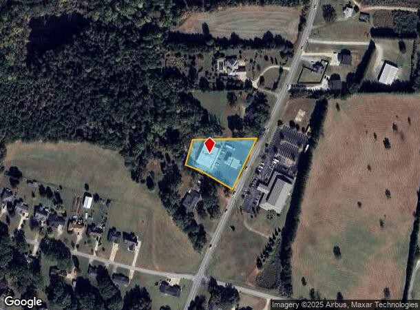
4019 Parris Bridge Rd, Boiling Springs, SC 29316

NEARBY LISTINGS FOR SALE OR LEASE
Property Detail
4019 Parris Bridge Rd
2-45-00-004.01
Creek
Commercialnec
W SIDE PARRIS BRIDGE ROAD E OF S HOALLY CREEK ALSO DB 49Q-410 & 49S-185 CORREC
X
Spartanburg
45083C0162D
South Carolina
2024
1.39 AC
2025
North Side/Rt 9 Corr
022410
Greenville/Spartanburg
8,660 SF
Spartanburg, SC
DEMOGRAPHICS near 4019 Parris Bridge Rd
1 Mile
3 Mile
5 Mile
2024 Total Population
3,883
26,221
65,752
2029 Population
4,365
29,720
74,515
Pop Growth 2024-2029
+ 12.41%
+ 13.34%
+ 13.33%
Average Age
37
38
38
2024 Total Households
1,438
10,024
24,572
HH Growth 2024-2029
+ 12.66%
+ 13.63%
+ 13.65%
Median Household Inc
$68,921
$67,053
$61,839
Avg Household Size
2.70
2.60
2.50
2024 Avg HH Vehicles
2.00
2.00
2.00
Median Home Value
$177,690
$193,865
$180,176
Median Year Built
2001
1999
1994
Nearby Places
Map Layers
Map Styles
 Street
 Aerial
- Restaurants
- Banks
- Shops
- Fitness
- Groceries
PUBLIC TRANSPORTATION
COMMUTER RAIL
Spartanburg Amtrak Station (Crescent - Amtrak)
DRIVE
WALK
Distance
Spartanburg Amtrak Station (Crescent - Amtrak)
14 min
6.4 mi
AIRPORT
Greenville Spartanburg International
DRIVE
WALK
Distance
Greenville Spartanburg International
33 min
21.6 mi
Freight Ports
North Charleston Terminal
DRIVE
WALK
Distance
North Charleston Terminal
230 min
202.2 mi
Nearby Properties
Address
Land Use
TOTAL SIZE
Lot Size
Zoning
Address
Land Use
TOTAL SIZE
Lot Size
Zoning
22,955 SF
5.05 AC
Address
Land Use
TOTAL SIZE
Lot Size
Zoning
3,406 SF
13.10 AC
Address
Land Use
TOTAL SIZE
Lot Size
Zoning
3,412 SF
21.60 AC
Address
Land Use
TOTAL SIZE
Lot Size
Zoning
5,034 SF
17.60 AC
Address
Land Use
TOTAL SIZE
Lot Size
Zoning
89,435 SF
5.33 AC
Address
Land Use
TOTAL SIZE
Lot Size
Zoning
3,112 SF
20.17 AC
Address
Land Use
TOTAL SIZE
Lot Size
Zoning
8,911 SF
23.64 AC
Address
Land Use
TOTAL SIZE
Lot Size
Zoning
6,816 SF
14.16 AC
Address
Land Use
TOTAL SIZE
Lot Size
Zoning
9,649 SF
9.67 AC
Address
Land Use
TOTAL SIZE
Lot Size
Zoning
184,015 SF
19.23 AC
Address
Land Use
TOTAL SIZE
Lot Size
Zoning
641,891 SF
16.26 AC
Address
Land Use
TOTAL SIZE
Lot Size
Zoning
108,060 SF
2.95 AC
Address
Land Use
TOTAL SIZE
Lot Size
Zoning
5,236 SF
0.65 AC
Address
Land Use
TOTAL SIZE
Lot Size
Zoning
6,695 SF
0.30 AC
Address
Land Use
TOTAL SIZE
Lot Size
Zoning
25,214 SF
4.48 AC
Address
Land Use
TOTAL SIZE
Lot Size
Zoning
53,066 SF
8.39 AC
Address
Land Use
TOTAL SIZE
Lot Size
Zoning
4,426 SF
Address
Land Use
TOTAL SIZE
Lot Size
Zoning
4,950 SF
6.93 AC
Address
Land Use
TOTAL SIZE
Lot Size
Zoning
5,263 SF
0.77 AC
Address
Land Use
TOTAL SIZE
Lot Size
Zoning
Address
Land Use
TOTAL SIZE
Lot Size
Zoning
3,683 SF
0.21 AC
Address
Land Use
TOTAL SIZE
Lot Size
Zoning
4,398 SF
0.25 AC
Address
Land Use
TOTAL SIZE
Lot Size
Zoning
4,091 SF
0.28 AC
Address
Land Use
TOTAL SIZE
Lot Size
Zoning
Address
Land Use
TOTAL SIZE
Lot Size
Zoning
86,347 SF
39.12 AC
Address
Land Use
TOTAL SIZE
Lot Size
Zoning
3,663 SF
11.40 AC
Address
Land Use
TOTAL SIZE
Lot Size
Zoning
209,070 SF
16.24 AC
Address
Land Use
TOTAL SIZE
Lot Size
Zoning
5,180 SF
0.22 AC
Address
Land Use
TOTAL SIZE
Lot Size
Zoning
44 SF
23.59 AC
Address
Land Use
TOTAL SIZE
Lot Size
Zoning
3,591 SF
0.78 AC
The World's #1 Commercial Real Estate Marketplace
Connect with us
© 2025 CoStar Group
The information above has been obtained from sources believed reliable. While we do not doubt its accuracy we have not verified it and make no guarantee, warranty or representation about it. It is your responsibility to independently confirm its accuracy and completeness. Any projections, opinions, assumptions, or estimates used are for example only and do not represent the current or future performance of the property. The value of this transaction to you depends on tax and other factors which should be evaluated by your tax, financial, and legal advisors. You and your advisors should conduct a careful, independent investigation of the property to determine to your satisfaction the suitability of the property for your needs.