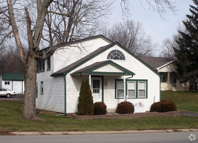
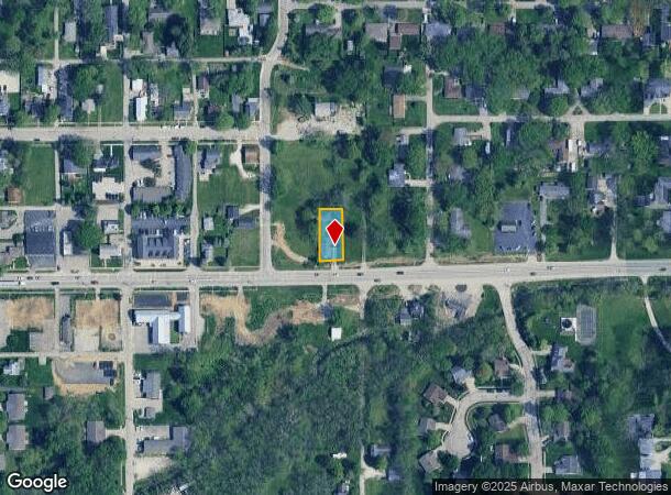
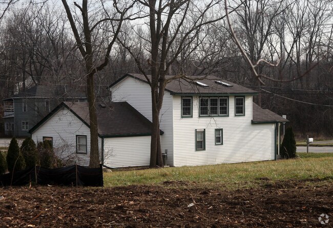
Property Record
410 E Main St, Westfield, IN 46074
NEARBY LISTINGS FOR SALE OR LEASE
-
-
-
SR 32 & Promenade of Noblesville Pkwy @ Promenade of Noblesville Pkwy
Noblesville, IN 46062
Negotiable
3,167 SF
Office
-
View all Westfield listings for lease on LoopNet.com
Property Detail
410 E Main St
29-06-31-308-009.000-015
Roberts Revised Rolling Acres
Officebuilding
ACREAGE .16, SECTION 31, TOWNSHIP 19, RANGE 4
X
Hamilton
18057C0136G
Indiana
2023
0.16 AC
2024
Far North Hamilton Cnty
110401
Indianapolis
1,578 SF
Indianapolis-Carmel-Anderson, IN
DEMOGRAPHICS near 410 E Main St
1 Mile
3 Mile
5 Mile
2024 Total Population
6,927
46,683
124,855
2029 Population
7,828
53,098
141,843
Pop Growth 2024-2029
+ 13.01%
+ 13.74%
+ 13.61%
Average Age
38
37
39
2024 Total Households
2,672
16,993
45,993
HH Growth 2024-2029
+ 12.95%
+ 13.72%
+ 13.65%
Median Household Inc
$81,050
$95,482
$102,268
Avg Household Size
2.50
2.70
2.70
2024 Avg HH Vehicles
2.00
2.00
2.00
Median Home Value
$265,040
$330,151
$346,922
Median Year Built
1997
2007
2002
Nearby Places
- Restaurants
- Banks
- Shops
- Fitness
- Groceries
PUBLIC TRANSPORTATION
AIRPORT
Indianapolis International
DRIVE
WALK
Distance
Indianapolis International
56 min
36.0 mi
Freight Ports
Port of Toledo
DRIVE
WALK
Distance
Port of Toledo
259 min
214.4 mi
SALE & LEASE HISTORY
LISTING DATE
SALE/LEASE

Aug 22, 2018
For Lease
Nearby Properties
Address
Land Use
TOTAL SIZE
Lot Size
Zoning
Address
Land Use
TOTAL SIZE
Lot Size
Zoning
27,385 SF
77.27 AC
Address
Land Use
TOTAL SIZE
Lot Size
Zoning
383,016 SF
16.62 AC
Address
Land Use
TOTAL SIZE
Lot Size
Zoning
372,542 SF
32.10 AC
Address
Land Use
TOTAL SIZE
Lot Size
Zoning
328,692 SF
12 AC
Address
Land Use
TOTAL SIZE
Lot Size
Zoning
388,202 SF
23.97 AC
Address
Land Use
TOTAL SIZE
Lot Size
Zoning
6.46 AC
Address
Land Use
TOTAL SIZE
Lot Size
Zoning
296,315 SF
17.65 AC
Address
Land Use
TOTAL SIZE
Lot Size
Zoning
97,726 SF
8.49 AC
Address
Land Use
TOTAL SIZE
Lot Size
Zoning
297,641 SF
70.35 AC
Address
Land Use
TOTAL SIZE
Lot Size
Zoning
239,148 SF
18.56 AC
Address
Land Use
TOTAL SIZE
Lot Size
Zoning
370,914 SF
14.30 AC
Address
Land Use
TOTAL SIZE
Lot Size
Zoning
173,884 SF
14.07 AC
Address
Land Use
TOTAL SIZE
Lot Size
Zoning
203,619 SF
6.66 AC
Address
Land Use
TOTAL SIZE
Lot Size
Zoning
129,851 SF
42.03 AC
Address
Land Use
TOTAL SIZE
Lot Size
Zoning
153,602 SF
50.17 AC
Address
Land Use
TOTAL SIZE
Lot Size
Zoning
141,255 SF
21.61 AC
Address
Land Use
TOTAL SIZE
Lot Size
Zoning
231,080 SF
9.28 AC
Address
Land Use
TOTAL SIZE
Lot Size
Zoning
73,680 SF
19.08 AC
Address
Land Use
TOTAL SIZE
Lot Size
Zoning
314,499 SF
12 AC
Address
Land Use
TOTAL SIZE
Lot Size
Zoning
147,081 SF
56.70 AC
Address
Land Use
TOTAL SIZE
Lot Size
Zoning
290,862 SF
2.54 AC
Address
Land Use
TOTAL SIZE
Lot Size
Zoning
120,584 SF
20 AC
Address
Land Use
TOTAL SIZE
Lot Size
Zoning
129,005 SF
13.19 AC
Address
Land Use
TOTAL SIZE
Lot Size
Zoning
151,448 SF
10.58 AC
Address
Land Use
TOTAL SIZE
Lot Size
Zoning
110,412 SF
9.70 AC
Address
Land Use
TOTAL SIZE
Lot Size
Zoning
282,022 SF
7.65 AC
Address
Land Use
TOTAL SIZE
Lot Size
Zoning
129,634 SF
12.71 AC
Address
Land Use
TOTAL SIZE
Lot Size
Zoning
183,536 SF
13.34 AC
Address
Land Use
TOTAL SIZE
Lot Size
Zoning
300,782 SF
53.87 AC
Address
Land Use
TOTAL SIZE
Lot Size
Zoning
65,466 SF
7 AC
The World's #1 Commercial Real Estate Marketplace
Connect with us
© 2025 CoStar Group
The information above has been obtained from sources believed reliable. While we do not doubt its accuracy we have not verified it and make no guarantee, warranty or representation about it. It is your responsibility to independently confirm its accuracy and completeness. Any projections, opinions, assumptions, or estimates used are for example only and do not represent the current or future performance of the property. The value of this transaction to you depends on tax and other factors which should be evaluated by your tax, financial, and legal advisors. You and your advisors should conduct a careful, independent investigation of the property to determine to your satisfaction the suitability of the property for your needs.