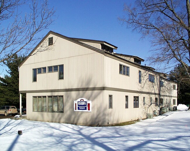
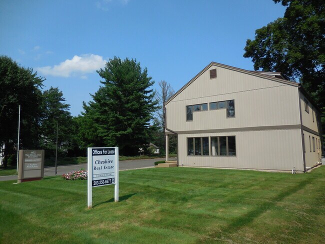
Property Record
402 Highland Ave, Cheshire, CT 06410
NEARBY LISTINGS FOR SALE OR LEASE
Property Detail
402 Highland Ave
Officebuilding
New Haven
X
Connecticut
09009C0144J
0.68 AC
2025
Cheshire
2025
Westchester/So Connecticut
343102
New Haven-Milford, CT
6,800 SF
CHES-000050-000304
DEMOGRAPHICS near 402 Highland Ave
1 Mile
3 Mile
5 Mile
2024 Total Population
5,918
27,946
88,068
2029 Population
5,923
27,981
87,894
Pop Growth 2024-2029
+ 0.08%
+ 0.13%
(0.20%)
Average Age
43
43
43
2024 Total Households
2,245
10,026
33,578
HH Growth 2024-2029
+ 0.13%
+ 0.09%
(0.24%)
Median Household Inc
$103,511
$129,626
$95,803
Avg Household Size
2.50
2.60
2.50
2024 Avg HH Vehicles
2.00
2.00
2.00
Median Home Value
$357,348
$367,026
$306,747
Median Year Built
1963
1971
1970
Nearby Places
Map Layers
Map Styles
 Street
 Aerial
- Restaurants
- Banks
- Shops
- Fitness
- Groceries
PUBLIC TRANSPORTATION
COMMUTER RAIL
DRIVE
WALK
Distance
14 min
8.1 mi
DRIVE
WALK
Distance
11 min
8.7 mi
SALE & LEASE HISTORY
LISTING DATE
SALE/LEASE

Nov 02, 2017
For Lease
Nearby Properties
Address
Land Use
TOTAL SIZE
Lot Size
Zoning
Address
Land Use
TOTAL SIZE
Lot Size
Zoning
1,664 SF
166.95 AC
I-2
Address
Land Use
TOTAL SIZE
Lot Size
Zoning
23,338 SF
37.36 AC
R-40
Address
Land Use
TOTAL SIZE
Lot Size
Zoning
72,415 SF
48.10 AC
R-20
Address
Land Use
TOTAL SIZE
Lot Size
Zoning
2,400 SF
38.29 AC
M-3
Address
Land Use
TOTAL SIZE
Lot Size
Zoning
313,293 SF
53.21 AC
I-1
Address
Land Use
TOTAL SIZE
Lot Size
Zoning
168,763 SF
107.36 AC
R-40
Address
Land Use
TOTAL SIZE
Lot Size
Zoning
30.10 AC
ICSDD
Address
Land Use
TOTAL SIZE
Lot Size
Zoning
5,600 SF
59 AC
R-40
Address
Land Use
TOTAL SIZE
Lot Size
Zoning
245,122 SF
32.60 AC
R-1
Address
Land Use
TOTAL SIZE
Lot Size
Zoning
24.80 AC
R-20A
Address
Land Use
TOTAL SIZE
Lot Size
Zoning
12,250 SF
101.84 AC
R-40
Address
Land Use
TOTAL SIZE
Lot Size
Zoning
116,196 SF
9.45 AC
R-20
Address
Land Use
TOTAL SIZE
Lot Size
Zoning
41,198 SF
2.59 AC
C-1
Address
Land Use
TOTAL SIZE
Lot Size
Zoning
69,492 SF
25 AC
R-40
Address
Land Use
TOTAL SIZE
Lot Size
Zoning
41,031 SF
17.07 AC
R-20
Address
Land Use
TOTAL SIZE
Lot Size
Zoning
12,960 SF
12.25 AC
R-20
Address
Land Use
TOTAL SIZE
Lot Size
Zoning
172,891 SF
75 AC
I-2
Address
Land Use
TOTAL SIZE
Lot Size
Zoning
241,500 SF
16.93 AC
I-1
Address
Land Use
TOTAL SIZE
Lot Size
Zoning
10,876 SF
5.73 AC
AHD
Address
Land Use
TOTAL SIZE
Lot Size
Zoning
67,494 SF
8.38 AC
C-3
Address
Land Use
TOTAL SIZE
Lot Size
Zoning
62,955 SF
2.76 AC
C-2
Address
Land Use
TOTAL SIZE
Lot Size
Zoning
46,950 SF
6.71 AC
C-3
Address
Land Use
TOTAL SIZE
Lot Size
Zoning
35,463 SF
2.03 AC
R-20
Address
Land Use
TOTAL SIZE
Lot Size
Zoning
48,960 SF
5.94 AC
R-20
Address
Land Use
TOTAL SIZE
Lot Size
Zoning
57,572 SF
9.87 AC
I-1
Address
Land Use
TOTAL SIZE
Lot Size
Zoning
143,115 SF
13.14 AC
I-2
Address
Land Use
TOTAL SIZE
Lot Size
Zoning
72,224 SF
9.09 AC
I-2
Address
Land Use
TOTAL SIZE
Lot Size
Zoning
25,200 SF
5.80 AC
I-2
Address
Land Use
TOTAL SIZE
Lot Size
Zoning
23,590 SF
12.30 AC
R-20
Address
Land Use
TOTAL SIZE
Lot Size
Zoning
39,888 SF
5.75 AC
I-1
The World's #1 Commercial Real Estate Marketplace
Connect with us
© 2025 CoStar Group
The information above has been obtained from sources believed reliable. While we do not doubt its accuracy we have not verified it and make no guarantee, warranty or representation about it. It is your responsibility to independently confirm its accuracy and completeness. Any projections, opinions, assumptions, or estimates used are for example only and do not represent the current or future performance of the property. The value of this transaction to you depends on tax and other factors which should be evaluated by your tax, financial, and legal advisors. You and your advisors should conduct a careful, independent investigation of the property to determine to your satisfaction the suitability of the property for your needs.