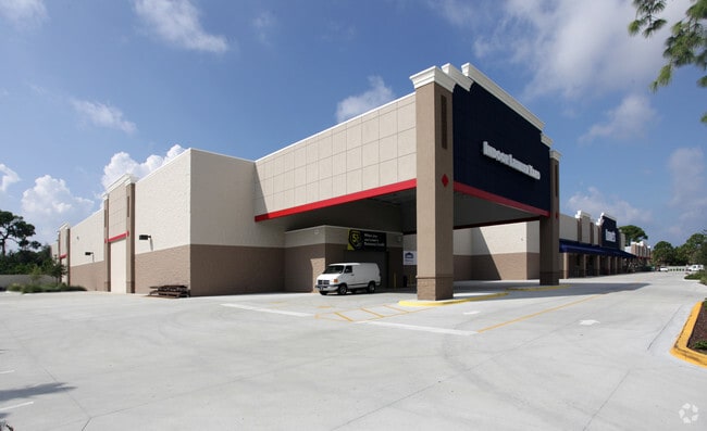
Property Record
4020 Central Sarasota Pky, Sarasota, FL 34238

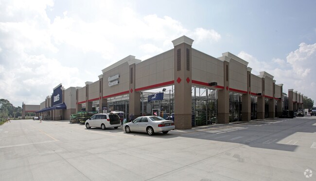

NEARBY LISTINGS FOR SALE OR LEASE
Property Detail
4020 Central Sarasota Pky
North Port-Bradenton-Sarasota, FL
Not Part Of A Subdivision
0132-02-0001
BEG AT NW COR OF NE 1/4 OF SEC 34-37-18 TH S 03-30-32 W 1318.9 FT TO SW COR OF LOT 6, BLK 1, TH S 89-53-01 E 635.53 FT TH N 00-06-59 E 669.21 FT TH NELY ALG CURVE TO LEFT 76.17 FT TH N 30-51-05 E
Departmentstore
Sarasota
AE
Florida
12115C0226G
6
2024
20 AC
2025
Sarasota
002007
Tampa/St Petersburg
111,041 SF
DEMOGRAPHICS near 4020 Central Sarasota Pky
1 Mile
3 Mile
5 Mile
2024 Total Population
8,225
40,340
92,861
2029 Population
9,429
46,867
107,871
Pop Growth 2024-2029
+ 14.64%
+ 16.18%
+ 16.16%
Average Age
56
56
53
2024 Total Households
4,405
20,644
44,912
HH Growth 2024-2029
+ 14.64%
+ 16.28%
+ 16.34%
Median Household Inc
$72,923
$85,346
$80,313
Avg Household Size
1.80
1.90
2.00
2024 Avg HH Vehicles
1.00
2.00
2.00
Median Home Value
$351,527
$431,672
$410,786
Median Year Built
1991
1993
1987
Nearby Places
Map Layers
Map Styles
 Street
 Aerial
- Restaurants
- Banks
- Shops
- Fitness
- Groceries
PUBLIC TRANSPORTATION
AIRPORT
Sarasota/Bradenton International
DRIVE
WALK
Distance
Sarasota/Bradenton International
29 min
14.1 mi
Punta Gorda
DRIVE
WALK
Distance
Punta Gorda
58 min
45.0 mi
Freight Ports
Port Manatee
DRIVE
WALK
Distance
Port Manatee
49 min
35.1 mi
Nearby Properties
Address
Land Use
TOTAL SIZE
Lot Size
Zoning
Address
Land Use
TOTAL SIZE
Lot Size
Zoning
912,672 SF
88.39 AC
RMF1
Address
Land Use
TOTAL SIZE
Lot Size
Zoning
530,029 SF
14.92 AC
RMF4
Address
Land Use
TOTAL SIZE
Lot Size
Zoning
912,253 SF
43.46 AC
PID
Address
Land Use
TOTAL SIZE
Lot Size
Zoning
318,414 SF
22.35 AC
RMF1
Address
Land Use
TOTAL SIZE
Lot Size
Zoning
242,685 SF
26.67 AC
RMF1
Address
Land Use
TOTAL SIZE
Lot Size
Zoning
258,994 SF
20.03 AC
PCD
Address
Land Use
TOTAL SIZE
Lot Size
Zoning
312,294 SF
40.21 AC
OPI
Address
Land Use
TOTAL SIZE
Lot Size
Zoning
286,775 SF
10.85 AC
RMF3
Address
Land Use
TOTAL SIZE
Lot Size
Zoning
181,467 SF
59.39 AC
RMF1
Address
Land Use
TOTAL SIZE
Lot Size
Zoning
244,492 SF
73.19 AC
GU
Address
Land Use
TOTAL SIZE
Lot Size
Zoning
17,785 SF
56.32 AC
RMF2
Address
Land Use
TOTAL SIZE
Lot Size
Zoning
148,339 SF
12.86 AC
CG
Address
Land Use
TOTAL SIZE
Lot Size
Zoning
373,288 SF
53.07 AC
PID
Address
Land Use
TOTAL SIZE
Lot Size
Zoning
426.09 AC
VPD
Address
Land Use
TOTAL SIZE
Lot Size
Zoning
133,430 SF
19.60 AC
GU
Address
Land Use
TOTAL SIZE
Lot Size
Zoning
123,338 SF
8.53 AC
OPI
Address
Land Use
TOTAL SIZE
Lot Size
Zoning
124,423 SF
76 AC
GU
Address
Land Use
TOTAL SIZE
Lot Size
Zoning
145,945 SF
13.93 AC
CG
Address
Land Use
TOTAL SIZE
Lot Size
Zoning
139,974 SF
6.07 AC
RMF4
Address
Land Use
TOTAL SIZE
Lot Size
Zoning
73,121 SF
426.09 AC
OUE2
Address
Land Use
TOTAL SIZE
Lot Size
Zoning
209,566 SF
18.63 AC
CG
Address
Land Use
TOTAL SIZE
Lot Size
Zoning
46,727 SF
38.73 AC
CG
Address
Land Use
TOTAL SIZE
Lot Size
Zoning
64,581 SF
11.85 AC
CG
Address
Land Use
TOTAL SIZE
Lot Size
Zoning
49,691 SF
360.97 AC
RSF2
Address
Land Use
TOTAL SIZE
Lot Size
Zoning
150,217 SF
14.83 AC
CG
Address
Land Use
TOTAL SIZE
Lot Size
Zoning
8,407 SF
30.21 AC
RSF1
Address
Land Use
TOTAL SIZE
Lot Size
Zoning
7,969 SF
38.20 AC
RMH
Address
Land Use
TOTAL SIZE
Lot Size
Zoning
98,877 SF
7.07 AC
RSF2
Address
Land Use
TOTAL SIZE
Lot Size
Zoning
15,095 SF
2.78 AC
RE2
The World's #1 Commercial Real Estate Marketplace
Connect with us
© 2026 CoStar Group
The information above has been obtained from sources believed reliable. While we do not doubt its accuracy we have not verified it and make no guarantee, warranty or representation about it. It is your responsibility to independently confirm its accuracy and completeness. Any projections, opinions, assumptions, or estimates used are for example only and do not represent the current or future performance of the property. The value of this transaction to you depends on tax and other factors which should be evaluated by your tax, financial, and legal advisors. You and your advisors should conduct a careful, independent investigation of the property to determine to your satisfaction the suitability of the property for your needs.