Property Record
4020 Wiley Dr, Simpsonville, SC 29680
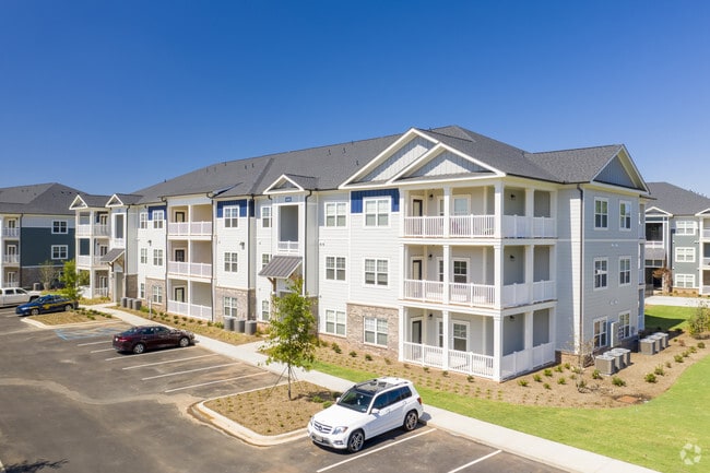
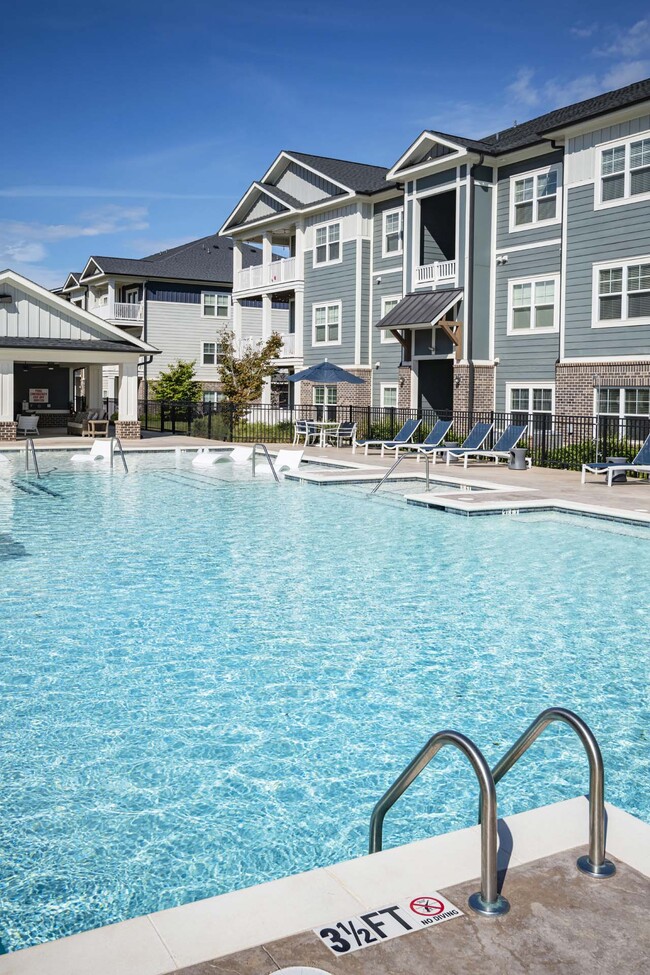
Property Detail
4020 Wiley Dr
Greenville-Anderson-Greer, SC
TR 2
0574.02-01-010.09
GREENVILLE
Apartment
South Carolina
ID
010.11
B and X Area of moderate flood hazard, usually the area between the limits of the 100-year and 500-year floods.
17.65 AC
2025
Simpsonville
2025
Greenville/Spartanburg
003014
NEARBY LISTINGS FOR SALE OR LEASE
-
-
View all Simpsonville listings for sale on LoopNet.com
DEMOGRAPHICS near 4020 Wiley Dr
1 mile
3 mile
5 mile
2025 Total Population
5,216
57,829
117,816
2030 Population
5,717
62,549
127,758
Pop Growth 2025-2030
+ 9.61%
+ 8.16%
+ 8.44%
Average Age
40
40
40
2025 Total Households
2,225
22,144
45,524
HH Growth 2025-2030
+ 9.71%
+ 8.40%
+ 8.65%
Median Household Inc
$85,719
$91,623
$90,126
Avg Household Size
2.30
2.60
2.60
2025 Avg HH Vehicles
2.00
2.00
2.00
Median Home Value
$269,662
$313,452
$310,737
Median Year Built
1993
1999
2000
Nearby Places
Map Layers
Map Styles
 Street
 Aerial
Layers
 Traffic
 Biking
Places
Listings with unknown addresses are not visible on the map
- Restaurants
- Banks
- Shops
- Fitness
- Groceries
PUBLIC TRANSPORTATION
AIRPORT
Greenville Spartanburg International
Drive
Walk
Distance
Greenville Spartanburg International
24 min
15.7 mi
Freight Ports
North Charleston Terminal
Drive
Walk
Distance
North Charleston Terminal
214 min
191.2 mi
Nearby Properties
Address
Land Use
TOTAL SIZE
Lot Size
Zoning
Address
Land Use
TOTAL SIZE
Lot Size
Zoning
23.23 AC
Address
Land Use
TOTAL SIZE
Lot Size
Zoning
16.32 AC
ROI
Address
Land Use
TOTAL SIZE
Lot Size
Zoning
17.02 AC
BG
Address
Land Use
TOTAL SIZE
Lot Size
Zoning
12.31 AC
Address
Land Use
TOTAL SIZE
Lot Size
Zoning
17.59 AC
Address
Land Use
TOTAL SIZE
Lot Size
Zoning
195.23 AC
RRROW
Address
Land Use
TOTAL SIZE
Lot Size
Zoning
11.91 AC
RM20
Address
Land Use
TOTAL SIZE
Lot Size
Zoning
10.04 AC
BG
Address
Land Use
TOTAL SIZE
Lot Size
Zoning
29.21 AC
I1
Address
Land Use
TOTAL SIZE
Lot Size
Zoning
26.30 AC
ROI
Address
Land Use
TOTAL SIZE
Lot Size
Zoning
4.59 AC
BI
Address
Land Use
TOTAL SIZE
Lot Size
Zoning
10.78 AC
I1
Address
Land Use
TOTAL SIZE
Lot Size
Zoning
Address
Land Use
TOTAL SIZE
Lot Size
Zoning
12.11 AC
BG
Address
Land Use
TOTAL SIZE
Lot Size
Zoning
5.30 AC
BI
Address
Land Use
TOTAL SIZE
Lot Size
Zoning
9.46 AC
I1
Address
Land Use
TOTAL SIZE
Lot Size
Zoning
50.76 AC
PDC
Address
Land Use
TOTAL SIZE
Lot Size
Zoning
76.20 AC
R20
Address
Land Use
TOTAL SIZE
Lot Size
Zoning
1,176 SF
126.24 AC
RS
Address
Land Use
TOTAL SIZE
Lot Size
Zoning
12.43 AC
RS
Address
Land Use
TOTAL SIZE
Lot Size
Zoning
10.50 AC
RRROW
Address
Land Use
TOTAL SIZE
Lot Size
Zoning
12.87 AC
RLO
Address
Land Use
TOTAL SIZE
Lot Size
Zoning
51.30 AC
RS
Address
Land Use
TOTAL SIZE
Lot Size
Zoning
Address
Land Use
TOTAL SIZE
Lot Size
Zoning
5.90 AC
RS
Address
Land Use
TOTAL SIZE
Lot Size
Zoning
7.10 AC
BG
Address
Land Use
TOTAL SIZE
Lot Size
Zoning
96.14 AC
NZ
Address
Land Use
TOTAL SIZE
Lot Size
Zoning
7.03 AC
I1
Address
Land Use
TOTAL SIZE
Lot Size
Zoning
8.23 AC
S1
Address
Land Use
TOTAL SIZE
Lot Size
Zoning
1,155 SF
34.77 AC
I1
The World's #1 Commercial Real Estate Marketplace
Connect with us
© 2026 CoStar Group
The information above has been obtained from sources believed reliable. While we do not doubt its accuracy we have not verified it and make no guarantee, warranty or representation about it. It is your responsibility to independently confirm its accuracy and completeness. Any projections, opinions, assumptions, or estimates used are for example only and do not represent the current or future performance of the property. The value of this transaction to you depends on tax and other factors which should be evaluated by your tax, financial, and legal advisors. You and your advisors should conduct a careful, independent investigation of the property to determine to your satisfaction the suitability of the property for your needs.