Property Record
4021 Main St, Trappe, MD 21673

Property Detail
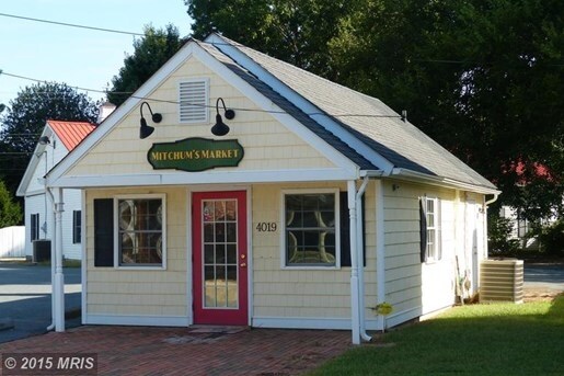
4021 Main St
Restaurantbuilding
L 65'MAIN/75' MAPLE S/S E MAPLE ST TRAPPE
C
Talbot
B and X Area of moderate flood hazard, usually the area between the limits of the 100-year and 500-year floods.
Maryland
2025
0.12 AC
2025
Other Market Areas
960900
Easton, MD
5,676 SF
03-105385
NEARBY LISTINGS FOR SALE OR LEASE
-
-
View all Trappe listings for sale on LoopNet.com
DEMOGRAPHICS near 4021 Main St
1 mile
3 mile
5 mile
2025 Total Population
1,055
2,277
4,010
2030 Population
1,069
2,311
4,066
Pop Growth 2025-2030
+ 1.33%
+ 1.49%
+ 1.40%
Average Age
40
44
46
2025 Total Households
412
925
1,672
HH Growth 2025-2030
+ 1.46%
+ 1.51%
+ 1.44%
Median Household Inc
$48,552
$66,864
$72,964
Avg Household Size
2.60
2.50
2.40
2025 Avg HH Vehicles
2.00
2.00
2.00
Median Home Value
$299,999
$353,723
$381,999
Median Year Built
1978
1980
1981
Nearby Places
Map Layers
Map Styles
 Street
 Aerial
Layers
 Traffic
 Biking
Places
Listings with unknown addresses are not visible on the map
- Restaurants
- Banks
- Shops
- Fitness
- Groceries
PUBLIC TRANSPORTATION
AIRPORT
Salisbury-Ocean City Wicomico Regional
Drive
Walk
Distance
Salisbury-Ocean City Wicomico Regional
70 min
47.0 mi
Freight Ports
Port of Baltimore
Drive
Walk
Distance
Port of Baltimore
103 min
70.6 mi
SALE & LEASE HISTORY
LISTING DATE
SALE/LEASE

Feb 05, 2019
For Sale
Nearby Properties
Address
Land Use
TOTAL SIZE
Lot Size
Zoning
Address
Land Use
TOTAL SIZE
Lot Size
Zoning
45,880 SF
11.21 AC
E
Address
Land Use
TOTAL SIZE
Lot Size
Zoning
24,831 SF
20.57 AC
A2
Address
Land Use
TOTAL SIZE
Lot Size
Zoning
27,000 SF
1.48 AC
C
Address
Land Use
TOTAL SIZE
Lot Size
Zoning
12,763 SF
1.36 AC
C
Address
Land Use
TOTAL SIZE
Lot Size
Zoning
648 SF
6.54 AC
M
Address
Land Use
TOTAL SIZE
Lot Size
Zoning
14,563 SF
0.56 AC
C
Address
Land Use
TOTAL SIZE
Lot Size
Zoning
6,192 SF
7.11 AC
Address
Land Use
TOTAL SIZE
Lot Size
Zoning
14,520 SF
1.03 AC
Address
Land Use
TOTAL SIZE
Lot Size
Zoning
2,914 SF
1.29 AC
C
Address
Land Use
TOTAL SIZE
Lot Size
Zoning
4,966 SF
0.81 AC
Address
Land Use
TOTAL SIZE
Lot Size
Zoning
0.43 AC
Address
Land Use
TOTAL SIZE
Lot Size
Zoning
4,160 SF
0.27 AC
C
Address
Land Use
TOTAL SIZE
Lot Size
Zoning
4,432 SF
2.06 AC
Address
Land Use
TOTAL SIZE
Lot Size
Zoning
3,616 SF
3.34 AC
Address
Land Use
TOTAL SIZE
Lot Size
Zoning
6.21 AC
Address
Land Use
TOTAL SIZE
Lot Size
Zoning
5,120 SF
0.61 AC
C
Address
Land Use
TOTAL SIZE
Lot Size
Zoning
5,346 SF
0.75 AC
Address
Land Use
TOTAL SIZE
Lot Size
Zoning
2,409 SF
1.13 AC
E
Address
Land Use
TOTAL SIZE
Lot Size
Zoning
12.11 AC
Address
Land Use
TOTAL SIZE
Lot Size
Zoning
6,939 SF
2.32 AC
Address
Land Use
TOTAL SIZE
Lot Size
Zoning
3,551 SF
0.20 AC
Address
Land Use
TOTAL SIZE
Lot Size
Zoning
2,400 SF
1 AC
Address
Land Use
TOTAL SIZE
Lot Size
Zoning
3,502 SF
0.16 AC
Address
Land Use
TOTAL SIZE
Lot Size
Zoning
1,440 SF
12.41 AC
Address
Land Use
TOTAL SIZE
Lot Size
Zoning
2,662 SF
0.98 AC
A1
Address
Land Use
TOTAL SIZE
Lot Size
Zoning
3,386 SF
0.19 AC
Address
Land Use
TOTAL SIZE
Lot Size
Zoning
3,666 SF
0.19 AC
Address
Land Use
TOTAL SIZE
Lot Size
Zoning
1,421 SF
7.60 AC
C2
Address
Land Use
TOTAL SIZE
Lot Size
Zoning
7,960 SF
0.27 AC
C
Address
Land Use
TOTAL SIZE
Lot Size
Zoning
24.60 AC
The World's #1 Commercial Real Estate Marketplace
Connect with us
© 2026 CoStar Group
The information above has been obtained from sources believed reliable. While we do not doubt its accuracy we have not verified it and make no guarantee, warranty or representation about it. It is your responsibility to independently confirm its accuracy and completeness. Any projections, opinions, assumptions, or estimates used are for example only and do not represent the current or future performance of the property. The value of this transaction to you depends on tax and other factors which should be evaluated by your tax, financial, and legal advisors. You and your advisors should conduct a careful, independent investigation of the property to determine to your satisfaction the suitability of the property for your needs.