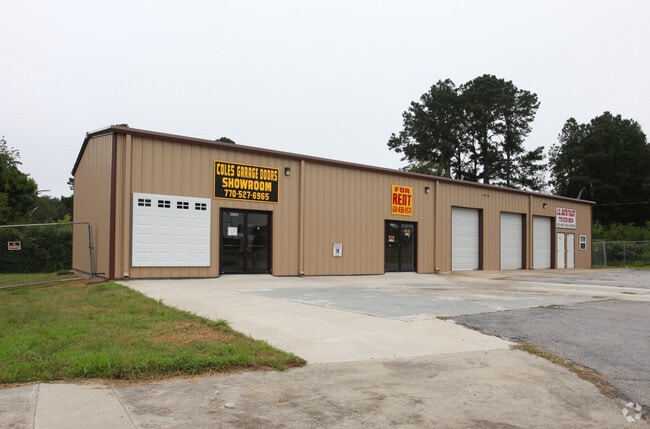
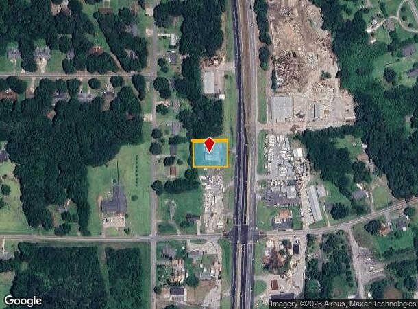
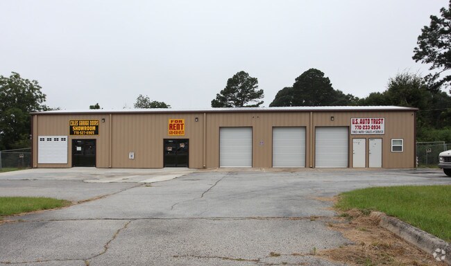
Property Record
4021 N Highway 19 41, Hampton, GA 30228
NEARBY LISTINGS FOR SALE OR LEASE
-
-
View all Hampton listings for sale on LoopNet.com
Property Detail
4021 N Highway 19 41
241A-03-001-A
HWY 19&41 OFFICE PB 11/96, 11/344
Storesoffices
Spalding
X
Georgia
13255C0060E
107
2024
0.39 AC
2024
S Clayton/Henry Cnty
160402
Atlanta
2,880 SF
Atlanta-Sandy Springs-Roswell, GA
DEMOGRAPHICS near 4021 N Highway 19 41
1 Mile
3 Mile
5 Mile
2024 Total Population
1,512
9,348
34,604
2029 Population
1,599
10,030
37,195
Pop Growth 2024-2029
+ 5.75%
+ 7.30%
+ 7.49%
Average Age
37
38
40
2024 Total Households
535
3,185
12,604
HH Growth 2024-2029
+ 5.79%
+ 7.10%
+ 7.35%
Median Household Inc
$56,864
$61,037
$63,461
Avg Household Size
2.80
2.90
2.70
2024 Avg HH Vehicles
2.00
2.00
2.00
Median Home Value
$154,504
$176,766
$190,294
Median Year Built
1990
1993
1996
Nearby Places
Map Layers
Map Styles
 Street
 Aerial
- Restaurants
- Banks
- Shops
- Fitness
- Groceries
PUBLIC TRANSPORTATION
AIRPORT
Hartsfield - Jackson Atlanta International
DRIVE
WALK
Distance
Hartsfield - Jackson Atlanta International
38 min
24.5 mi
Nearby Properties
Address
Land Use
TOTAL SIZE
Lot Size
Zoning
Address
Land Use
TOTAL SIZE
Lot Size
Zoning
1,424,654 SF
172.86 AC
Address
Land Use
TOTAL SIZE
Lot Size
Zoning
11,520 SF
8.77 AC
C-1B
Address
Land Use
TOTAL SIZE
Lot Size
Zoning
20 AC
AR-1
Address
Land Use
TOTAL SIZE
Lot Size
Zoning
21,542 SF
7.53 AC
C-1B
Address
Land Use
TOTAL SIZE
Lot Size
Zoning
2,160 SF
6.90 AC
C-1B
Address
Land Use
TOTAL SIZE
Lot Size
Zoning
594 SF
4.08 AC
C-1B
Address
Land Use
TOTAL SIZE
Lot Size
Zoning
5,751 SF
16.49 AC
C1
Address
Land Use
TOTAL SIZE
Lot Size
Zoning
39,681 SF
6.19 AC
C2
Address
Land Use
TOTAL SIZE
Lot Size
Zoning
5,518 SF
11.39 AC
C-1
Address
Land Use
TOTAL SIZE
Lot Size
Zoning
19,500 SF
3.09 AC
C
Address
Land Use
TOTAL SIZE
Lot Size
Zoning
25,925 SF
8.25 AC
Address
Land Use
TOTAL SIZE
Lot Size
Zoning
9,020 SF
3.30 AC
C1
Address
Land Use
TOTAL SIZE
Lot Size
Zoning
16,800 SF
2.01 AC
C-1B
Address
Land Use
TOTAL SIZE
Lot Size
Zoning
30.24 AC
M1
Address
Land Use
TOTAL SIZE
Lot Size
Zoning
40,536 SF
6 AC
Address
Land Use
TOTAL SIZE
Lot Size
Zoning
10,200 SF
8.35 AC
Address
Land Use
TOTAL SIZE
Lot Size
Zoning
308.50 AC
Address
Land Use
TOTAL SIZE
Lot Size
Zoning
19,026 SF
4.75 AC
RA
Address
Land Use
TOTAL SIZE
Lot Size
Zoning
73,390 SF
6.35 AC
M2
Address
Land Use
TOTAL SIZE
Lot Size
Zoning
16,800 SF
2.66 AC
Address
Land Use
TOTAL SIZE
Lot Size
Zoning
66 AC
C1/AR1
Address
Land Use
TOTAL SIZE
Lot Size
Zoning
9,100 SF
4.19 AC
Address
Land Use
TOTAL SIZE
Lot Size
Zoning
48,780 SF
3.84 AC
R2
Address
Land Use
TOTAL SIZE
Lot Size
Zoning
13,556 SF
8.43 AC
C-1
Address
Land Use
TOTAL SIZE
Lot Size
Zoning
8,967 SF
3.46 AC
Address
Land Use
TOTAL SIZE
Lot Size
Zoning
4,956 SF
2.89 AC
The World's #1 Commercial Real Estate Marketplace
Connect with us
© 2025 CoStar Group
The information above has been obtained from sources believed reliable. While we do not doubt its accuracy we have not verified it and make no guarantee, warranty or representation about it. It is your responsibility to independently confirm its accuracy and completeness. Any projections, opinions, assumptions, or estimates used are for example only and do not represent the current or future performance of the property. The value of this transaction to you depends on tax and other factors which should be evaluated by your tax, financial, and legal advisors. You and your advisors should conduct a careful, independent investigation of the property to determine to your satisfaction the suitability of the property for your needs.