Property Record
4021 Sunrise Blvd, Rancho Cordova, CA 95742


NEARBY LISTINGS FOR SALE OR LEASE
-
-
-
Rancho Cordova Pky @ International Dr.
Rancho Cordova, CA 95742
$645,559 - $14,951,316
1.56 - 14.36 AC Lot
Land
-
-
-
-
No Photo
-
View all Rancho Cordova listings for sale on LoopNet.com
Property Detail
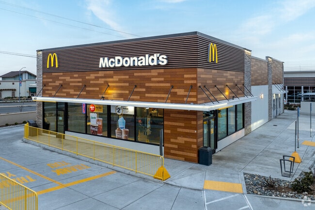
4021 Sunrise Blvd
067-2370-005
NULL
Restaurantdrivein
Sacramento
X
California
06067C0240J
1.04 AC
2024
Highway 50 Corridor
2025
Sacramento
008802
Sacramento-Roseville-Folsom, CA
DEMOGRAPHICS near 4021 Sunrise Blvd
1 Mile
3 Mile
5 Mile
2024 Total Population
5,759
29,728
91,681
2029 Population
5,915
30,221
92,358
Pop Growth 2024-2029
+ 2.71%
+ 1.66%
+ 0.74%
Average Age
35
37
38
2024 Total Households
1,588
9,245
32,414
HH Growth 2024-2029
+ 2.83%
+ 1.71%
+ 0.69%
Median Household Inc
$145,390
$131,542
$88,735
Avg Household Size
3.50
3.20
2.80
2024 Avg HH Vehicles
2.00
2.00
2.00
Median Home Value
$499,451
$539,889
$446,127
Median Year Built
2006
2007
1982
Nearby Places
Map Layers
Map Styles
 Street
 Aerial
- Restaurants
- Banks
- Shops
- Fitness
- Groceries
PUBLIC TRANSPORTATION
AIRPORT
Sacramento International
DRIVE
WALK
Distance
Sacramento International
39 min
28.9 mi
Freight Ports
Port of Stockton
DRIVE
WALK
Distance
Port of Stockton
68 min
51.0 mi
Nearby Properties
Address
Land Use
TOTAL SIZE
Lot Size
Zoning
Address
Land Use
TOTAL SIZE
Lot Size
Zoning
251,024 SF
5.19 AC
SPA (CVSPA
Address
Land Use
TOTAL SIZE
Lot Size
Zoning
83.57 AC
MP (RDOSP)
Address
Land Use
TOTAL SIZE
Lot Size
Zoning
323,088 SF
19.69 AC
OPMU
Address
Land Use
TOTAL SIZE
Lot Size
Zoning
166,216 SF
10.77 AC
M-2
Address
Land Use
TOTAL SIZE
Lot Size
Zoning
6.31 AC
RC (ZSPA)
Address
Land Use
TOTAL SIZE
Lot Size
Zoning
132,149 SF
8.29 AC
OPMU
Address
Land Use
TOTAL SIZE
Lot Size
Zoning
218,216 SF
14.22 AC
OPMU
Address
Land Use
TOTAL SIZE
Lot Size
Zoning
104,042 SF
7.40 AC
OIMU
Address
Land Use
TOTAL SIZE
Lot Size
Zoning
135,197 SF
11.38 AC
SPA (CVSPA
Address
Land Use
TOTAL SIZE
Lot Size
Zoning
137,306 SF
15.91 AC
GC
Address
Land Use
TOTAL SIZE
Lot Size
Zoning
98,767 SF
6.43 AC
BP (ZSPA)
Address
Land Use
TOTAL SIZE
Lot Size
Zoning
164,149 SF
9.31 AC
LI (ZSPA)
Address
Land Use
TOTAL SIZE
Lot Size
Zoning
12,988 SF
3.98 AC
M-2
Address
Land Use
TOTAL SIZE
Lot Size
Zoning
5.49 AC
BP (ZSPA)
Address
Land Use
TOTAL SIZE
Lot Size
Zoning
RD 7 (SDSP
Address
Land Use
TOTAL SIZE
Lot Size
Zoning
159,148 SF
11.07 AC
OPMU
Address
Land Use
TOTAL SIZE
Lot Size
Zoning
108,683 SF
7.31 AC
M-1
Address
Land Use
TOTAL SIZE
Lot Size
Zoning
129,848 SF
11.32 AC
M-2
Address
Land Use
TOTAL SIZE
Lot Size
Zoning
582.63 AC
SF (RDOSP)
Address
Land Use
TOTAL SIZE
Lot Size
Zoning
105,650 SF
7.02 AC
OPMU
Address
Land Use
TOTAL SIZE
Lot Size
Zoning
99,860 SF
6.62 AC
OPMU
Address
Land Use
TOTAL SIZE
Lot Size
Zoning
60,704 SF
4.97 AC
OPMU
Address
Land Use
TOTAL SIZE
Lot Size
Zoning
99,385 SF
6.61 AC
OPMU
Address
Land Use
TOTAL SIZE
Lot Size
Zoning
67,639 SF
5.13 AC
OPMU
Address
Land Use
TOTAL SIZE
Lot Size
Zoning
104,314 SF
6.02 AC
OPMU
Address
Land Use
TOTAL SIZE
Lot Size
Zoning
30,000 SF
1.94 AC
SPA (MFSPA
Address
Land Use
TOTAL SIZE
Lot Size
Zoning
99,387 SF
8.14 AC
OPMU
Address
Land Use
TOTAL SIZE
Lot Size
Zoning
62,957 SF
4.91 AC
OIMU
Address
Land Use
TOTAL SIZE
Lot Size
Zoning
49,069 SF
3.43 AC
OPMU
Address
Land Use
TOTAL SIZE
Lot Size
Zoning
43,185 SF
3.38 AC
GC
The World's #1 Commercial Real Estate Marketplace
Connect with us
© 2026 CoStar Group
The information above has been obtained from sources believed reliable. While we do not doubt its accuracy we have not verified it and make no guarantee, warranty or representation about it. It is your responsibility to independently confirm its accuracy and completeness. Any projections, opinions, assumptions, or estimates used are for example only and do not represent the current or future performance of the property. The value of this transaction to you depends on tax and other factors which should be evaluated by your tax, financial, and legal advisors. You and your advisors should conduct a careful, independent investigation of the property to determine to your satisfaction the suitability of the property for your needs.