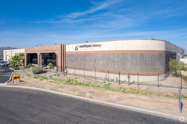
Property Record
4022 S 20Th St, Phoenix, AZ 85040


Current Lease Availabilities
Property Detail
4022 S 20Th St
122-38-152A
TWENTY FOURTH STREET INDUSTRIAL PARK 2 MCR 290-12
Warehouse
Maricopa
I-P
Arizona
C and X Area of minimal flood hazard, usually depicted on FIRMs as above the 500-year flood level.
40
2025
3.43 AC
2025
S Airport N of Roeser
115300
Phoenix
59,859 SF
Phoenix-Mesa-Chandler, AZ
NEARBY LISTINGS FOR SALE OR LEASE
DEMOGRAPHICS near 4022 S 20Th St
1 mile
3 mile
5 mile
2025 Total Population
11,049
80,441
276,269
2030 Population
11,486
84,049
288,942
Pop Growth 2025-2030
+ 3.96%
+ 4.49%
+ 4.59%
Average Age
35
36
36
2025 Total Households
3,506
26,061
97,700
HH Growth 2025-2030
+ 3.94%
+ 4.50%
+ 4.79%
Median Household Inc
$51,065
$64,344
$65,742
Avg Household Size
3.00
3.00
2.70
2025 Avg HH Vehicles
2.00
2.00
2.00
Median Home Value
$353,528
$383,008
$383,204
Median Year Built
1989
1989
1983
Nearby Places
Map Layers
Map Styles
 Street
 Aerial
Layers
 Traffic
 Biking
Places
Listings with unknown addresses are not visible on the map
- Restaurants
- Banks
- Shops
- Fitness
- Groceries
PUBLIC TRANSPORTATION
AIRPORT
Phoenix Sky Harbor International
Drive
Walk
Distance
Phoenix Sky Harbor International
12 min
4.7 mi
Phoenix-Mesa Gateway
Drive
Walk
Distance
Phoenix-Mesa Gateway
42 min
29.0 mi
Nearby Properties
Address
Land Use
TOTAL SIZE
Lot Size
Zoning
Address
Land Use
TOTAL SIZE
Lot Size
Zoning
2,901,193 SF
20.73 AC
A-1
Address
Land Use
TOTAL SIZE
Lot Size
Zoning
997,436 SF
24.84 AC
DC
Address
Land Use
TOTAL SIZE
Lot Size
Zoning
24.15 AC
Address
Land Use
TOTAL SIZE
Lot Size
Zoning
1,949,842 SF
40 AC
I-1
Address
Land Use
TOTAL SIZE
Lot Size
Zoning
2,705,875 SF
133.42 AC
I-1
Address
Land Use
TOTAL SIZE
Lot Size
Zoning
81,816 SF
7.95 AC
Address
Land Use
TOTAL SIZE
Lot Size
Zoning
94,162 SF
9.40 AC
I-2
Address
Land Use
TOTAL SIZE
Lot Size
Zoning
Address
Land Use
TOTAL SIZE
Lot Size
Zoning
10,776 SF
10.14 AC
C-C
Address
Land Use
TOTAL SIZE
Lot Size
Zoning
522,676 SF
264.16 AC
I-1
Address
Land Use
TOTAL SIZE
Lot Size
Zoning
709,191 SF
52.85 AC
I-1
Address
Land Use
TOTAL SIZE
Lot Size
Zoning
5.18 AC
Address
Land Use
TOTAL SIZE
Lot Size
Zoning
82,581 SF
3.06 AC
C3
Address
Land Use
TOTAL SIZE
Lot Size
Zoning
635,169 SF
92.76 AC
I-1
Address
Land Use
TOTAL SIZE
Lot Size
Zoning
13.72 AC
Address
Land Use
TOTAL SIZE
Lot Size
Zoning
469,025 SF
199.15 AC
A-1
Address
Land Use
TOTAL SIZE
Lot Size
Zoning
277,910 SF
53.82 AC
A-1
Address
Land Use
TOTAL SIZE
Lot Size
Zoning
359,401 SF
96.70 AC
R-6
Address
Land Use
TOTAL SIZE
Lot Size
Zoning
25,289 SF
2.70 AC
I-2
Address
Land Use
TOTAL SIZE
Lot Size
Zoning
369,723 SF
19.41 AC
R3
Address
Land Use
TOTAL SIZE
Lot Size
Zoning
34,520 SF
1.79 AC
C-G
Address
Land Use
TOTAL SIZE
Lot Size
Zoning
180,690 SF
11.20 AC
I-P
Address
Land Use
TOTAL SIZE
Lot Size
Zoning
351,199 SF
22.04 AC
I-1
Address
Land Use
TOTAL SIZE
Lot Size
Zoning
494,504 SF
18.83 AC
I-1
Address
Land Use
TOTAL SIZE
Lot Size
Zoning
40 AC
I-1
Address
Land Use
TOTAL SIZE
Lot Size
Zoning
734,975 SF
10.53 AC
Address
Land Use
TOTAL SIZE
Lot Size
Zoning
269,181 SF
78.11 AC
I-1
Address
Land Use
TOTAL SIZE
Lot Size
Zoning
159,136 SF
2.54 AC
C-3
Address
Land Use
TOTAL SIZE
Lot Size
Zoning
558,712 SF
30.72 AC
A2
Address
Land Use
TOTAL SIZE
Lot Size
Zoning
320,708 SF
16.25 AC
A1
The World's #1 Commercial Real Estate Marketplace
Connect with us
© 2026 CoStar Group
The information above has been obtained from sources believed reliable. While we do not doubt its accuracy we have not verified it and make no guarantee, warranty or representation about it. It is your responsibility to independently confirm its accuracy and completeness. Any projections, opinions, assumptions, or estimates used are for example only and do not represent the current or future performance of the property. The value of this transaction to you depends on tax and other factors which should be evaluated by your tax, financial, and legal advisors. You and your advisors should conduct a careful, independent investigation of the property to determine to your satisfaction the suitability of the property for your needs.