Property Record
4023 Forest Dr, Columbia, SC 29204
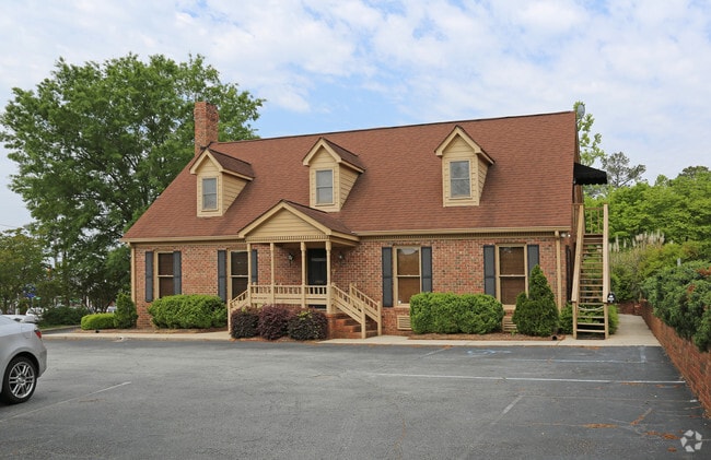


Property Detail
4023 Forest Dr
14010-09-21
LOT 2 130.6X148.6X108.8X76.6 #PR X-9698
Commercialnec
Richland
C-1
South Carolina
B and X Area of moderate flood hazard, usually the area between the limits of the 100-year and 500-year floods.
2,130
2025
0.24 AC
2024
Forest Acres
011202
Columbia
2,616 SF
Columbia, SC
NEARBY LISTINGS FOR SALE OR LEASE
DEMOGRAPHICS near 4023 Forest Dr
1 mile
3 mile
5 mile
2025 Total Population
8,463
78,999
172,902
2030 Population
8,714
81,652
179,257
Pop Growth 2025-2030
+ 2.97%
+ 3.36%
+ 3.68%
Average Age
41
38
36
2025 Total Households
4,035
32,853
72,081
HH Growth 2025-2030
+ 3.07%
+ 3.74%
+ 4.03%
Median Household Inc
$76,729
$58,634
$52,673
Avg Household Size
2.10
2.10
2.10
2025 Avg HH Vehicles
2.00
2.00
2.00
Median Home Value
$319,419
$290,203
$252,845
Median Year Built
1961
1964
1971
Nearby Places
Map Layers
Map Styles
 Street
 Aerial
Layers
 Traffic
 Biking
Places
Listings with unknown addresses are not visible on the map
- Restaurants
- Banks
- Shops
- Fitness
- Groceries
PUBLIC TRANSPORTATION
COMMUTER RAIL
Columbia Amtrak Station (Silver Star - Amtrak)
Drive
Walk
Distance
Columbia Amtrak Station (Silver Star - Amtrak)
10 min
4.6 mi
AIRPORT
Columbia Metro
Drive
Walk
Distance
Columbia Metro
29 min
14.1 mi
Freight Ports
North Charleston Terminal
Drive
Walk
Distance
North Charleston Terminal
126 min
109.1 mi
Nearby Properties
Address
Land Use
TOTAL SIZE
Lot Size
Zoning
Address
Land Use
TOTAL SIZE
Lot Size
Zoning
501,365 SF
13.28 AC
O-I
Address
Land Use
TOTAL SIZE
Lot Size
Zoning
383,491 SF
2.36 AC
C-3
Address
Land Use
TOTAL SIZE
Lot Size
Zoning
316,116 SF
21.73 AC
RG-2
Address
Land Use
TOTAL SIZE
Lot Size
Zoning
85,065 SF
2.43 AC
C-1
Address
Land Use
TOTAL SIZE
Lot Size
Zoning
1,704.85 AC
RU
Address
Land Use
TOTAL SIZE
Lot Size
Zoning
13,028 SF
31.69 AC
RG-1
Address
Land Use
TOTAL SIZE
Lot Size
Zoning
100 SF
156.42 AC
RSF-2
Address
Land Use
TOTAL SIZE
Lot Size
Zoning
147,399 SF
2.27 AC
C-1
Address
Land Use
TOTAL SIZE
Lot Size
Zoning
216,180 SF
15.66 AC
C-1
Address
Land Use
TOTAL SIZE
Lot Size
Zoning
231,426 SF
10 AC
C-3
Address
Land Use
TOTAL SIZE
Lot Size
Zoning
167,168 SF
1.37 AC
RG-2
Address
Land Use
TOTAL SIZE
Lot Size
Zoning
100 SF
19.24 AC
C-1
Address
Land Use
TOTAL SIZE
Lot Size
Zoning
14,360 SF
4.61 AC
C-1
Address
Land Use
TOTAL SIZE
Lot Size
Zoning
100 SF
15.68 AC
RG-2
Address
Land Use
TOTAL SIZE
Lot Size
Zoning
169,291 SF
18.97 AC
C-3
Address
Land Use
TOTAL SIZE
Lot Size
Zoning
9.66 AC
C-1
Address
Land Use
TOTAL SIZE
Lot Size
Zoning
129,721 SF
3.72 AC
C-3
Address
Land Use
TOTAL SIZE
Lot Size
Zoning
259,948 SF
14.40 AC
RM-HD
Address
Land Use
TOTAL SIZE
Lot Size
Zoning
202,048 SF
20.98 AC
C-3
Address
Land Use
TOTAL SIZE
Lot Size
Zoning
414,262 SF
34.45 AC
RM-HD
Address
Land Use
TOTAL SIZE
Lot Size
Zoning
78,094 SF
2 AC
C-1
Address
Land Use
TOTAL SIZE
Lot Size
Zoning
90,984 SF
2.83 AC
C-1
Address
Land Use
TOTAL SIZE
Lot Size
Zoning
23,379 SF
3.76 AC
M-1
Address
Land Use
TOTAL SIZE
Lot Size
Zoning
115,734 SF
0.98 AC
C-1
Address
Land Use
TOTAL SIZE
Lot Size
Zoning
55.91 AC
M-1
Address
Land Use
TOTAL SIZE
Lot Size
Zoning
277,459 SF
9.74 AC
C-1
Address
Land Use
TOTAL SIZE
Lot Size
Zoning
20 AC
C-3
Address
Land Use
TOTAL SIZE
Lot Size
Zoning
65,058 SF
3.54 AC
C-1
Address
Land Use
TOTAL SIZE
Lot Size
Zoning
67,200 SF
1.72 AC
C-1
Address
Land Use
TOTAL SIZE
Lot Size
Zoning
4.05 AC
C-1
The World's #1 Commercial Real Estate Marketplace
Connect with us
© 2026 CoStar Group
The information above has been obtained from sources believed reliable. While we do not doubt its accuracy we have not verified it and make no guarantee, warranty or representation about it. It is your responsibility to independently confirm its accuracy and completeness. Any projections, opinions, assumptions, or estimates used are for example only and do not represent the current or future performance of the property. The value of this transaction to you depends on tax and other factors which should be evaluated by your tax, financial, and legal advisors. You and your advisors should conduct a careful, independent investigation of the property to determine to your satisfaction the suitability of the property for your needs.