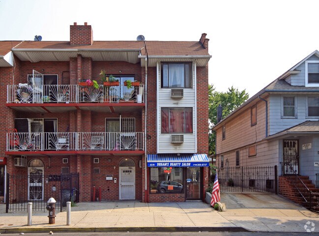
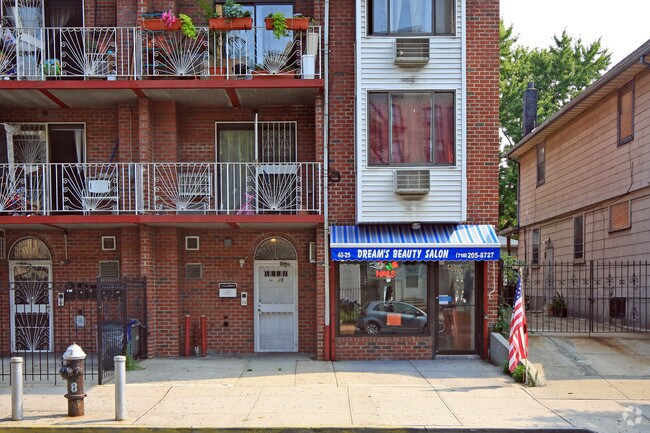
Property Record
4023 Gleane St, Elmhurst, NY 11373

NEARBY LISTINGS FOR SALE OR LEASE
Property Detail
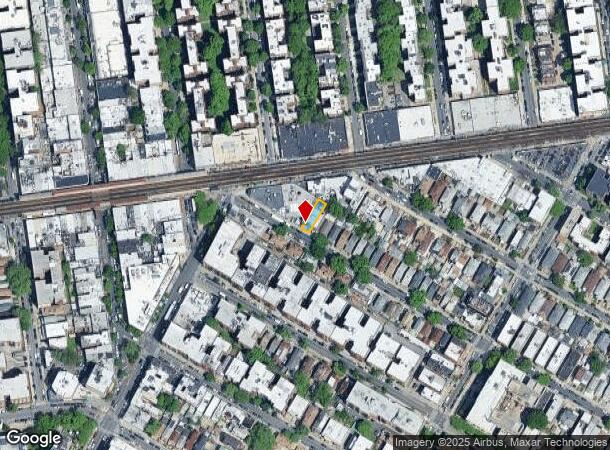
4023 Gleane St
01503-0075
Queens
Commercialofficeresidentialmixeduse
New York
X
75
3604970207F
0.06 AC
2024
Elmhurst
2025
Long Island (New York)
026901
New York-Jersey City-White Plains, NY-NJ
3,600 SF
DEMOGRAPHICS near 4023 Gleane St
1 Mile
3 Mile
5 Mile
2024 Total Population
226,152
842,858
2,332,323
2029 Population
211,590
791,091
2,180,579
Pop Growth 2024-2029
(6.44%)
(6.14%)
(6.51%)
Average Age
40
41
40
2024 Total Households
72,416
310,623
907,957
HH Growth 2024-2029
(6.48%)
(6.20%)
(6.69%)
Median Household Inc
$63,910
$72,800
$75,424
Avg Household Size
3.00
2.60
2.50
2024 Avg HH Vehicles
1.00
1.00
1.00
Median Home Value
$597,428
$679,848
$767,621
Median Year Built
1951
1952
1954
Nearby Places
Map Layers
Map Styles
 Street
 Aerial
- Restaurants
- Banks
- Shops
- Fitness
- Groceries
PUBLIC TRANSPORTATION
TRANSIT/SUBWAY
82 Street-Jackson Heights (7 - New York MTA Subway (The Subway))
DRIVE
WALK
Distance
82 Street-Jackson Heights (7 - New York MTA Subway (The Subway))
1 min
2 min
0.1 mi
90 Street-Elmhurst Avenue (7 - New York MTA Subway (The Subway))
DRIVE
WALK
Distance
90 Street-Elmhurst Avenue (7 - New York MTA Subway (The Subway))
2 min
7 min
0.4 mi
Elmhurst Avenue (E - New York MTA Subway (The Subway), M - New York MTA Subway (The Subway), R - New York MTA Subway (The Subway))
DRIVE
WALK
Distance
Elmhurst Avenue (E - New York MTA Subway (The Subway), M - New York MTA Subway (The Subway), R - New York MTA Subway (The Subway))
2 min
10 min
0.5 mi
Roosevelt Avenue-74 Street (7 - New York MTA Subway (The Subway), E - New York MTA Subway (The Subway), F - New York MTA Subway (The Subway), M - New York MTA Subway (The Subway), R - New York MTA Subway (The Subway))
DRIVE
WALK
Distance
Roosevelt Avenue-74 Street (7 - New York MTA Subway (The Subway), E - New York MTA Subway (The Subway), F - New York MTA Subway (The Subway), M - New York MTA Subway (The Subway), R - New York MTA Subway (The Subway))
3 min
10 min
0.5 mi
Junction Boulevard (7 - New York MTA Subway (The Subway))
DRIVE
WALK
Distance
Junction Boulevard (7 - New York MTA Subway (The Subway))
2 min
14 min
0.7 mi
COMMUTER RAIL
Woodside Station (Babylon Branch - Long Island Rail Road, Far Rockaway Branch - Long Island Rail Road, Hempstead Branch - Long Island Rail Road, Long Beach Branch - Long Island Rail Road, Montauk Branch - Long Island Rail Road, Port Jefferson Branch - Long Island Rail Road, Port Washington Branch - Long Island Rail Road, Ronkonkoma Branch - Long Island Rail Road)
DRIVE
WALK
Distance
Woodside Station (Babylon Branch - Long Island Rail Road, Far Rockaway Branch - Long Island Rail Road, Hempstead Branch - Long Island Rail Road, Long Beach Branch - Long Island Rail Road, Montauk Branch - Long Island Rail Road, Port Jefferson Branch - Long Island Rail Road, Port Washington Branch - Long Island Rail Road, Ronkonkoma Branch - Long Island Rail Road)
3 min
1.4 mi
Mets-Willets Point Station (Port Washington Branch - Long Island Rail Road)
DRIVE
WALK
Distance
Mets-Willets Point Station (Port Washington Branch - Long Island Rail Road)
9 min
2.8 mi
AIRPORT
LaGuardia
DRIVE
WALK
Distance
LaGuardia
8 min
2.7 mi
John F Kennedy International
DRIVE
WALK
Distance
John F Kennedy International
18 min
11.2 mi
Newark Liberty International
DRIVE
WALK
Distance
Newark Liberty International
33 min
21.2 mi
Freight Ports
NY - Red Hook Container Terminal
DRIVE
WALK
Distance
NY - Red Hook Container Terminal
19 min
10.0 mi
Nearby Properties
Address
Land Use
TOTAL SIZE
Lot Size
Zoning
Address
Land Use
TOTAL SIZE
Lot Size
Zoning
1,258,350 SF
410.24 AC
PARK
Address
Land Use
TOTAL SIZE
Lot Size
Zoning
1,065,915 SF
2.13 AC
M16R10
Address
Land Use
TOTAL SIZE
Lot Size
Zoning
1,502,532 SF
6.35 AC
R7B
Address
Land Use
TOTAL SIZE
Lot Size
Zoning
772,163 SF
5.24 AC
C4-5X
Address
Land Use
TOTAL SIZE
Lot Size
Zoning
1,292,074 SF
C4-2F
Address
Land Use
TOTAL SIZE
Lot Size
Zoning
234,891 SF
3.17 AC
C4-5X
Address
Land Use
TOTAL SIZE
Lot Size
Zoning
882,579 SF
0.51 AC
M16R10
Address
Land Use
TOTAL SIZE
Lot Size
Zoning
505,416 SF
M16R10
Address
Land Use
TOTAL SIZE
Lot Size
Zoning
1,516,458 SF
5.97 AC
R7-1
Address
Land Use
TOTAL SIZE
Lot Size
Zoning
15,000 SF
255.27 AC
PARK
Address
Land Use
TOTAL SIZE
Lot Size
Zoning
217,951 SF
0.91 AC
R6
Address
Land Use
TOTAL SIZE
Lot Size
Zoning
863,800 SF
2.71 AC
M1-4
Address
Land Use
TOTAL SIZE
Lot Size
Zoning
753,206 SF
5.30 AC
R6
Address
Land Use
TOTAL SIZE
Lot Size
Zoning
519,182 SF
0.50 AC
M16R10
Address
Land Use
TOTAL SIZE
Lot Size
Zoning
524,716 SF
1.60 AC
M16R10
Address
Land Use
TOTAL SIZE
Lot Size
Zoning
1,119,826 SF
2.76 AC
M1-4
Address
Land Use
TOTAL SIZE
Lot Size
Zoning
1,000 SF
210.07 AC
R3-2
Address
Land Use
TOTAL SIZE
Lot Size
Zoning
332,266 SF
12.57 AC
M2-1
Address
Land Use
TOTAL SIZE
Lot Size
Zoning
1,572,198 SF
22.06 AC
M1-2
Address
Land Use
TOTAL SIZE
Lot Size
Zoning
512,815 SF
0.63 AC
M16R10
Address
Land Use
TOTAL SIZE
Lot Size
Zoning
344,116 SF
0.92 AC
R7-1
Address
Land Use
TOTAL SIZE
Lot Size
Zoning
577,654 SF
5.38 AC
R6
Address
Land Use
TOTAL SIZE
Lot Size
Zoning
826,915 SF
8.83 AC
M3-1
Address
Land Use
TOTAL SIZE
Lot Size
Zoning
360,000 SF
5.88 AC
C4-2
Address
Land Use
TOTAL SIZE
Lot Size
Zoning
801,916 SF
1.89 AC
M15R9
Address
Land Use
TOTAL SIZE
Lot Size
Zoning
490,600 SF
12.01 AC
M1-1
Address
Land Use
TOTAL SIZE
Lot Size
Zoning
480,000 SF
16.98 AC
M1-1
Address
Land Use
TOTAL SIZE
Lot Size
Zoning
248,200 SF
1.25 AC
R6
Address
Land Use
TOTAL SIZE
Lot Size
Zoning
250,577 SF
23.17 AC
M2-1
Address
Land Use
TOTAL SIZE
Lot Size
Zoning
550,909 SF
2.76 AC
M1-4
The World's #1 Commercial Real Estate Marketplace
Connect with us
© 2026 CoStar Group
The information above has been obtained from sources believed reliable. While we do not doubt its accuracy we have not verified it and make no guarantee, warranty or representation about it. It is your responsibility to independently confirm its accuracy and completeness. Any projections, opinions, assumptions, or estimates used are for example only and do not represent the current or future performance of the property. The value of this transaction to you depends on tax and other factors which should be evaluated by your tax, financial, and legal advisors. You and your advisors should conduct a careful, independent investigation of the property to determine to your satisfaction the suitability of the property for your needs.