Property Record
4027 Front St, Toledo, OH 43605
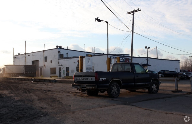

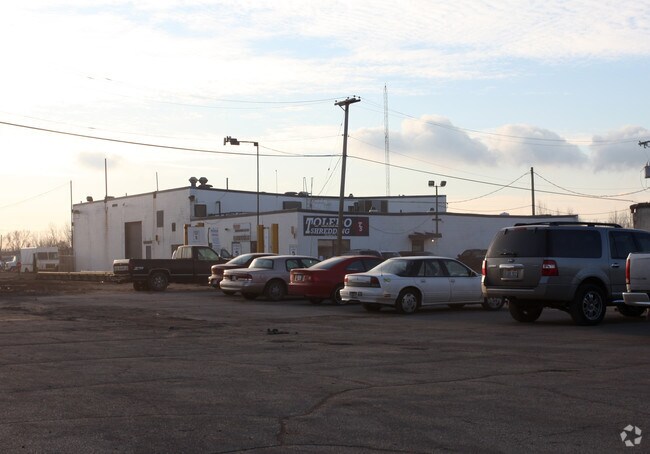
Property Detail
4027 Front St
08-06553
REPL PORTION IRONVILLE LOT 1 IRREG PCE MEAS 453.82 FT ON FRONT ST R/W
Warehouse
LUCAS
10-IG
Ohio
B and X Area of moderate flood hazard, usually the area between the limits of the 100-year and 500-year floods.
1
0
9.12 AC
2025
East Toledo/Oregon
004900
Toledo
7,573 SF
Toledo, OH
NEARBY LISTINGS FOR SALE OR LEASE
DEMOGRAPHICS near 4027 Front St
1 mile
3 mile
5 mile
2025 Total Population
1,343
44,563
119,900
2030 Population
1,330
44,725
120,869
Pop Growth 2025-2030
(0.97%)
+ 0.36%
+ 0.81%
Average Age
36
40
39
2025 Total Households
387
18,057
49,814
HH Growth 2025-2030
(0.78%)
+ 0.18%
+ 0.73%
Median Household Inc
$32,861
$45,903
$44,014
Avg Household Size
2.40
2.30
2.30
2025 Avg HH Vehicles
1.00
2.00
1.00
Median Home Value
$60,550
$110,536
$98,804
Median Year Built
1949
1954
1949
Nearby Places
Map Layers
Map Styles
 Street
 Aerial
Transit
 Traffic
 Biking
Places
Listings with unknown addresses are not visible on the map
- Restaurants
- Banks
- Shops
- Fitness
- Groceries
PUBLIC TRANSPORTATION
COMMUTER RAIL
Toledo (Capitol Limited - Amtrak, Lake Shore Limited - Amtrak)
Drive
Walk
Distance
Toledo (Capitol Limited - Amtrak, Lake Shore Limited - Amtrak)
10 min
5.1 mi
AIRPORT
Eugene F Kranz Toledo Express
Drive
Walk
Distance
Eugene F Kranz Toledo Express
41 min
23.1 mi
Freight Ports
Port of Toledo
Drive
Walk
Distance
Port of Toledo
4 min
1.4 mi
Nearby Properties
Address
Land Use
TOTAL SIZE
Lot Size
Zoning
Address
Land Use
TOTAL SIZE
Lot Size
Zoning
569,999 SF
45.25 AC
10-MX
Address
Land Use
TOTAL SIZE
Lot Size
Zoning
286,525 SF
105.33 AC
10-RS6
Address
Land Use
TOTAL SIZE
Lot Size
Zoning
605,609 SF
9.66 AC
40-C4
Address
Land Use
TOTAL SIZE
Lot Size
Zoning
169.42 AC
10-IG
Address
Land Use
TOTAL SIZE
Lot Size
Zoning
314,826 SF
10.28 AC
10-CM
Address
Land Use
TOTAL SIZE
Lot Size
Zoning
Address
Land Use
TOTAL SIZE
Lot Size
Zoning
225,407 SF
128.05 AC
10-MX
Address
Land Use
TOTAL SIZE
Lot Size
Zoning
169.42 AC
10-IG
Address
Land Use
TOTAL SIZE
Lot Size
Zoning
172,044 SF
12.78 AC
10-MX
Address
Land Use
TOTAL SIZE
Lot Size
Zoning
334,732 SF
516.10 AC
40-M2
Address
Land Use
TOTAL SIZE
Lot Size
Zoning
370,650 SF
13.65 AC
10-MX
Address
Land Use
TOTAL SIZE
Lot Size
Zoning
34.13 AC
10-IG
Address
Land Use
TOTAL SIZE
Lot Size
Zoning
214,312 SF
35.35 AC
40-C5
Address
Land Use
TOTAL SIZE
Lot Size
Zoning
84,527 SF
7.79 AC
10-RS6
Address
Land Use
TOTAL SIZE
Lot Size
Zoning
27.41 AC
40-CI
Address
Land Use
TOTAL SIZE
Lot Size
Zoning
73,731 SF
2 AC
10-RD6
Address
Land Use
TOTAL SIZE
Lot Size
Zoning
150,000 SF
17.55 AC
40-CI
Address
Land Use
TOTAL SIZE
Lot Size
Zoning
187,988 SF
20 AC
40-M2
Address
Land Use
TOTAL SIZE
Lot Size
Zoning
61,289 SF
2 AC
10-RD6
Address
Land Use
TOTAL SIZE
Lot Size
Zoning
29.92 AC
40-CI
Address
Land Use
TOTAL SIZE
Lot Size
Zoning
62,546 SF
4.27 AC
10-RD6
Address
Land Use
TOTAL SIZE
Lot Size
Zoning
117,094 SF
28.04 AC
40-R2
Address
Land Use
TOTAL SIZE
Lot Size
Zoning
52,343 SF
2 AC
10-RD6
Address
Land Use
TOTAL SIZE
Lot Size
Zoning
18,843 SF
30.05 AC
40-M2
Address
Land Use
TOTAL SIZE
Lot Size
Zoning
265,601 SF
11.34 AC
10-IG
Address
Land Use
TOTAL SIZE
Lot Size
Zoning
178,841 SF
19 AC
10-RM36
Address
Land Use
TOTAL SIZE
Lot Size
Zoning
55,544 SF
13 AC
40-R2
Address
Land Use
TOTAL SIZE
Lot Size
Zoning
91,261 SF
5.47 AC
40-C2
Address
Land Use
TOTAL SIZE
Lot Size
Zoning
57,550 SF
1.61 AC
10-RM36
Address
Land Use
TOTAL SIZE
Lot Size
Zoning
58,281 SF
2.60 AC
40-C2
The World's #1 Commercial Real Estate Marketplace
Connect with us
© 2026 CoStar Group
The information above has been obtained from sources believed reliable. While we do not doubt its accuracy we have not verified it and make no guarantee, warranty or representation about it. It is your responsibility to independently confirm its accuracy and completeness. Any projections, opinions, assumptions, or estimates used are for example only and do not represent the current or future performance of the property. The value of this transaction to you depends on tax and other factors which should be evaluated by your tax, financial, and legal advisors. You and your advisors should conduct a careful, independent investigation of the property to determine to your satisfaction the suitability of the property for your needs.