Property Record
403 Furys Ferry Rd, Augusta, GA 30907
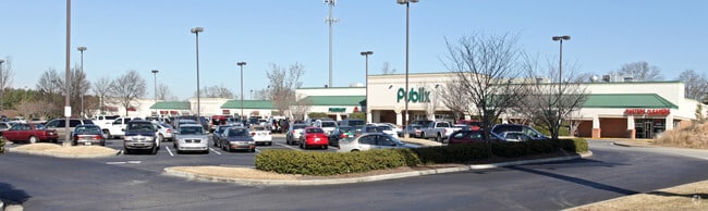


Property Detail
403 Furys Ferry Rd
082A073
TRACT B & G 8.96 ACS; PUBLIX
Restaurantbuilding
Columbia
C-2;GEN CO
Georgia
B and X Area of moderate flood hazard, usually the area between the limits of the 100-year and 500-year floods.
8.96 AC
2025
Evans/Martinez
2025
Augusta/Richmond County
030108
Augusta-Richmond County, GA-SC
4,441 SF
NEARBY LISTINGS FOR SALE OR LEASE
DEMOGRAPHICS near 403 Furys Ferry Rd
1 mile
3 mile
5 mile
2025 Total Population
6,778
53,799
116,900
2030 Population
7,027
55,053
119,605
Pop Growth 2025-2030
+ 3.67%
+ 2.33%
+ 2.31%
Average Age
42
41
41
2025 Total Households
2,542
22,587
49,510
HH Growth 2025-2030
+ 3.74%
+ 1.82%
+ 2.02%
Median Household Inc
$107,444
$82,361
$78,918
Avg Household Size
2.60
2.30
2.30
2025 Avg HH Vehicles
2.00
2.00
2.00
Median Home Value
$357,452
$290,820
$289,631
Median Year Built
1986
1989
1987
Nearby Places
Map Layers
Map Styles
 Street
 Aerial
Layers
 Traffic
 Biking
Places
Listings with unknown addresses are not visible on the map
- Restaurants
- Banks
- Shops
- Fitness
- Groceries
PUBLIC TRANSPORTATION
AIRPORT
Augusta Regional at Bush Field
Drive
Walk
Distance
Augusta Regional at Bush Field
28 min
16.4 mi
Freight Ports
Georgia Ports - Savannah
Drive
Walk
Distance
Georgia Ports - Savannah
162 min
125.5 mi
SALE & LEASE HISTORY
LISTING DATE
SALE/LEASE

Sep 25, 2016
For Lease
Oct 27, 2016
For Lease
May 25, 2024
For Lease
Aug 01, 2017
For Lease
Nearby Properties
Address
Land Use
TOTAL SIZE
Lot Size
Zoning
Address
Land Use
TOTAL SIZE
Lot Size
Zoning
2,070 SF
24.68 AC
Address
Land Use
TOTAL SIZE
Lot Size
Zoning
7,216 SF
53.27 AC
B-1 SPEX
Address
Land Use
TOTAL SIZE
Lot Size
Zoning
4,077 SF
20.88 AC
C-2;GEN CO
Address
Land Use
TOTAL SIZE
Lot Size
Zoning
13.19 AC
Address
Land Use
TOTAL SIZE
Lot Size
Zoning
7,749 SF
17.02 AC
R2
Address
Land Use
TOTAL SIZE
Lot Size
Zoning
57,341 SF
54.33 AC
Address
Land Use
TOTAL SIZE
Lot Size
Zoning
3,680 SF
13.42 AC
B-2
Address
Land Use
TOTAL SIZE
Lot Size
Zoning
3,498 SF
12.61 AC
B-2
Address
Land Use
TOTAL SIZE
Lot Size
Zoning
2,326 SF
21.90 AC
R-3B
Address
Land Use
TOTAL SIZE
Lot Size
Zoning
4,800 SF
19.81 AC
B-2
Address
Land Use
TOTAL SIZE
Lot Size
Zoning
16,323 SF
24.61 AC
Address
Land Use
TOTAL SIZE
Lot Size
Zoning
3,447 SF
16.67 AC
R-3B
Address
Land Use
TOTAL SIZE
Lot Size
Zoning
2,508 SF
14.61 AC
A-R;APARTM
Address
Land Use
TOTAL SIZE
Lot Size
Zoning
150,807 SF
16.91 AC
R-1A SPEX
Address
Land Use
TOTAL SIZE
Lot Size
Zoning
997 SF
19.16 AC
Address
Land Use
TOTAL SIZE
Lot Size
Zoning
114,153 SF
12.91 AC
B-2
Address
Land Use
TOTAL SIZE
Lot Size
Zoning
66,300 SF
18.22 AC
B-1
Address
Land Use
TOTAL SIZE
Lot Size
Zoning
4,108 SF
14.12 AC
B-2
Address
Land Use
TOTAL SIZE
Lot Size
Zoning
150,263 SF
18.75 AC
PUD
Address
Land Use
TOTAL SIZE
Lot Size
Zoning
112,947 SF
14.91 AC
Address
Land Use
TOTAL SIZE
Lot Size
Zoning
2,757 SF
19.55 AC
B-2_R-1
Address
Land Use
TOTAL SIZE
Lot Size
Zoning
129,068 SF
8.74 AC
Address
Land Use
TOTAL SIZE
Lot Size
Zoning
62,440 SF
5.70 AC
B-2
Address
Land Use
TOTAL SIZE
Lot Size
Zoning
125,466 SF
15.98 AC
B-2
Address
Land Use
TOTAL SIZE
Lot Size
Zoning
2,355 SF
12.97 AC
B-2
Address
Land Use
TOTAL SIZE
Lot Size
Zoning
62,280 SF
22.83 AC
R-3A
Address
Land Use
TOTAL SIZE
Lot Size
Zoning
156,372 SF
17.81 AC
B-2
Address
Land Use
TOTAL SIZE
Lot Size
Zoning
106,072 SF
9.35 AC
007
Address
Land Use
TOTAL SIZE
Lot Size
Zoning
68,640 SF
12.02 AC
R-3B
Address
Land Use
TOTAL SIZE
Lot Size
Zoning
79,224 SF
2.90 AC
B-2
The World's #1 Commercial Real Estate Marketplace
Connect with us
© 2026 CoStar Group
The information above has been obtained from sources believed reliable. While we do not doubt its accuracy we have not verified it and make no guarantee, warranty or representation about it. It is your responsibility to independently confirm its accuracy and completeness. Any projections, opinions, assumptions, or estimates used are for example only and do not represent the current or future performance of the property. The value of this transaction to you depends on tax and other factors which should be evaluated by your tax, financial, and legal advisors. You and your advisors should conduct a careful, independent investigation of the property to determine to your satisfaction the suitability of the property for your needs.