Property Record
403 Gill St, Punta Gorda, FL 33950


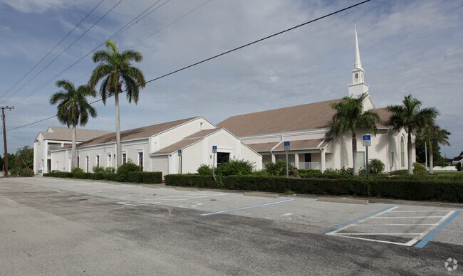
Property Detail
403 Gill St
412307111008
PUNTA GORDA BLK 60 ALL LTS 17 THRU 28 & A 25 FT STRIP ADJ TO NW LINE LTS 23 & 24 & PORTION OF VAC. CHARLOTTE ST E534/230 542/644 V1721/1078 V2050/848 3661/1739 PUG 000 0060 0001 PUNTA GORDA BLK 60 LT 1 & E 37.7 FT LT 2 & N 7.5 FT LT 16 VAR1721/107
Religious
Charlotte
NR-10
Florida
AE The base floodplain where base flood elevations are provided. AE Zones are now used on new format FIRMs instead of A1-A30 Zones.
17
0
5.66 AC
2025
Charlotte County
010301
Southwest Florida
11,870 SF
Punta Gorda, FL
NEARBY LISTINGS FOR SALE OR LEASE
DEMOGRAPHICS near 403 Gill St
1 mile
3 mile
5 mile
2025 Total Population
5,116
28,242
61,916
2030 Population
5,662
31,100
67,997
Pop Growth 2025-2030
+ 10.67%
+ 10.12%
+ 9.82%
Average Age
56
59
55
2025 Total Households
2,581
14,205
29,492
HH Growth 2025-2030
+ 10.54%
+ 9.92%
+ 9.77%
Median Household Inc
$68,457
$80,174
$71,199
Avg Household Size
1.90
1.90
2.00
2025 Avg HH Vehicles
2.00
2.00
2.00
Median Home Value
$423,267
$533,824
$372,595
Median Year Built
1988
1993
1990
Nearby Places
Map Layers
Map Styles
 Street
 Aerial
Layers
 Traffic
 Biking
Places
Listings with unknown addresses are not visible on the map
- Restaurants
- Banks
- Shops
- Fitness
- Groceries
PUBLIC TRANSPORTATION
AIRPORT
Punta Gorda
Drive
Walk
Distance
Punta Gorda
9 min
4.3 mi
Freight Ports
Port Manatee
Drive
Walk
Distance
Port Manatee
87 min
73.0 mi
Nearby Properties
Address
Land Use
TOTAL SIZE
Lot Size
Zoning
Address
Land Use
TOTAL SIZE
Lot Size
Zoning
333,027 SF
9.79 AC
CHRW
Address
Land Use
TOTAL SIZE
Lot Size
Zoning
349,844 SF
78.47 AC
P
Address
Land Use
TOTAL SIZE
Lot Size
Zoning
77,154 SF
10.30 AC
CC
Address
Land Use
TOTAL SIZE
Lot Size
Zoning
161,439 SF
171 AC
RE1
Address
Land Use
TOTAL SIZE
Lot Size
Zoning
47,443 SF
7.94 AC
CC
Address
Land Use
TOTAL SIZE
Lot Size
Zoning
114,417 SF
4.36 AC
GM-15
Address
Land Use
TOTAL SIZE
Lot Size
Zoning
15,253 SF
13.27 AC
P
Address
Land Use
TOTAL SIZE
Lot Size
Zoning
208,560 SF
36.69 AC
PD-GM
Address
Land Use
TOTAL SIZE
Lot Size
Zoning
142,812 SF
7.89 AC
HC
Address
Land Use
TOTAL SIZE
Lot Size
Zoning
6,313 SF
15.49 AC
P
Address
Land Use
TOTAL SIZE
Lot Size
Zoning
73,095 SF
5 AC
NC
Address
Land Use
TOTAL SIZE
Lot Size
Zoning
44,185 SF
1.22 AC
CC
Address
Land Use
TOTAL SIZE
Lot Size
Zoning
128,594 SF
25.54 AC
PD
Address
Land Use
TOTAL SIZE
Lot Size
Zoning
25,356 SF
1.40 AC
CC
Address
Land Use
TOTAL SIZE
Lot Size
Zoning
70,518 SF
2.08 AC
PD
Address
Land Use
TOTAL SIZE
Lot Size
Zoning
82,379 SF
0.88 AC
CC
Address
Land Use
TOTAL SIZE
Lot Size
Zoning
12,159 SF
0.56 AC
CC
Address
Land Use
TOTAL SIZE
Lot Size
Zoning
24,880 SF
84.50 AC
PKR
Address
Land Use
TOTAL SIZE
Lot Size
Zoning
1,296 SF
14.46 AC
CG
Address
Land Use
TOTAL SIZE
Lot Size
Zoning
43,755 SF
8.19 AC
CC
Address
Land Use
TOTAL SIZE
Lot Size
Zoning
30,472 SF
3.19 AC
NR-10
Address
Land Use
TOTAL SIZE
Lot Size
Zoning
81,167 SF
5.63 AC
CG
Address
Land Use
TOTAL SIZE
Lot Size
Zoning
30,940 SF
0.42 AC
NC
Address
Land Use
TOTAL SIZE
Lot Size
Zoning
448 SF
16.37 AC
PD
Address
Land Use
TOTAL SIZE
Lot Size
Zoning
68,492 SF
6.38 AC
HC
Address
Land Use
TOTAL SIZE
Lot Size
Zoning
82,865 SF
19.74 AC
RMF12
Address
Land Use
TOTAL SIZE
Lot Size
Zoning
43,914 SF
4.06 AC
HC
Address
Land Use
TOTAL SIZE
Lot Size
Zoning
11.50 AC
CHRW
Address
Land Use
TOTAL SIZE
Lot Size
Zoning
63,902 SF
5.87 AC
HC
Address
Land Use
TOTAL SIZE
Lot Size
Zoning
181,137 SF
12.34 AC
NR-15
The World's #1 Commercial Real Estate Marketplace
Connect with us
© 2026 CoStar Group
The information above has been obtained from sources believed reliable. While we do not doubt its accuracy we have not verified it and make no guarantee, warranty or representation about it. It is your responsibility to independently confirm its accuracy and completeness. Any projections, opinions, assumptions, or estimates used are for example only and do not represent the current or future performance of the property. The value of this transaction to you depends on tax and other factors which should be evaluated by your tax, financial, and legal advisors. You and your advisors should conduct a careful, independent investigation of the property to determine to your satisfaction the suitability of the property for your needs.