Property Record
403 N 21St St, Mount Vernon, WA 98273


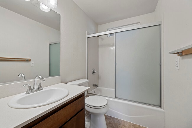
This Property Is For Sale
NEARBY LISTINGS FOR SALE OR LEASE
-
-
View all Mount Vernon listings for sale on LoopNet.com
Property Detail
403 N 21St St
Other Market Areas
City Of Mount Vernon
Mount Vernon-Anacortes, WA
(0.4800 AC) THAT PORTION OF THE WEST HALF OF THE EAST HALF OF THE SOUTHEAST QUARTER OF THE NORTHEAST QUARTER OF SECTION 20, TOWNSHIP 34 NORTH, RANGE 4 EAST, W.M., DESCRIBED AS FOLLOWS: BEGINNING AT THE NORTHEAST CORNER OF SAID SUBDIVISION; THENCE SOU
P26917
Skagit
Quadruplex
Washington
2025
31
2025
0.48 AC
952303
Bellingham/Northwest
2,380 SF
DEMOGRAPHICS near 403 N 21St St
1 Mile
3 Mile
5 Mile
2024 Total Population
15,981
42,538
60,570
2029 Population
16,633
44,464
63,200
Pop Growth 2024-2029
+ 4.08%
+ 4.53%
+ 4.34%
Average Age
38
40
40
2024 Total Households
5,951
15,669
22,336
HH Growth 2024-2029
+ 4.20%
+ 4.66%
+ 4.47%
Median Household Inc
$53,558
$63,557
$65,757
Avg Household Size
2.60
2.60
2.60
2024 Avg HH Vehicles
2.00
2.00
2.00
Median Home Value
$384,055
$406,234
$427,440
Median Year Built
1977
1988
1986
Nearby Places
Map Layers
Map Styles
 Street
 Aerial
- Restaurants
- Banks
- Shops
- Fitness
- Groceries
PUBLIC TRANSPORTATION
COMMUTER RAIL
Mount Vernon Amtrak Station (Amtrak Cascades - Amtrak)
DRIVE
WALK
Distance
Mount Vernon Amtrak Station (Amtrak Cascades - Amtrak)
4 min
1.6 mi
AIRPORT
Bellingham International
DRIVE
WALK
Distance
Bellingham International
44 min
33.9 mi
Freight Ports
Port of Anacortes
DRIVE
WALK
Distance
Port of Anacortes
30 min
18.6 mi
Nearby Properties
Address
Land Use
TOTAL SIZE
Lot Size
Zoning
Address
Land Use
TOTAL SIZE
Lot Size
Zoning
404,511 SF
9.01 AC
Address
Land Use
TOTAL SIZE
Lot Size
Zoning
16,345 SF
32.99 AC
Address
Land Use
TOTAL SIZE
Lot Size
Zoning
Address
Land Use
TOTAL SIZE
Lot Size
Zoning
1,500 SF
9.93 AC
Address
Land Use
TOTAL SIZE
Lot Size
Zoning
Address
Land Use
TOTAL SIZE
Lot Size
Zoning
77,414 SF
15.20 AC
Address
Land Use
TOTAL SIZE
Lot Size
Zoning
212,480 SF
35.36 AC
Address
Land Use
TOTAL SIZE
Lot Size
Zoning
105,000 SF
1 AC
Address
Land Use
TOTAL SIZE
Lot Size
Zoning
96,782 SF
4.50 AC
Address
Land Use
TOTAL SIZE
Lot Size
Zoning
200,145 SF
9.35 AC
Address
Land Use
TOTAL SIZE
Lot Size
Zoning
74,608 SF
87 SF
Address
Land Use
TOTAL SIZE
Lot Size
Zoning
Address
Land Use
TOTAL SIZE
Lot Size
Zoning
0.01 AC
Address
Land Use
TOTAL SIZE
Lot Size
Zoning
138,226 SF
30.55 AC
Address
Land Use
TOTAL SIZE
Lot Size
Zoning
2,468 SF
0.68 AC
Address
Land Use
TOTAL SIZE
Lot Size
Zoning
0.01 AC
Address
Land Use
TOTAL SIZE
Lot Size
Zoning
64,668 SF
0.29 AC
Address
Land Use
TOTAL SIZE
Lot Size
Zoning
114,589 SF
10.63 AC
Address
Land Use
TOTAL SIZE
Lot Size
Zoning
52,239 SF
5.50 AC
Address
Land Use
TOTAL SIZE
Lot Size
Zoning
51,416 SF
Address
Land Use
TOTAL SIZE
Lot Size
Zoning
0.01 AC
Address
Land Use
TOTAL SIZE
Lot Size
Zoning
138,353 SF
10 AC
Address
Land Use
TOTAL SIZE
Lot Size
Zoning
68,326 SF
5.29 AC
Address
Land Use
TOTAL SIZE
Lot Size
Zoning
Address
Land Use
TOTAL SIZE
Lot Size
Zoning
74,419 SF
2.16 AC
Address
Land Use
TOTAL SIZE
Lot Size
Zoning
44,812 SF
6 AC
Address
Land Use
TOTAL SIZE
Lot Size
Zoning
55,326 SF
9.12 AC
Address
Land Use
TOTAL SIZE
Lot Size
Zoning
143,806 SF
5.50 AC
Address
Land Use
TOTAL SIZE
Lot Size
Zoning
93,720 SF
4.82 AC
Address
Land Use
TOTAL SIZE
Lot Size
Zoning
2,195 SF
7.52 AC
The World's #1 Commercial Real Estate Marketplace
Connect with us
© 2025 CoStar Group
The information above has been obtained from sources believed reliable. While we do not doubt its accuracy we have not verified it and make no guarantee, warranty or representation about it. It is your responsibility to independently confirm its accuracy and completeness. Any projections, opinions, assumptions, or estimates used are for example only and do not represent the current or future performance of the property. The value of this transaction to you depends on tax and other factors which should be evaluated by your tax, financial, and legal advisors. You and your advisors should conduct a careful, independent investigation of the property to determine to your satisfaction the suitability of the property for your needs.