Property Record
300 W 2Nd Ave, Derry, PA 15627
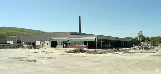

Property Detail
300 W 2Nd Ave
06-01-13-0-047
PCL LAND
Agriculturalland
WESTMORELAND
AE The base floodplain where base flood elevations are provided. AE Zones are now used on new format FIRMs instead of A1-A30 Zones.
Pennsylvania
0
18.10 AC
2026
Westmoreland County
808200
Pittsburgh
1,480 SF
Pittsburgh, PA
NEARBY LISTINGS FOR SALE OR LEASE
-
-
View all Derry listings for sale on LoopNet.com
DEMOGRAPHICS near 300 W 2Nd Ave
1 mile
3 mile
5 mile
2025 Total Population
3,884
8,436
23,731
2030 Population
3,868
8,390
23,557
Pop Growth 2025-2030
(0.41%)
(0.55%)
(0.73%)
Average Age
44
45
46
2025 Total Households
1,686
3,674
10,507
HH Growth 2025-2030
(0.42%)
(0.60%)
(0.76%)
Median Household Inc
$58,267
$59,280
$60,842
Avg Household Size
2.30
2.30
2.20
2025 Avg HH Vehicles
2.00
2.00
2.00
Median Home Value
$146,277
$158,702
$166,280
Median Year Built
1952
1956
1956
Nearby Places
Map Layers
Map Styles
 Street
 Aerial
Layers
 Traffic
 Biking
Places
Listings with unknown addresses are not visible on the map
- Restaurants
- Banks
- Shops
- Fitness
- Groceries
PUBLIC TRANSPORTATION
COMMUTER RAIL
Latrobe Amtrak (Pennsylvanian - Amtrak)
Drive
Walk
Distance
Latrobe Amtrak (Pennsylvanian - Amtrak)
10 min
5.9 mi
AIRPORT
Arnold Palmer Regional
Drive
Walk
Distance
Arnold Palmer Regional
16 min
8.8 mi
Freight Ports
Port of Baltimore
Drive
Walk
Distance
Port of Baltimore
262 min
200.6 mi
Nearby Properties
Address
Land Use
TOTAL SIZE
Lot Size
Zoning
Address
Land Use
TOTAL SIZE
Lot Size
Zoning
43.50 AC
Address
Land Use
TOTAL SIZE
Lot Size
Zoning
Address
Land Use
TOTAL SIZE
Lot Size
Zoning
56,822 SF
9.08 AC
Address
Land Use
TOTAL SIZE
Lot Size
Zoning
474.30 AC
Address
Land Use
TOTAL SIZE
Lot Size
Zoning
17.80 AC
Address
Land Use
TOTAL SIZE
Lot Size
Zoning
18.85 AC
Address
Land Use
TOTAL SIZE
Lot Size
Zoning
34.60 AC
Address
Land Use
TOTAL SIZE
Lot Size
Zoning
1.79 AC
Address
Land Use
TOTAL SIZE
Lot Size
Zoning
0.65 AC
Address
Land Use
TOTAL SIZE
Lot Size
Zoning
27,072 SF
39.10 AC
Address
Land Use
TOTAL SIZE
Lot Size
Zoning
93,020 SF
15.60 AC
Address
Land Use
TOTAL SIZE
Lot Size
Zoning
3.10 AC
Address
Land Use
TOTAL SIZE
Lot Size
Zoning
153.10 AC
Address
Land Use
TOTAL SIZE
Lot Size
Zoning
8.70 AC
Address
Land Use
TOTAL SIZE
Lot Size
Zoning
13,896 SF
9.90 AC
Address
Land Use
TOTAL SIZE
Lot Size
Zoning
12.79 AC
Address
Land Use
TOTAL SIZE
Lot Size
Zoning
82,562 SF
4.20 AC
Address
Land Use
TOTAL SIZE
Lot Size
Zoning
4,468 SF
0.57 AC
Address
Land Use
TOTAL SIZE
Lot Size
Zoning
0.28 AC
Address
Land Use
TOTAL SIZE
Lot Size
Zoning
5.90 AC
Address
Land Use
TOTAL SIZE
Lot Size
Zoning
4,820 SF
2.10 AC
Address
Land Use
TOTAL SIZE
Lot Size
Zoning
21.20 AC
Address
Land Use
TOTAL SIZE
Lot Size
Zoning
41,080 SF
5.10 AC
Address
Land Use
TOTAL SIZE
Lot Size
Zoning
3,650 AC
Address
Land Use
TOTAL SIZE
Lot Size
Zoning
1.10 AC
Address
Land Use
TOTAL SIZE
Lot Size
Zoning
1.90 AC
Address
Land Use
TOTAL SIZE
Lot Size
Zoning
1.40 AC
Address
Land Use
TOTAL SIZE
Lot Size
Zoning
0.54 AC
Address
Land Use
TOTAL SIZE
Lot Size
Zoning
1.10 AC
Address
Land Use
TOTAL SIZE
Lot Size
Zoning
14.04 AC
The World's #1 Commercial Real Estate Marketplace
Connect with us
© 2026 CoStar Group
The information above has been obtained from sources believed reliable. While we do not doubt its accuracy we have not verified it and make no guarantee, warranty or representation about it. It is your responsibility to independently confirm its accuracy and completeness. Any projections, opinions, assumptions, or estimates used are for example only and do not represent the current or future performance of the property. The value of this transaction to you depends on tax and other factors which should be evaluated by your tax, financial, and legal advisors. You and your advisors should conduct a careful, independent investigation of the property to determine to your satisfaction the suitability of the property for your needs.