Property Record
403 West St, Ludlow, MA 01056

NEARBY LISTINGS FOR SALE OR LEASE
Property Detail
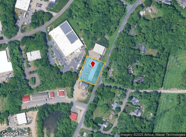
403 West St
Commercialbuilding
Hampden
X
Massachusetts
25013C0209E
0.96 AC
2025
Hampden County
2025
Hartford
810414
Springfield, MA
10,180 SF
LUDL-317700-000000-000066E
DEMOGRAPHICS near 403 West St
1 mile
3 mile
5 mile
2024 Total Population
3,669
30,141
107,344
2029 Population
3,686
29,592
104,072
Pop Growth 2024-2029
+ 0.46%
(1.82%)
(3.05%)
Average Age
44
42
42
2024 Total Households
1,117
12,015
43,803
HH Growth 2024-2029
+ 1.07%
(1.89%)
(3.20%)
Median Household Inc
$84,495
$64,880
$63,355
Avg Household Size
2.40
2.40
2.40
2024 Avg HH Vehicles
2.00
2.00
2.00
Median Home Value
$278,238
$254,033
$241,053
Median Year Built
1975
1961
1959
Nearby Places
Map Layers
Map Styles
 Street
 Aerial
Transit
 Traffic
 Biking
Places
Listings with unknown addresses are not visible on the map
- Restaurants
- Banks
- Shops
- Fitness
- Groceries
PUBLIC TRANSPORTATION
COMMUTER RAIL
Drive
Walk
Distance
13 min
8.2 mi
Drive
Walk
Distance
17 min
8.6 mi
AIRPORT
Bradley International
Drive
Walk
Distance
Bradley International
42 min
22.1 mi
Worcester Regional
Drive
Walk
Distance
Worcester Regional
66 min
46.3 mi
Nearby Properties
Address
Land Use
TOTAL SIZE
Lot Size
Zoning
Address
Land Use
TOTAL SIZE
Lot Size
Zoning
45,444 SF
13.80 AC
Address
Land Use
TOTAL SIZE
Lot Size
Zoning
131,942 SF
40.30 AC
R1
Address
Land Use
TOTAL SIZE
Lot Size
Zoning
60.25 AC
Address
Land Use
TOTAL SIZE
Lot Size
Zoning
39,776 SF
8.16 AC
R2
Address
Land Use
TOTAL SIZE
Lot Size
Zoning
71,911 SF
9.19 AC
Address
Land Use
TOTAL SIZE
Lot Size
Zoning
762,340 SF
76.18 AC
SR1R2I
Address
Land Use
TOTAL SIZE
Lot Size
Zoning
99,792 SF
123.26 AC
S
Address
Land Use
TOTAL SIZE
Lot Size
Zoning
26.68 AC
110
Address
Land Use
TOTAL SIZE
Lot Size
Zoning
136,326 SF
65.19 AC
Address
Land Use
TOTAL SIZE
Lot Size
Zoning
257,179 SF
22.84 AC
110
Address
Land Use
TOTAL SIZE
Lot Size
Zoning
6.81 AC
S
Address
Land Use
TOTAL SIZE
Lot Size
Zoning
34 AC
Address
Land Use
TOTAL SIZE
Lot Size
Zoning
109,136 SF
5.01 AC
Address
Land Use
TOTAL SIZE
Lot Size
Zoning
81.65 AC
110
Address
Land Use
TOTAL SIZE
Lot Size
Zoning
13.02 AC
Address
Land Use
TOTAL SIZE
Lot Size
Zoning
320,639 SF
14.16 AC
110
Address
Land Use
TOTAL SIZE
Lot Size
Zoning
133,600 SF
23.27 AC
R3
Address
Land Use
TOTAL SIZE
Lot Size
Zoning
199,007 SF
50.95 AC
S
Address
Land Use
TOTAL SIZE
Lot Size
Zoning
491.50 AC
108
Address
Land Use
TOTAL SIZE
Lot Size
Zoning
243.13 AC
109
Address
Land Use
TOTAL SIZE
Lot Size
Zoning
217,640 SF
12.21 AC
110
Address
Land Use
TOTAL SIZE
Lot Size
Zoning
152,380 SF
11.36 AC
110
Address
Land Use
TOTAL SIZE
Lot Size
Zoning
72,793 SF
1.50 AC
Address
Land Use
TOTAL SIZE
Lot Size
Zoning
1,200 SF
1.61 AC
B2
Address
Land Use
TOTAL SIZE
Lot Size
Zoning
17.97 AC
108
Address
Land Use
TOTAL SIZE
Lot Size
Zoning
30,428 SF
1.46 AC
R2
Address
Land Use
TOTAL SIZE
Lot Size
Zoning
291,714 SF
35.75 AC
110
Address
Land Use
TOTAL SIZE
Lot Size
Zoning
190,638 SF
17.62 AC
110
Address
Land Use
TOTAL SIZE
Lot Size
Zoning
85,518 SF
15.74 AC
109
Address
Land Use
TOTAL SIZE
Lot Size
Zoning
1,230 SF
38.23 AC
OS
The World's #1 Commercial Real Estate Marketplace
Connect with us
© 2026 CoStar Group
The information above has been obtained from sources believed reliable. While we do not doubt its accuracy we have not verified it and make no guarantee, warranty or representation about it. It is your responsibility to independently confirm its accuracy and completeness. Any projections, opinions, assumptions, or estimates used are for example only and do not represent the current or future performance of the property. The value of this transaction to you depends on tax and other factors which should be evaluated by your tax, financial, and legal advisors. You and your advisors should conduct a careful, independent investigation of the property to determine to your satisfaction the suitability of the property for your needs.