Property Record
4030 Eastern Rd, Doylestown, OH 44230

Property Detail
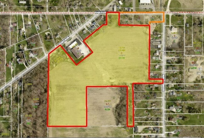
4030 Eastern Rd
12-01344-000
11-18-02 NEPT NE 12.503A CD 1530
Residentialacreage
Wayne
B and X Area of moderate flood hazard, usually the area between the limits of the 100-year and 500-year floods.
Ohio
2025
12.50 AC
2024
Ohio North Area
002902
Other Market Areas
1,972 SF
Wooster, OH
NEARBY LISTINGS FOR SALE OR LEASE
-
-
View all Doylestown listings for sale on LoopNet.com
DEMOGRAPHICS near 4030 Eastern Rd
1 mile
3 mile
5 mile
2024 Total Population
1,297
21,932
63,602
2029 Population
1,315
21,930
63,748
Pop Growth 2024-2029
+ 1.39%
(0.01%)
+ 0.23%
Average Age
45
43
42
2024 Total Households
575
9,006
26,251
HH Growth 2024-2029
+ 1.39%
(0.07%)
+ 0.19%
Median Household Inc
$49,642
$67,084
$64,889
Avg Household Size
2.20
2.40
2.40
2024 Avg HH Vehicles
2.00
2.00
2.00
Median Home Value
$105,723
$178,582
$189,779
Median Year Built
1975
1966
1965
Nearby Places
Map Layers
Map Styles
 Street
 Aerial
Transit
 Traffic
 Biking
Places
Listings with unknown addresses are not visible on the map
- Restaurants
- Banks
- Shops
- Fitness
- Groceries
PUBLIC TRANSPORTATION
AIRPORT
Akron-Canton Regional
Drive
Walk
Distance
Akron-Canton Regional
28 min
21.9 mi
Freight Ports
Port of Toledo
Drive
Walk
Distance
Port of Toledo
160 min
136.2 mi
SALE & LEASE HISTORY
LISTING DATE
SALE/LEASE

Sep 05, 2023
For Sale
Jul 17, 2023
For Sale
Nearby Properties
Address
Land Use
TOTAL SIZE
Lot Size
Zoning
Address
Land Use
TOTAL SIZE
Lot Size
Zoning
38,794 SF
40 AC
Address
Land Use
TOTAL SIZE
Lot Size
Zoning
34.80 AC
Address
Land Use
TOTAL SIZE
Lot Size
Zoning
87,486 SF
7.25 AC
Address
Land Use
TOTAL SIZE
Lot Size
Zoning
29,161 SF
15.94 AC
Address
Land Use
TOTAL SIZE
Lot Size
Zoning
448.72 AC
Address
Land Use
TOTAL SIZE
Lot Size
Zoning
43,727 SF
97.90 AC
Address
Land Use
TOTAL SIZE
Lot Size
Zoning
17.87 AC
Address
Land Use
TOTAL SIZE
Lot Size
Zoning
144,162 SF
17.39 AC
Address
Land Use
TOTAL SIZE
Lot Size
Zoning
32,084 SF
24.15 AC
Address
Land Use
TOTAL SIZE
Lot Size
Zoning
6,760 SF
12.55 AC
Address
Land Use
TOTAL SIZE
Lot Size
Zoning
1,362 SF
3.77 AC
Address
Land Use
TOTAL SIZE
Lot Size
Zoning
296,613 SF
206.47 AC
Address
Land Use
TOTAL SIZE
Lot Size
Zoning
176,050 SF
9.07 AC
Address
Land Use
TOTAL SIZE
Lot Size
Zoning
36,188 SF
7.39 AC
Address
Land Use
TOTAL SIZE
Lot Size
Zoning
39,793 SF
8.28 AC
Address
Land Use
TOTAL SIZE
Lot Size
Zoning
45,337 SF
11.59 AC
Address
Land Use
TOTAL SIZE
Lot Size
Zoning
39,854 SF
2.21 AC
Address
Land Use
TOTAL SIZE
Lot Size
Zoning
58,897 SF
268.65 AC
Address
Land Use
TOTAL SIZE
Lot Size
Zoning
85,679 SF
9.88 AC
Address
Land Use
TOTAL SIZE
Lot Size
Zoning
32,933 SF
2.48 AC
Address
Land Use
TOTAL SIZE
Lot Size
Zoning
23,750 SF
3.14 AC
Address
Land Use
TOTAL SIZE
Lot Size
Zoning
32,792 SF
6.18 AC
Address
Land Use
TOTAL SIZE
Lot Size
Zoning
45,290 SF
8 AC
Address
Land Use
TOTAL SIZE
Lot Size
Zoning
2,976 SF
152.88 AC
Address
Land Use
TOTAL SIZE
Lot Size
Zoning
139.68 AC
Address
Land Use
TOTAL SIZE
Lot Size
Zoning
19,858 SF
0.20 AC
Address
Land Use
TOTAL SIZE
Lot Size
Zoning
63,200 SF
29.88 AC
Address
Land Use
TOTAL SIZE
Lot Size
Zoning
Address
Land Use
TOTAL SIZE
Lot Size
Zoning
43,083 SF
2.51 AC
Address
Land Use
TOTAL SIZE
Lot Size
Zoning
4,000 SF
7.24 AC
The World's #1 Commercial Real Estate Marketplace
Connect with us
© 2026 CoStar Group
The information above has been obtained from sources believed reliable. While we do not doubt its accuracy we have not verified it and make no guarantee, warranty or representation about it. It is your responsibility to independently confirm its accuracy and completeness. Any projections, opinions, assumptions, or estimates used are for example only and do not represent the current or future performance of the property. The value of this transaction to you depends on tax and other factors which should be evaluated by your tax, financial, and legal advisors. You and your advisors should conduct a careful, independent investigation of the property to determine to your satisfaction the suitability of the property for your needs.