Property Record
4030 N Monroe St, Tallahassee, FL 32303
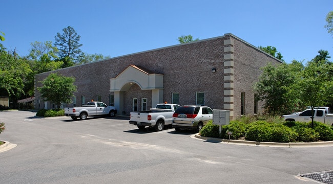


This Property Is For Sale
NEARBY LISTINGS FOR SALE OR LEASE
Property Detail
4030 N Monroe St
Tallahassee, FL
Lake Jackson Drive
21-04-51-000-006.0
LAKE JACKSON DRIVE 4 & 5 1N 1W & 32 2N 1W 1.851 A PART OF LOTS 4 & 5 OR 321/174 321/204 1396/2306 OR 1458/557
Officebuilding
Leon
X
Florida
12073C0115F
4,5
2025
1.85 AC
2025
Northwest Leon County
002208
Tallahassee
10,016 SF
DEMOGRAPHICS near 4030 N Monroe St
1 Mile
3 Mile
5 Mile
2024 Total Population
6,326
36,221
94,784
2029 Population
6,663
38,412
99,262
Pop Growth 2024-2029
+ 5.33%
+ 6.05%
+ 4.72%
Average Age
39
36
34
2024 Total Households
2,638
15,217
39,464
HH Growth 2024-2029
+ 5.50%
+ 6.24%
+ 4.83%
Median Household Inc
$63,991
$58,435
$45,772
Avg Household Size
2.40
2.30
2.20
2024 Avg HH Vehicles
2.00
2.00
2.00
Median Home Value
$197,721
$179,802
$194,498
Median Year Built
1983
1987
1985
Nearby Places
Map Layers
Map Styles
 Street
 Aerial
- Restaurants
- Banks
- Shops
- Fitness
- Groceries
PUBLIC TRANSPORTATION
AIRPORT
Tallahassee International
DRIVE
WALK
Distance
Tallahassee International
18 min
8.9 mi
Freight Ports
Port of Panama City
DRIVE
WALK
Distance
Port of Panama City
139 min
103.0 mi
Nearby Properties
Address
Land Use
TOTAL SIZE
Lot Size
Zoning
Address
Land Use
TOTAL SIZE
Lot Size
Zoning
883,293 SF
35.97 AC
R4
Address
Land Use
TOTAL SIZE
Lot Size
Zoning
901,437 SF
27.40 AC
Address
Land Use
TOTAL SIZE
Lot Size
Zoning
711,296 SF
17.86 AC
PUD
Address
Land Use
TOTAL SIZE
Lot Size
Zoning
127,486 SF
8.23 AC
M1
Address
Land Use
TOTAL SIZE
Lot Size
Zoning
332,760 SF
14.68 AC
MR1
Address
Land Use
TOTAL SIZE
Lot Size
Zoning
123,020 SF
9.45 AC
M1
Address
Land Use
TOTAL SIZE
Lot Size
Zoning
240,852 SF
8.21 AC
MR1
Address
Land Use
TOTAL SIZE
Lot Size
Zoning
347,286 SF
12.76 AC
MR1
Address
Land Use
TOTAL SIZE
Lot Size
Zoning
233,372 SF
10.02 AC
LP
Address
Land Use
TOTAL SIZE
Lot Size
Zoning
98,912 SF
3.03 AC
OR2
Address
Land Use
TOTAL SIZE
Lot Size
Zoning
76,842 SF
16.42 AC
Address
Land Use
TOTAL SIZE
Lot Size
Zoning
374,982 SF
6.76 AC
M1
Address
Land Use
TOTAL SIZE
Lot Size
Zoning
154,499 SF
17.29 AC
PUD
Address
Land Use
TOTAL SIZE
Lot Size
Zoning
82,554 SF
3.65 AC
CP
Address
Land Use
TOTAL SIZE
Lot Size
Zoning
100,000 SF
20 AC
RP2
Address
Land Use
TOTAL SIZE
Lot Size
Zoning
272,330 SF
16.46 AC
R3
Address
Land Use
TOTAL SIZE
Lot Size
Zoning
105,608 SF
30 AC
RP
Address
Land Use
TOTAL SIZE
Lot Size
Zoning
24,864 SF
4.38 AC
PUD
Address
Land Use
TOTAL SIZE
Lot Size
Zoning
102,584 SF
15.61 AC
PUD
Address
Land Use
TOTAL SIZE
Lot Size
Zoning
195,024 SF
4.90 AC
MR1
Address
Land Use
TOTAL SIZE
Lot Size
Zoning
208,526 SF
8.54 AC
MR1
Address
Land Use
TOTAL SIZE
Lot Size
Zoning
289,055 SF
33.02 AC
I
Address
Land Use
TOTAL SIZE
Lot Size
Zoning
26,953 SF
42.54 AC
RPMH
Address
Land Use
TOTAL SIZE
Lot Size
Zoning
71,325 SF
85.31 AC
R3
Address
Land Use
TOTAL SIZE
Lot Size
Zoning
42,031 SF
11.02 AC
CP
Address
Land Use
TOTAL SIZE
Lot Size
Zoning
203,457 SF
8 AC
MR1
Address
Land Use
TOTAL SIZE
Lot Size
Zoning
187,137 SF
6.04 AC
MR1
Address
Land Use
TOTAL SIZE
Lot Size
Zoning
83,320 SF
8.18 AC
LP
Address
Land Use
TOTAL SIZE
Lot Size
Zoning
60,805 SF
3.66 AC
OR3
Address
Land Use
TOTAL SIZE
Lot Size
Zoning
69,136 SF
8.78 AC
M1
The World's #1 Commercial Real Estate Marketplace
Connect with us
© 2026 CoStar Group
The information above has been obtained from sources believed reliable. While we do not doubt its accuracy we have not verified it and make no guarantee, warranty or representation about it. It is your responsibility to independently confirm its accuracy and completeness. Any projections, opinions, assumptions, or estimates used are for example only and do not represent the current or future performance of the property. The value of this transaction to you depends on tax and other factors which should be evaluated by your tax, financial, and legal advisors. You and your advisors should conduct a careful, independent investigation of the property to determine to your satisfaction the suitability of the property for your needs.