Property Record
4031 Fm 1463 Rd, Katy, TX 77494


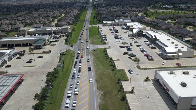

Property Detail
4031 Fm 1463 Rd
0300-00-002-0014-914
0300 A PHILLIPS, BLOCK 1, ACRES 1.61, RESTRICTED RESERVE A, (COMMERCIAL), CARDIFF RANCH COMMERCIAL PLAZA
Commercialnec
Fort Bend
B and X Area of moderate flood hazard, usually the area between the limits of the 100-year and 500-year floods.
Texas
2024
1.61 AC
2025
Far Katy South
673111
Houston
10,424 SF
Houston-Pasadena-The Woodlands, TX
NEARBY LISTINGS FOR SALE OR LEASE
DEMOGRAPHICS near 4031 Fm 1463 Rd
1 mile
3 mile
5 mile
2025 Total Population
18,597
114,415
217,831
2030 Population
20,968
130,619
247,899
Pop Growth 2025-2030
+ 12.75%
+ 14.16%
+ 13.80%
Average Age
33
35
36
2025 Total Households
5,022
33,317
68,182
HH Growth 2025-2030
+ 13.24%
+ 14.77%
+ 14.18%
Median Household Inc
$177,687
$165,111
$145,358
Avg Household Size
3.70
3.40
3.20
2025 Avg HH Vehicles
2.00
2.00
2.00
Median Home Value
$593,542
$556,555
$483,663
Median Year Built
2011
2011
2010
Nearby Places
Map Layers
Map Styles
 Street
 Aerial
Transit
 Traffic
 Biking
Places
Listings with unknown addresses are not visible on the map
- Restaurants
- Banks
- Shops
- Fitness
- Groceries
PUBLIC TRANSPORTATION
AIRPORT
William P Hobby
Drive
Walk
Distance
William P Hobby
63 min
43.3 mi
George Bush Intcntl/Houston
Drive
Walk
Distance
George Bush Intcntl/Houston
60 min
46.2 mi
SALE & LEASE HISTORY
LISTING DATE
SALE/LEASE

Sep 28, 2016
For Sale
Oct 09, 2018
For Lease
Oct 07, 2022
For Sale
Feb 10, 2020
For Lease
Dec 29, 2025
For Lease
Nearby Properties
Address
Land Use
TOTAL SIZE
Lot Size
Zoning
Address
Land Use
TOTAL SIZE
Lot Size
Zoning
39.24 AC
Address
Land Use
TOTAL SIZE
Lot Size
Zoning
786,753 SF
116.13 AC
Address
Land Use
TOTAL SIZE
Lot Size
Zoning
610,000 SF
99.39 AC
Y
Address
Land Use
TOTAL SIZE
Lot Size
Zoning
350,883 SF
29.41 AC
Address
Land Use
TOTAL SIZE
Lot Size
Zoning
165,097 SF
43.81 AC
Address
Land Use
TOTAL SIZE
Lot Size
Zoning
185,815 SF
30.28 AC
Address
Land Use
TOTAL SIZE
Lot Size
Zoning
21.54 AC
Address
Land Use
TOTAL SIZE
Lot Size
Zoning
1,022 SF
21.43 AC
RAD
Address
Land Use
TOTAL SIZE
Lot Size
Zoning
Address
Land Use
TOTAL SIZE
Lot Size
Zoning
Address
Land Use
TOTAL SIZE
Lot Size
Zoning
15.87 AC
Address
Land Use
TOTAL SIZE
Lot Size
Zoning
16.46 AC
Address
Land Use
TOTAL SIZE
Lot Size
Zoning
174,906 SF
31.18 AC
Address
Land Use
TOTAL SIZE
Lot Size
Zoning
Address
Land Use
TOTAL SIZE
Lot Size
Zoning
71.96 AC
Address
Land Use
TOTAL SIZE
Lot Size
Zoning
108,600 SF
9.08 AC
Address
Land Use
TOTAL SIZE
Lot Size
Zoning
Address
Land Use
TOTAL SIZE
Lot Size
Zoning
92,916 SF
7.96 AC
Address
Land Use
TOTAL SIZE
Lot Size
Zoning
117,000 SF
13.77 AC
Address
Land Use
TOTAL SIZE
Lot Size
Zoning
18,240 SF
66.52 AC
MYN
Address
Land Use
TOTAL SIZE
Lot Size
Zoning
120,000 SF
13.48 AC
Address
Land Use
TOTAL SIZE
Lot Size
Zoning
13.39 AC
Address
Land Use
TOTAL SIZE
Lot Size
Zoning
123,966 SF
13.71 AC
Address
Land Use
TOTAL SIZE
Lot Size
Zoning
123,960 SF
13.76 AC
Address
Land Use
TOTAL SIZE
Lot Size
Zoning
12.58 AC
Address
Land Use
TOTAL SIZE
Lot Size
Zoning
6,725 SF
23.26 AC
S
Address
Land Use
TOTAL SIZE
Lot Size
Zoning
123,154 SF
10.83 AC
Address
Land Use
TOTAL SIZE
Lot Size
Zoning
Address
Land Use
TOTAL SIZE
Lot Size
Zoning
121,638 SF
12.95 AC
I
Address
Land Use
TOTAL SIZE
Lot Size
Zoning
6 AC
N
The World's #1 Commercial Real Estate Marketplace
Connect with us
© 2026 CoStar Group
The information above has been obtained from sources believed reliable. While we do not doubt its accuracy we have not verified it and make no guarantee, warranty or representation about it. It is your responsibility to independently confirm its accuracy and completeness. Any projections, opinions, assumptions, or estimates used are for example only and do not represent the current or future performance of the property. The value of this transaction to you depends on tax and other factors which should be evaluated by your tax, financial, and legal advisors. You and your advisors should conduct a careful, independent investigation of the property to determine to your satisfaction the suitability of the property for your needs.