Property Record
4031 Nw 6Th St, Gainesville, FL 32609

Property Detail
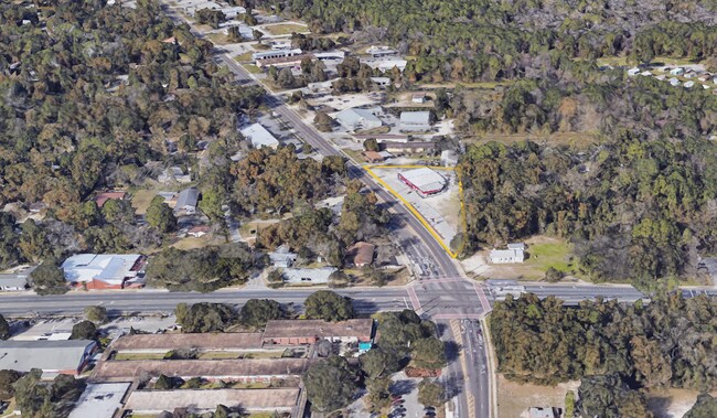
4031 Nw 6Th St
07988-000-000
COM 160.00 FT N OF SE COR OF SW1/4 POB N 408.85 FT N 87 DEG W 235.90 FT TO E/LY R/W N W 6TH ST S/LY ALONG SAID R/W 460.56 FT S 87 DEG E 41.11 FT POB LESS R/W PER OR 1594/1307) OR 3111/0796 & OR 3917/1532 & OR 4048/2162 & OR 5020/1860
Warehouse
Alachua
BA
Florida
B and X Area of moderate flood hazard, usually the area between the limits of the 100-year and 500-year floods.
1.24 AC
2025
Gainesville
2025
Other Market Areas
000302
Gainesville, FL
5,290 SF
NEARBY LISTINGS FOR SALE OR LEASE
DEMOGRAPHICS near 4031 Nw 6Th St
1 mile
3 mile
5 mile
2025 Total Population
4,890
54,288
131,952
2030 Population
5,158
56,093
136,382
Pop Growth 2025-2030
+ 5.48%
+ 3.32%
+ 3.36%
Average Age
38
37
36
2025 Total Households
2,358
24,261
52,719
HH Growth 2025-2030
+ 6.06%
+ 3.78%
+ 3.88%
Median Household Inc
$38,816
$52,312
$53,410
Avg Household Size
2.00
2.10
2.20
2025 Avg HH Vehicles
1.00
2.00
2.00
Median Home Value
$171,649
$256,661
$272,645
Median Year Built
1975
1976
1980
Nearby Places
Map Layers
Map Styles
 Street
 Aerial
Layers
 Traffic
 Biking
Places
Listings with unknown addresses are not visible on the map
- Restaurants
- Banks
- Shops
- Fitness
- Groceries
PUBLIC TRANSPORTATION
AIRPORT
Gainesville Regional
Drive
Walk
Distance
Gainesville Regional
11 min
4.3 mi
Freight Ports
Jacksonville Port
Drive
Walk
Distance
Jacksonville Port
96 min
74.1 mi
SALE & LEASE HISTORY
LISTING DATE
SALE/LEASE

Sep 27, 2021
For Sale
Jun 12, 2024
For Lease
Nearby Properties
Address
Land Use
TOTAL SIZE
Lot Size
Zoning
Address
Land Use
TOTAL SIZE
Lot Size
Zoning
17.87 AC
ED
Address
Land Use
TOTAL SIZE
Lot Size
Zoning
430,590 SF
16.95 AC
ED
Address
Land Use
TOTAL SIZE
Lot Size
Zoning
682,400 SF
20 AC
ED
Address
Land Use
TOTAL SIZE
Lot Size
Zoning
959,910 SF
2.50 AC
PD
Address
Land Use
TOTAL SIZE
Lot Size
Zoning
399,130 SF
18.13 AC
ED
Address
Land Use
TOTAL SIZE
Lot Size
Zoning
416,200 SF
20 AC
ED
Address
Land Use
TOTAL SIZE
Lot Size
Zoning
334,819 SF
1.79 AC
U9
Address
Land Use
TOTAL SIZE
Lot Size
Zoning
325,519 SF
1.25 AC
U8
Address
Land Use
TOTAL SIZE
Lot Size
Zoning
357,020 SF
20 AC
ED
Address
Land Use
TOTAL SIZE
Lot Size
Zoning
594,946 SF
4.47 AC
DT
Address
Land Use
TOTAL SIZE
Lot Size
Zoning
271,079 SF
0.94 AC
PD
Address
Land Use
TOTAL SIZE
Lot Size
Zoning
279,647 SF
1.66 AC
PD
Address
Land Use
TOTAL SIZE
Lot Size
Zoning
117,563 SF
1.61 AC
U8
Address
Land Use
TOTAL SIZE
Lot Size
Zoning
362,539 SF
2.11 AC
U8
Address
Land Use
TOTAL SIZE
Lot Size
Zoning
414,780 SF
1.99 AC
PD
Address
Land Use
TOTAL SIZE
Lot Size
Zoning
299,737 SF
1.14 AC
DT
Address
Land Use
TOTAL SIZE
Lot Size
Zoning
280,840 SF
20 AC
ED
Address
Land Use
TOTAL SIZE
Lot Size
Zoning
404,722 SF
2.82 AC
U6
Address
Land Use
TOTAL SIZE
Lot Size
Zoning
444,350 SF
4.38 AC
DT
Address
Land Use
TOTAL SIZE
Lot Size
Zoning
1,331,605 SF
32.61 AC
ED
Address
Land Use
TOTAL SIZE
Lot Size
Zoning
395,561 SF
19.11 AC
PD
Address
Land Use
TOTAL SIZE
Lot Size
Zoning
60,480 SF
117.68 AC
PS
Address
Land Use
TOTAL SIZE
Lot Size
Zoning
346,154 SF
22.02 AC
U6
Address
Land Use
TOTAL SIZE
Lot Size
Zoning
378,985 SF
7.21 AC
PD
Address
Land Use
TOTAL SIZE
Lot Size
Zoning
199,720 SF
1.10 AC
U9
Address
Land Use
TOTAL SIZE
Lot Size
Zoning
87,350 SF
13.16 AC
ED
Address
Land Use
TOTAL SIZE
Lot Size
Zoning
161,840 SF
2.25 AC
U6
Address
Land Use
TOTAL SIZE
Lot Size
Zoning
254,026 SF
24.75 AC
RMF6
Address
Land Use
TOTAL SIZE
Lot Size
Zoning
125,495 SF
19.11 AC
ED
Address
Land Use
TOTAL SIZE
Lot Size
Zoning
70,788 SF
1.13 AC
DT
The World's #1 Commercial Real Estate Marketplace
Connect with us
© 2026 CoStar Group
The information above has been obtained from sources believed reliable. While we do not doubt its accuracy we have not verified it and make no guarantee, warranty or representation about it. It is your responsibility to independently confirm its accuracy and completeness. Any projections, opinions, assumptions, or estimates used are for example only and do not represent the current or future performance of the property. The value of this transaction to you depends on tax and other factors which should be evaluated by your tax, financial, and legal advisors. You and your advisors should conduct a careful, independent investigation of the property to determine to your satisfaction the suitability of the property for your needs.