Property Record
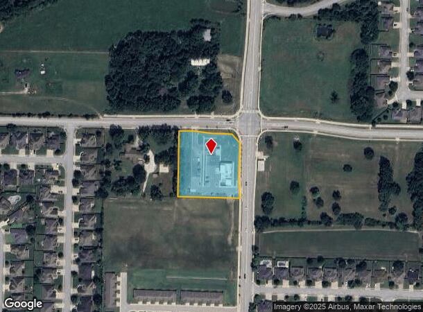
4032 W Garrett Rd, Rogers, AR 72758

NEARBY LISTINGS FOR SALE OR LEASE
Property Detail
4032 W Garrett Rd
02-14850-000
Rogers
Animalhospitalvet
PART OF THE NORTHEAST QUARTER (NE ) OF SECTION FOUR (4), TOWNSHIP EIGHTEEN (18) NORTH, RANGE THIRTY (30) WEST OF THE FIFTH PRINCIPAL MERIDIAN, BENTON COUNTY, ARKANSAS, FURTHER DESCRIBED AS FOLLOWS: COMMENCING AT THE NORTHEAST CORNER OF SAID NORTHEAST
X
Benton
05007C0270K
Arkansas
2025
1.92 AC
2025
West Rogers
021316
Fayetteville/Springdale/Rogers
4,596 SF
Fayetteville-Springdale-Rogers, AR
DEMOGRAPHICS near 4032 W Garrett Rd
1 Mile
3 Mile
5 Mile
2024 Total Population
5,256
37,213
96,460
2029 Population
6,186
44,054
112,997
Pop Growth 2024-2029
+ 17.69%
+ 18.38%
+ 17.14%
Average Age
35
36
36
2024 Total Households
1,769
13,368
33,743
HH Growth 2024-2029
+ 17.69%
+ 18.60%
+ 17.42%
Median Household Inc
$128,750
$114,118
$85,364
Avg Household Size
3.00
2.70
2.80
2024 Avg HH Vehicles
2.00
2.00
2.00
Median Home Value
$324,922
$324,280
$254,957
Median Year Built
2008
2008
2000
Nearby Places
Map Layers
Map Styles
 Street
 Aerial
- Restaurants
- Banks
- Shops
- Fitness
- Groceries
PUBLIC TRANSPORTATION
AIRPORT
Northwest Arkansas Ntl
DRIVE
WALK
Distance
Northwest Arkansas Ntl
24 min
10.5 mi
Freight Ports
Tulsa Port of Inola
DRIVE
WALK
Distance
Tulsa Port of Inola
109 min
92.2 mi
Nearby Properties
Address
Land Use
TOTAL SIZE
Lot Size
Zoning
Address
Land Use
TOTAL SIZE
Lot Size
Zoning
52,778 SF
1.04 AC
Address
Land Use
TOTAL SIZE
Lot Size
Zoning
441,673 SF
55.19 AC
Address
Land Use
TOTAL SIZE
Lot Size
Zoning
384,427 SF
10.51 AC
Address
Land Use
TOTAL SIZE
Lot Size
Zoning
472,987 SF
3.75 AC
Address
Land Use
TOTAL SIZE
Lot Size
Zoning
367,076 SF
57.31 AC
Address
Land Use
TOTAL SIZE
Lot Size
Zoning
307,725 SF
9.36 AC
Address
Land Use
TOTAL SIZE
Lot Size
Zoning
405,394 SF
10.97 AC
Address
Land Use
TOTAL SIZE
Lot Size
Zoning
412,893 SF
11.51 AC
Address
Land Use
TOTAL SIZE
Lot Size
Zoning
306,814 SF
8.77 AC
Address
Land Use
TOTAL SIZE
Lot Size
Zoning
269,397 SF
27.07 AC
Address
Land Use
TOTAL SIZE
Lot Size
Zoning
299,595 SF
18 AC
Address
Land Use
TOTAL SIZE
Lot Size
Zoning
305,450 SF
12.16 AC
Address
Land Use
TOTAL SIZE
Lot Size
Zoning
251,590 SF
6.95 AC
Address
Land Use
TOTAL SIZE
Lot Size
Zoning
365,674 SF
18.05 AC
Address
Land Use
TOTAL SIZE
Lot Size
Zoning
84,890 SF
5.89 AC
Address
Land Use
TOTAL SIZE
Lot Size
Zoning
108,103 SF
8.53 AC
Address
Land Use
TOTAL SIZE
Lot Size
Zoning
80,045 SF
8.29 AC
Address
Land Use
TOTAL SIZE
Lot Size
Zoning
166,973 SF
7.58 AC
Address
Land Use
TOTAL SIZE
Lot Size
Zoning
274,950 SF
3.80 AC
Address
Land Use
TOTAL SIZE
Lot Size
Zoning
430,236 SF
3.96 AC
Address
Land Use
TOTAL SIZE
Lot Size
Zoning
210,971 SF
8.46 AC
Address
Land Use
TOTAL SIZE
Lot Size
Zoning
209,369 SF
21.60 AC
Address
Land Use
TOTAL SIZE
Lot Size
Zoning
106,031 SF
0.87 AC
Address
Land Use
TOTAL SIZE
Lot Size
Zoning
251,508 SF
30 AC
Address
Land Use
TOTAL SIZE
Lot Size
Zoning
132,494 SF
21.56 AC
Address
Land Use
TOTAL SIZE
Lot Size
Zoning
306,148 SF
48.89 AC
Address
Land Use
TOTAL SIZE
Lot Size
Zoning
20,878 SF
24.78 AC
Address
Land Use
TOTAL SIZE
Lot Size
Zoning
75,610 SF
5.62 AC
Address
Land Use
TOTAL SIZE
Lot Size
Zoning
249,393 SF
10.70 AC
Address
Land Use
TOTAL SIZE
Lot Size
Zoning
292,470 SF
17.27 AC
The World's #1 Commercial Real Estate Marketplace
Connect with us
© 2026 CoStar Group
The information above has been obtained from sources believed reliable. While we do not doubt its accuracy we have not verified it and make no guarantee, warranty or representation about it. It is your responsibility to independently confirm its accuracy and completeness. Any projections, opinions, assumptions, or estimates used are for example only and do not represent the current or future performance of the property. The value of this transaction to you depends on tax and other factors which should be evaluated by your tax, financial, and legal advisors. You and your advisors should conduct a careful, independent investigation of the property to determine to your satisfaction the suitability of the property for your needs.