Property Record
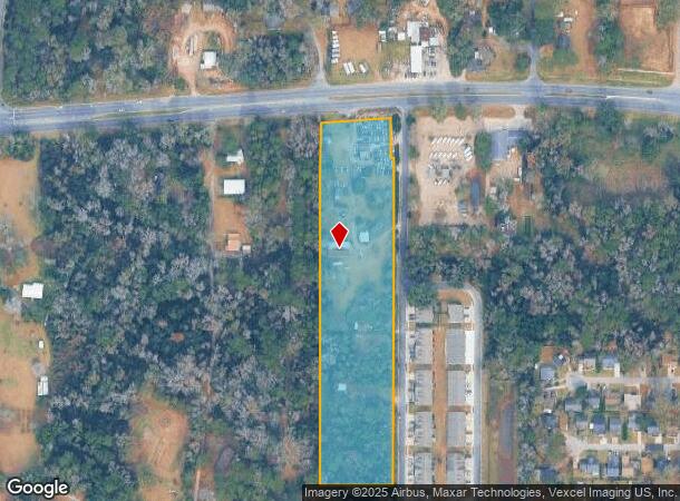
4033 Apalachee Pkwy, Tallahassee, FL 32311


NEARBY LISTINGS FOR SALE OR LEASE
Property Detail
4033 Apalachee Pkwy
31-02-20-032-000.0
Unplatted Land
Commercialofficeresidentialmixeduse
2 1S 1E IN E 1/2 OR 101/294 1676/550 1750/1809 1811 2031/769
X
Leon
12073C0315F
Florida
2025
5.58 AC
2025
Southeast Leon County
002516
Tallahassee
5,485 SF
Tallahassee, FL
DEMOGRAPHICS near 4033 Apalachee Pkwy
1 Mile
3 Mile
5 Mile
2024 Total Population
5,517
37,169
83,540
2029 Population
5,838
39,581
88,685
Pop Growth 2024-2029
+ 5.82%
+ 6.49%
+ 6.16%
Average Age
39
37
39
2024 Total Households
2,594
16,638
37,837
HH Growth 2024-2029
+ 5.98%
+ 6.80%
+ 6.40%
Median Household Inc
$68,939
$68,791
$66,710
Avg Household Size
2.10
2.10
2.10
2024 Avg HH Vehicles
2.00
2.00
2.00
Median Home Value
$193,851
$248,103
$261,709
Median Year Built
2001
1996
1989
Nearby Places
Map Layers
Map Styles
 Street
 Aerial
- Restaurants
- Banks
- Shops
- Fitness
- Groceries
PUBLIC TRANSPORTATION
AIRPORT
Tallahassee International
DRIVE
WALK
Distance
Tallahassee International
22 min
11.4 mi
Freight Ports
Port of Panama City
DRIVE
WALK
Distance
Port of Panama City
154 min
114.0 mi
Nearby Properties
Address
Land Use
TOTAL SIZE
Lot Size
Zoning
Address
Land Use
TOTAL SIZE
Lot Size
Zoning
577,345 SF
30.63 AC
Address
Land Use
TOTAL SIZE
Lot Size
Zoning
846,072 SF
166.39 AC
R1
Address
Land Use
TOTAL SIZE
Lot Size
Zoning
756,595 SF
18.35 AC
Address
Land Use
TOTAL SIZE
Lot Size
Zoning
494,919 SF
20.12 AC
R4
Address
Land Use
TOTAL SIZE
Lot Size
Zoning
708,504 SF
50.44 AC
PUD
Address
Land Use
TOTAL SIZE
Lot Size
Zoning
380,000 SF
21.78 AC
PUD
Address
Land Use
TOTAL SIZE
Lot Size
Zoning
399,048 SF
19.43 AC
PUD
Address
Land Use
TOTAL SIZE
Lot Size
Zoning
376,746 SF
12.92 AC
OR2
Address
Land Use
TOTAL SIZE
Lot Size
Zoning
543,726 SF
13.13 AC
PUD
Address
Land Use
TOTAL SIZE
Lot Size
Zoning
737,861 SF
24.79 AC
OR2
Address
Land Use
TOTAL SIZE
Lot Size
Zoning
97,373 SF
16.38 AC
PUD
Address
Land Use
TOTAL SIZE
Lot Size
Zoning
399,815 SF
18.65 AC
Address
Land Use
TOTAL SIZE
Lot Size
Zoning
619,964 SF
6.47 AC
OR3
Address
Land Use
TOTAL SIZE
Lot Size
Zoning
338,619 SF
107.89 AC
GO1
Address
Land Use
TOTAL SIZE
Lot Size
Zoning
312,935 SF
11.74 AC
MR1
Address
Land Use
TOTAL SIZE
Lot Size
Zoning
312,935 SF
12.82 AC
MR1
Address
Land Use
TOTAL SIZE
Lot Size
Zoning
456,212 SF
117.40 AC
MR1
Address
Land Use
TOTAL SIZE
Lot Size
Zoning
367,311 SF
20.01 AC
PUD
Address
Land Use
TOTAL SIZE
Lot Size
Zoning
312,392 SF
14.52 AC
MR1
Address
Land Use
TOTAL SIZE
Lot Size
Zoning
534,652 SF
57.35 AC
MR1
Address
Land Use
TOTAL SIZE
Lot Size
Zoning
247,794 SF
17.24 AC
CP
Address
Land Use
TOTAL SIZE
Lot Size
Zoning
449,952 SF
13.18 AC
AC
Address
Land Use
TOTAL SIZE
Lot Size
Zoning
605,124 SF
15.72 AC
AC
Address
Land Use
TOTAL SIZE
Lot Size
Zoning
145,652 SF
7.89 AC
M1
Address
Land Use
TOTAL SIZE
Lot Size
Zoning
319,584 SF
14.67 AC
PUD
Address
Land Use
TOTAL SIZE
Lot Size
Zoning
394,086 SF
19.22 AC
MR1
Address
Land Use
TOTAL SIZE
Lot Size
Zoning
122,546 SF
8.82 AC
AC
Address
Land Use
TOTAL SIZE
Lot Size
Zoning
123,530 SF
27.64 AC
PUD
Address
Land Use
TOTAL SIZE
Lot Size
Zoning
363,466 SF
12.96 AC
MR1
Address
Land Use
TOTAL SIZE
Lot Size
Zoning
211,154 SF
18.85 AC
PUD
The World's #1 Commercial Real Estate Marketplace
Connect with us
© 2026 CoStar Group
The information above has been obtained from sources believed reliable. While we do not doubt its accuracy we have not verified it and make no guarantee, warranty or representation about it. It is your responsibility to independently confirm its accuracy and completeness. Any projections, opinions, assumptions, or estimates used are for example only and do not represent the current or future performance of the property. The value of this transaction to you depends on tax and other factors which should be evaluated by your tax, financial, and legal advisors. You and your advisors should conduct a careful, independent investigation of the property to determine to your satisfaction the suitability of the property for your needs.