Property Record
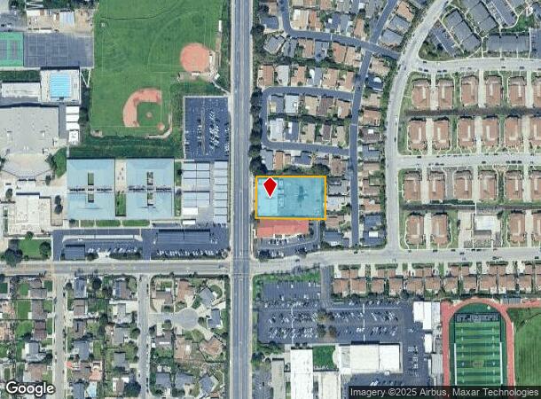
4034 S Bradley Rd, Santa Maria, CA 93455


NEARBY LISTINGS FOR SALE OR LEASE
Property Detail
4034 S Bradley Rd
107-860-076
Santa Barbara
Miscellaneous
California
X
0.97 AC
06083C0195F
North SB County
0
Santa Barbara/Sta Maria/Goleta
2025
Santa Maria-Santa Barbara, CA
002008
DEMOGRAPHICS near 4034 S Bradley Rd
1 Mile
3 Mile
5 Mile
2024 Total Population
10,550
43,271
92,960
2029 Population
10,426
42,942
92,444
Pop Growth 2024-2029
(1.18%)
(0.76%)
(0.56%)
Average Age
41
40
36
2024 Total Households
3,786
15,365
28,478
HH Growth 2024-2029
(1.32%)
(0.87%)
(0.69%)
Median Household Inc
$99,195
$102,686
$83,647
Avg Household Size
2.70
2.70
3.20
2024 Avg HH Vehicles
2.00
2.00
2.00
Median Home Value
$492,541
$531,414
$480,445
Median Year Built
1979
1982
1981
Nearby Places
Map Layers
Map Styles
 Street
 Aerial
- Restaurants
- Banks
- Shops
- Fitness
- Groceries
PUBLIC TRANSPORTATION
AIRPORT
San Luis County Regional
DRIVE
WALK
Distance
San Luis County Regional
44 min
31.3 mi
Freight Ports
The Port of Hueneme
DRIVE
WALK
Distance
The Port of Hueneme
130 min
98.1 mi
Nearby Properties
Address
Land Use
TOTAL SIZE
Lot Size
Zoning
Address
Land Use
TOTAL SIZE
Lot Size
Zoning
Address
Land Use
TOTAL SIZE
Lot Size
Zoning
49.99 AC
Address
Land Use
TOTAL SIZE
Lot Size
Zoning
18.19 AC
Address
Land Use
TOTAL SIZE
Lot Size
Zoning
17.71 AC
Address
Land Use
TOTAL SIZE
Lot Size
Zoning
4.05 AC
Address
Land Use
TOTAL SIZE
Lot Size
Zoning
Address
Land Use
TOTAL SIZE
Lot Size
Zoning
10.81 AC
Address
Land Use
TOTAL SIZE
Lot Size
Zoning
0.60 AC
1E1
Address
Land Use
TOTAL SIZE
Lot Size
Zoning
5.80 AC
DR20
Address
Land Use
TOTAL SIZE
Lot Size
Zoning
Address
Land Use
TOTAL SIZE
Lot Size
Zoning
Address
Land Use
TOTAL SIZE
Lot Size
Zoning
71,487 SF
4.41 AC
DR123
Address
Land Use
TOTAL SIZE
Lot Size
Zoning
Address
Land Use
TOTAL SIZE
Lot Size
Zoning
3.99 AC
Address
Land Use
TOTAL SIZE
Lot Size
Zoning
2.04 AC
Address
Land Use
TOTAL SIZE
Lot Size
Zoning
4.62 AC
Address
Land Use
TOTAL SIZE
Lot Size
Zoning
13.36 AC
Address
Land Use
TOTAL SIZE
Lot Size
Zoning
3.49 AC
Address
Land Use
TOTAL SIZE
Lot Size
Zoning
24.71 AC
C2
Address
Land Use
TOTAL SIZE
Lot Size
Zoning
27.03 AC
Address
Land Use
TOTAL SIZE
Lot Size
Zoning
11.99 AC
Address
Land Use
TOTAL SIZE
Lot Size
Zoning
Address
Land Use
TOTAL SIZE
Lot Size
Zoning
Address
Land Use
TOTAL SIZE
Lot Size
Zoning
2.71 AC
Address
Land Use
TOTAL SIZE
Lot Size
Zoning
Address
Land Use
TOTAL SIZE
Lot Size
Zoning
Address
Land Use
TOTAL SIZE
Lot Size
Zoning
9.12 AC
Address
Land Use
TOTAL SIZE
Lot Size
Zoning
2.21 AC
Address
Land Use
TOTAL SIZE
Lot Size
Zoning
7.80 AC
OTR14GC
Address
Land Use
TOTAL SIZE
Lot Size
Zoning
9.61 AC
The World's #1 Commercial Real Estate Marketplace
Connect with us
© 2025 CoStar Group
The information above has been obtained from sources believed reliable. While we do not doubt its accuracy we have not verified it and make no guarantee, warranty or representation about it. It is your responsibility to independently confirm its accuracy and completeness. Any projections, opinions, assumptions, or estimates used are for example only and do not represent the current or future performance of the property. The value of this transaction to you depends on tax and other factors which should be evaluated by your tax, financial, and legal advisors. You and your advisors should conduct a careful, independent investigation of the property to determine to your satisfaction the suitability of the property for your needs.