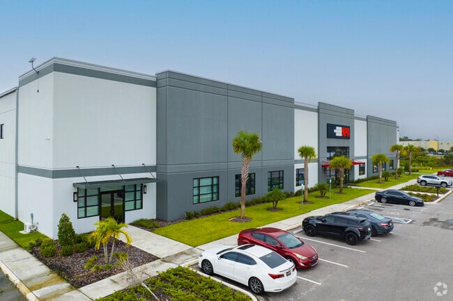
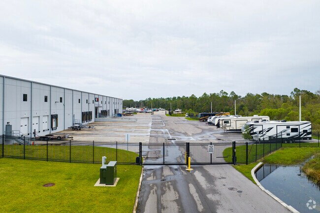
Property Record
4035 Frontage Rd N, Lakeland, FL 33810
NEARBY LISTINGS FOR SALE OR LEASE
Property Detail
4035 Frontage Rd N
Lakeland-Winter Haven, FL
Pinesthe
23-28-17-000000-021080
E1/4 OF NW1/4OF NW1/4 LYING N OF SR 600 & W1/2 OF SE1/4 OF NW1/4 OF NW1/4 LYING N OF SR 600 BEING PART OF BORROW PIT #4 LESS ADDNL R/W FOR SR 400
Warehouse
Polk
AE
Florida
12105C0292G
22
2024
12.40 AC
2025
Polk County
012113
Tampa/St Petersburg
141,960 SF
DEMOGRAPHICS near 4035 Frontage Rd N
1 Mile
3 Mile
5 Mile
2024 Total Population
3,094
24,123
90,297
2029 Population
3,708
28,948
107,475
Pop Growth 2024-2029
+ 19.84%
+ 20.00%
+ 19.02%
Average Age
42
40
40
2024 Total Households
1,259
9,306
35,630
HH Growth 2024-2029
+ 20.02%
+ 20.13%
+ 19.30%
Median Household Inc
$45,500
$45,572
$50,228
Avg Household Size
2.40
2.50
2.40
2024 Avg HH Vehicles
2.00
2.00
2.00
Median Home Value
$157,894
$140,920
$186,884
Median Year Built
1977
1980
1983
Nearby Places
Map Layers
Map Styles
 Street
 Aerial
- Restaurants
- Banks
- Shops
- Fitness
- Groceries
PUBLIC TRANSPORTATION
COMMUTER RAIL
Lakeland (Silver Star - Amtrak)
DRIVE
WALK
Distance
Lakeland (Silver Star - Amtrak)
12 min
6.2 mi
Freight Ports
Port of Tampa Bay
DRIVE
WALK
Distance
Port of Tampa Bay
41 min
29.5 mi
SALE & LEASE HISTORY
LISTING DATE
SALE/LEASE

Sep 25, 2016
For Lease
Nearby Properties
Address
Land Use
TOTAL SIZE
Lot Size
Zoning
Address
Land Use
TOTAL SIZE
Lot Size
Zoning
2,095,234 SF
102.45 AC
PUD
Address
Land Use
TOTAL SIZE
Lot Size
Zoning
1,210,880 SF
405.82 AC
PUD
Address
Land Use
TOTAL SIZE
Lot Size
Zoning
1,494,080 SF
116.77 AC
Address
Land Use
TOTAL SIZE
Lot Size
Zoning
705,615 SF
33.05 AC
Address
Land Use
TOTAL SIZE
Lot Size
Zoning
711,568 SF
42.87 AC
PD
Address
Land Use
TOTAL SIZE
Lot Size
Zoning
711,568 SF
43.33 AC
PD
Address
Land Use
TOTAL SIZE
Lot Size
Zoning
723,962 SF
47.49 AC
I
Address
Land Use
TOTAL SIZE
Lot Size
Zoning
655,123 SF
45.28 AC
Address
Land Use
TOTAL SIZE
Lot Size
Zoning
1,004,426 SF
93.42 AC
C4
Address
Land Use
TOTAL SIZE
Lot Size
Zoning
520,806 SF
25.62 AC
Address
Land Use
TOTAL SIZE
Lot Size
Zoning
492,960 SF
22.09 AC
Address
Land Use
TOTAL SIZE
Lot Size
Zoning
602,125 SF
43.97 AC
Address
Land Use
TOTAL SIZE
Lot Size
Zoning
599,280 SF
35.27 AC
GI
Address
Land Use
TOTAL SIZE
Lot Size
Zoning
566,274 SF
33.79 AC
GI
Address
Land Use
TOTAL SIZE
Lot Size
Zoning
417,890 SF
14.59 AC
Address
Land Use
TOTAL SIZE
Lot Size
Zoning
568,801 SF
37.13 AC
C4
Address
Land Use
TOTAL SIZE
Lot Size
Zoning
220,510 SF
37.56 AC
I
Address
Land Use
TOTAL SIZE
Lot Size
Zoning
172,176 SF
8.93 AC
RE2
Address
Land Use
TOTAL SIZE
Lot Size
Zoning
349,920 SF
22.21 AC
Address
Land Use
TOTAL SIZE
Lot Size
Zoning
297,600 SF
27.53 AC
XX
Address
Land Use
TOTAL SIZE
Lot Size
Zoning
441,480 SF
24.28 AC
Address
Land Use
TOTAL SIZE
Lot Size
Zoning
309,334 SF
41.64 AC
Address
Land Use
TOTAL SIZE
Lot Size
Zoning
451,505 SF
30.12 AC
GI
Address
Land Use
TOTAL SIZE
Lot Size
Zoning
682,828 SF
36.01 AC
Address
Land Use
TOTAL SIZE
Lot Size
Zoning
198,294 SF
10.31 AC
Address
Land Use
TOTAL SIZE
Lot Size
Zoning
181,400 SF
17.06 AC
I
Address
Land Use
TOTAL SIZE
Lot Size
Zoning
210,000 SF
12.91 AC
Address
Land Use
TOTAL SIZE
Lot Size
Zoning
245,294 SF
8.84 AC
Address
Land Use
TOTAL SIZE
Lot Size
Zoning
210,000 SF
13.28 AC
Address
Land Use
TOTAL SIZE
Lot Size
Zoning
155,716 SF
55.85 AC
XX
The World's #1 Commercial Real Estate Marketplace
Connect with us
© 2025 CoStar Group
The information above has been obtained from sources believed reliable. While we do not doubt its accuracy we have not verified it and make no guarantee, warranty or representation about it. It is your responsibility to independently confirm its accuracy and completeness. Any projections, opinions, assumptions, or estimates used are for example only and do not represent the current or future performance of the property. The value of this transaction to you depends on tax and other factors which should be evaluated by your tax, financial, and legal advisors. You and your advisors should conduct a careful, independent investigation of the property to determine to your satisfaction the suitability of the property for your needs.