Property Record
4036 S Shields St, Fort Collins, CO 80526


NEARBY LISTINGS FOR SALE OR LEASE
-
-
View all Fort Collins listings for lease on LoopNet.com
Property Detail
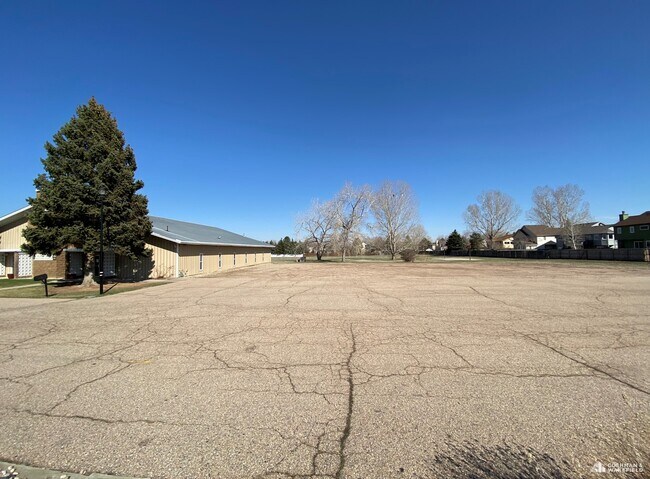
4036 S Shields St
97352-00-920
TR IN NW 1/4 35-7-69 DESC AS COM AT W 1/4 COR, N 312 FT, S 89 53 E 558.46 FT, S 312 FT, N 89 53 W 558.46 FT TPOB, FTC; LESS ROW 97051441; LESS ROAD ROW PER 2001029338
Religious
Larimer
X
Colorado
08069C0986G
3.86 AC
0
Fort Collins/Loveland
2025
Denver
001109
Fort Collins-Loveland, CO
8,000 SF
DEMOGRAPHICS near 4036 S Shields St
1 mile
3 mile
5 mile
2024 Total Population
15,760
84,349
169,169
2029 Population
16,716
89,284
178,827
Pop Growth 2024-2029
+ 6.07%
+ 5.85%
+ 5.71%
Average Age
38
38
36
2024 Total Households
6,379
35,027
68,587
HH Growth 2024-2029
+ 6.46%
+ 6.26%
+ 6.20%
Median Household Inc
$82,171
$70,599
$71,866
Avg Household Size
2.40
2.30
2.30
2024 Avg HH Vehicles
2.00
2.00
2.00
Median Home Value
$454,116
$469,009
$492,308
Median Year Built
1991
1987
1991
Nearby Places
Map Layers
Map Styles
 Street
 Aerial
Transit
 Traffic
 Biking
Places
Listings with unknown addresses are not visible on the map
- Restaurants
- Banks
- Shops
- Fitness
- Groceries
SALE & LEASE HISTORY
LISTING DATE
SALE/LEASE

Apr 07, 2020
For Lease
Nearby Properties
Address
Land Use
TOTAL SIZE
Lot Size
Zoning
Address
Land Use
TOTAL SIZE
Lot Size
Zoning
521,085 SF
80.60 AC
CSU
Address
Land Use
TOTAL SIZE
Lot Size
Zoning
95,880 SF
16.69 AC
Address
Land Use
TOTAL SIZE
Lot Size
Zoning
283,141 SF
24 AC
RL
Address
Land Use
TOTAL SIZE
Lot Size
Zoning
222,592 SF
21.69 AC
HC
Address
Land Use
TOTAL SIZE
Lot Size
Zoning
281,945 SF
15.01 AC
NCL
Address
Land Use
TOTAL SIZE
Lot Size
Zoning
173,575 SF
28.86 AC
RL
Address
Land Use
TOTAL SIZE
Lot Size
Zoning
337,566 SF
2.62 AC
Address
Land Use
TOTAL SIZE
Lot Size
Zoning
93,138 SF
14.45 AC
MMN
Address
Land Use
TOTAL SIZE
Lot Size
Zoning
227,180 SF
39 AC
E
Address
Land Use
TOTAL SIZE
Lot Size
Zoning
170,119 SF
12.83 AC
C
Address
Land Use
TOTAL SIZE
Lot Size
Zoning
181,956 SF
5 AC
C
Address
Land Use
TOTAL SIZE
Lot Size
Zoning
189,920 SF
6 AC
E
Address
Land Use
TOTAL SIZE
Lot Size
Zoning
67,144 SF
39.41 AC
Address
Land Use
TOTAL SIZE
Lot Size
Zoning
115,260 SF
9.08 AC
HC
Address
Land Use
TOTAL SIZE
Lot Size
Zoning
112,500 SF
30 AC
RL
Address
Land Use
TOTAL SIZE
Lot Size
Zoning
363,294 SF
20.28 AC
MMN
Address
Land Use
TOTAL SIZE
Lot Size
Zoning
106,534 SF
7.55 AC
E
Address
Land Use
TOTAL SIZE
Lot Size
Zoning
99,997 SF
10.47 AC
NC
Address
Land Use
TOTAL SIZE
Lot Size
Zoning
71,244 SF
5.96 AC
C
Address
Land Use
TOTAL SIZE
Lot Size
Zoning
400,513 SF
2.01 AC
Address
Land Use
TOTAL SIZE
Lot Size
Zoning
95,815 SF
7.46 AC
C
Address
Land Use
TOTAL SIZE
Lot Size
Zoning
129,570 SF
11.95 AC
HC
Address
Land Use
TOTAL SIZE
Lot Size
Zoning
193,385 SF
12.97 AC
MMN
Address
Land Use
TOTAL SIZE
Lot Size
Zoning
322,880 SF
12.40 AC
HC
Address
Land Use
TOTAL SIZE
Lot Size
Zoning
100,000 SF
4.88 AC
LMN
Address
Land Use
TOTAL SIZE
Lot Size
Zoning
117,558 SF
7.96 AC
Address
Land Use
TOTAL SIZE
Lot Size
Zoning
110,500 SF
20 AC
RL
Address
Land Use
TOTAL SIZE
Lot Size
Zoning
154,404 SF
8.64 AC
C
Address
Land Use
TOTAL SIZE
Lot Size
Zoning
100,339 SF
8.24 AC
HC
The World's #1 Commercial Real Estate Marketplace
Connect with us
© 2026 CoStar Group
The information above has been obtained from sources believed reliable. While we do not doubt its accuracy we have not verified it and make no guarantee, warranty or representation about it. It is your responsibility to independently confirm its accuracy and completeness. Any projections, opinions, assumptions, or estimates used are for example only and do not represent the current or future performance of the property. The value of this transaction to you depends on tax and other factors which should be evaluated by your tax, financial, and legal advisors. You and your advisors should conduct a careful, independent investigation of the property to determine to your satisfaction the suitability of the property for your needs.