Property Record
4037 E Newport Rd, Newport, MI 48166
NEARBY LISTINGS FOR SALE OR LEASE
Property Detail
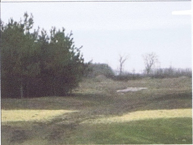
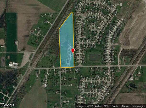
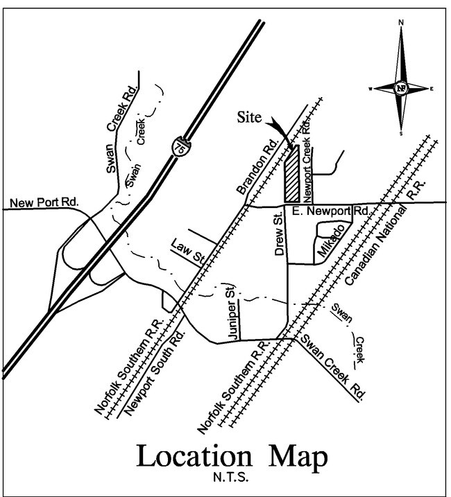
4037 E Newport Rd
03-031-005-10
BEING PART OF THE SW 1/4 OF SEC 31, T5S R10E COM AT THE SW COR OF SAID SEC 31 AS THE POB; TH N 00 DEG 03' 38" E 925.64 FT; TH
Residentialacreage
Monroe
X
Michigan
26115C0118E
8.64 AC
2025
Monroe County
2025
Detroit
830200
Monroe, MI
1,354 SF
DEMOGRAPHICS near 4037 E Newport Rd
1 Mile
3 Mile
5 Mile
2024 Total Population
1,618
10,999
23,968
2029 Population
1,654
11,242
24,363
Pop Growth 2024-2029
+ 2.22%
+ 2.21%
+ 1.65%
Average Age
38
38
41
2024 Total Households
577
4,111
9,397
HH Growth 2024-2029
+ 2.25%
+ 2.21%
+ 1.60%
Median Household Inc
$91,105
$70,869
$70,040
Avg Household Size
2.80
2.60
2.50
2024 Avg HH Vehicles
2.00
2.00
2.00
Median Home Value
$251,732
$198,747
$211,816
Median Year Built
1999
1996
1989
Nearby Places
Map Layers
Map Styles
 Street
 Aerial
- Restaurants
- Banks
- Shops
- Fitness
- Groceries
PUBLIC TRANSPORTATION
AIRPORT
Detroit Metro Wayne County
DRIVE
WALK
Distance
Detroit Metro Wayne County
26 min
19.6 mi
Windsor International
DRIVE
WALK
Distance
Windsor International
57 min
38.9 mi
Freight Ports
Port of Toledo
DRIVE
WALK
Distance
Port of Toledo
45 min
32.6 mi
Nearby Properties
Address
Land Use
TOTAL SIZE
Lot Size
Zoning
Address
Land Use
TOTAL SIZE
Lot Size
Zoning
Address
Land Use
TOTAL SIZE
Lot Size
Zoning
453,206 SF
156.60 AC
AG
Address
Land Use
TOTAL SIZE
Lot Size
Zoning
720,420 SF
71.34 AC
LM-LIGHT M
Address
Land Use
TOTAL SIZE
Lot Size
Zoning
5,216 SF
81.10 AC
MHP
Address
Land Use
TOTAL SIZE
Lot Size
Zoning
29.81 AC
MHP
Address
Land Use
TOTAL SIZE
Lot Size
Zoning
100,407 SF
16.34 AC
Address
Land Use
TOTAL SIZE
Lot Size
Zoning
4,419 SF
64.34 AC
MHP
Address
Land Use
TOTAL SIZE
Lot Size
Zoning
28.87 AC
MHP
Address
Land Use
TOTAL SIZE
Lot Size
Zoning
3,272 SF
121.75 AC
MHP
Address
Land Use
TOTAL SIZE
Lot Size
Zoning
2,472 SF
46.65 AC
Address
Land Use
TOTAL SIZE
Lot Size
Zoning
37,665 SF
9.13 AC
Address
Land Use
TOTAL SIZE
Lot Size
Zoning
5,712 SF
0.84 AC
Address
Land Use
TOTAL SIZE
Lot Size
Zoning
34.40 AC
MHP
Address
Land Use
TOTAL SIZE
Lot Size
Zoning
14,118 SF
37.23 AC
Address
Land Use
TOTAL SIZE
Lot Size
Zoning
8,048 SF
148.21 AC
Address
Land Use
TOTAL SIZE
Lot Size
Zoning
3,136 SF
3.92 AC
Address
Land Use
TOTAL SIZE
Lot Size
Zoning
16,239 SF
2.71 AC
Address
Land Use
TOTAL SIZE
Lot Size
Zoning
13,730 SF
2.43 AC
Address
Land Use
TOTAL SIZE
Lot Size
Zoning
9,146 SF
1.86 AC
Address
Land Use
TOTAL SIZE
Lot Size
Zoning
13,500 SF
2.34 AC
Address
Land Use
TOTAL SIZE
Lot Size
Zoning
28,800 SF
13.60 AC
Address
Land Use
TOTAL SIZE
Lot Size
Zoning
Address
Land Use
TOTAL SIZE
Lot Size
Zoning
5 AC
MHP
Address
Land Use
TOTAL SIZE
Lot Size
Zoning
6,109 SF
1.20 AC
Address
Land Use
TOTAL SIZE
Lot Size
Zoning
154.42 AC
AG
Address
Land Use
TOTAL SIZE
Lot Size
Zoning
1,562 SF
83.97 AC
A-AGRICULT
Address
Land Use
TOTAL SIZE
Lot Size
Zoning
3,885 SF
1.26 AC
Address
Land Use
TOTAL SIZE
Lot Size
Zoning
1,330 SF
55.20 AC
Address
Land Use
TOTAL SIZE
Lot Size
Zoning
2,135 SF
71.24 AC
A-AGRICULT
Address
Land Use
TOTAL SIZE
Lot Size
Zoning
3,347 SF
13.62 AC
A-AGRICULT
The World's #1 Commercial Real Estate Marketplace
Connect with us
© 2026 CoStar Group
The information above has been obtained from sources believed reliable. While we do not doubt its accuracy we have not verified it and make no guarantee, warranty or representation about it. It is your responsibility to independently confirm its accuracy and completeness. Any projections, opinions, assumptions, or estimates used are for example only and do not represent the current or future performance of the property. The value of this transaction to you depends on tax and other factors which should be evaluated by your tax, financial, and legal advisors. You and your advisors should conduct a careful, independent investigation of the property to determine to your satisfaction the suitability of the property for your needs.