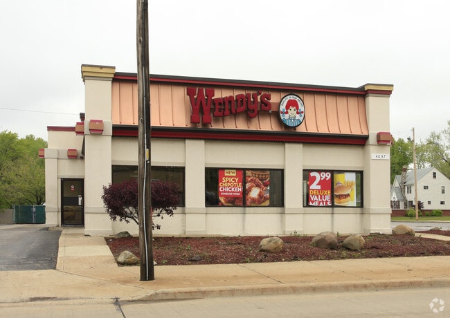
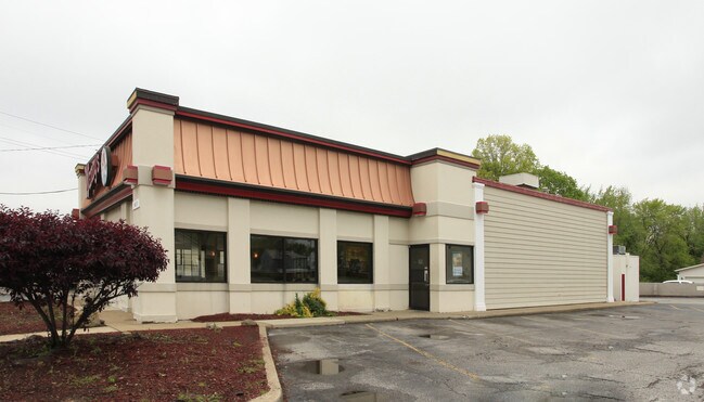
Property Record
4037 Mayfield Rd, Cleveland, OH 44121

NEARBY LISTINGS FOR SALE OR LEASE
Property Detail
4037 Mayfield Rd
Cleveland-Elyria, OH
James D Neiheiser
702-06-011
63 0001 70206012
Restaurantdrivein
Cuyahoga
X
Ohio
39035C0093E
1
2024
0.64 AC
2024
East
185103
Cleveland
2,552 SF
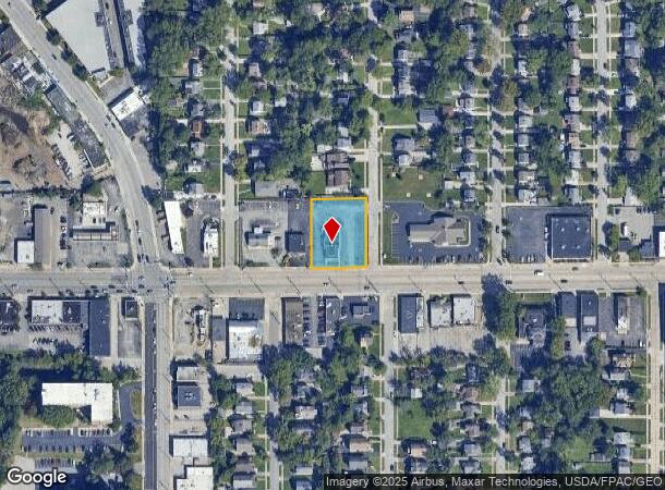
DEMOGRAPHICS near 4037 Mayfield Rd
1 Mile
3 Mile
5 Mile
2024 Total Population
16,810
129,723
316,788
2029 Population
16,374
127,563
312,374
Pop Growth 2024-2029
(2.59%)
(1.67%)
(1.39%)
Average Age
40
42
41
2024 Total Households
6,989
56,384
141,487
HH Growth 2024-2029
(2.88%)
(1.76%)
(1.45%)
Median Household Inc
$61,001
$57,558
$47,845
Avg Household Size
2.30
2.20
2.10
2024 Avg HH Vehicles
2.00
1.00
1.00
Median Home Value
$126,346
$160,612
$158,477
Median Year Built
1948
1952
1952
Nearby Places
Map Layers
Map Styles
 Street
 Aerial
- Restaurants
- Banks
- Shops
- Fitness
- Groceries
PUBLIC TRANSPORTATION
AIRPORT
Cleveland-Hopkins International
DRIVE
WALK
Distance
Cleveland-Hopkins International
40 min
21.2 mi
Freight Ports
Port of Toledo
DRIVE
WALK
Distance
Port of Toledo
153 min
121.7 mi
Nearby Properties
Address
Land Use
TOTAL SIZE
Lot Size
Zoning
Address
Land Use
TOTAL SIZE
Lot Size
Zoning
964,082 SF
40.67 AC
Address
Land Use
TOTAL SIZE
Lot Size
Zoning
1,066,853 SF
42.18 AC
U-5
Address
Land Use
TOTAL SIZE
Lot Size
Zoning
650,536 SF
19.01 AC
U-3A
Address
Land Use
TOTAL SIZE
Lot Size
Zoning
379,326 SF
43.45 AC
CRG
Address
Land Use
TOTAL SIZE
Lot Size
Zoning
229,833 SF
19.04 AC
U-3
Address
Land Use
TOTAL SIZE
Lot Size
Zoning
302,009 SF
6.62 AC
U-7A
Address
Land Use
TOTAL SIZE
Lot Size
Zoning
257,048 SF
17.93 AC
S1
Address
Land Use
TOTAL SIZE
Lot Size
Zoning
413,626 SF
21.95 AC
S2
Address
Land Use
TOTAL SIZE
Lot Size
Zoning
294,215 SF
4.70 AC
U-3A
Address
Land Use
TOTAL SIZE
Lot Size
Zoning
346,762 SF
4.57 AC
U-3A
Address
Land Use
TOTAL SIZE
Lot Size
Zoning
91,540 SF
14.35 AC
CRG
Address
Land Use
TOTAL SIZE
Lot Size
Zoning
297,799 SF
4.18 AC
U-3
Address
Land Use
TOTAL SIZE
Lot Size
Zoning
108,198 SF
25.45 AC
U-5
Address
Land Use
TOTAL SIZE
Lot Size
Zoning
189,444 SF
9.71 AC
U-5
Address
Land Use
TOTAL SIZE
Lot Size
Zoning
222,426 SF
3.60 AC
U1
Address
Land Use
TOTAL SIZE
Lot Size
Zoning
59,308 SF
5.84 AC
U-1A-2
Address
Land Use
TOTAL SIZE
Lot Size
Zoning
131,846 SF
5.94 AC
U-9
Address
Land Use
TOTAL SIZE
Lot Size
Zoning
222,800 SF
2.32 AC
U-3
Address
Land Use
TOTAL SIZE
Lot Size
Zoning
100,469 SF
25.96 AC
AA
Address
Land Use
TOTAL SIZE
Lot Size
Zoning
249,712 SF
22.69 AC
I
Address
Land Use
TOTAL SIZE
Lot Size
Zoning
255,964 SF
39.41 AC
R-75
Address
Land Use
TOTAL SIZE
Lot Size
Zoning
275,040 SF
9.07 AC
U3
Address
Land Use
TOTAL SIZE
Lot Size
Zoning
256,546 SF
25.35 AC
U-1
Address
Land Use
TOTAL SIZE
Lot Size
Zoning
153,560 SF
32.47 AC
I
Address
Land Use
TOTAL SIZE
Lot Size
Zoning
157,761 SF
14.27 AC
R-50
Address
Land Use
TOTAL SIZE
Lot Size
Zoning
89,347 SF
1.10 AC
CRG
Address
Land Use
TOTAL SIZE
Lot Size
Zoning
186,262 SF
5.06 AC
U-4A
Address
Land Use
TOTAL SIZE
Lot Size
Zoning
61,352 SF
10.79 AC
M-I
Address
Land Use
TOTAL SIZE
Lot Size
Zoning
129,593 SF
72.95 AC
P
Address
Land Use
TOTAL SIZE
Lot Size
Zoning
111,800 SF
8 AC
1F-4
The World's #1 Commercial Real Estate Marketplace
Connect with us
© 2025 CoStar Group
The information above has been obtained from sources believed reliable. While we do not doubt its accuracy we have not verified it and make no guarantee, warranty or representation about it. It is your responsibility to independently confirm its accuracy and completeness. Any projections, opinions, assumptions, or estimates used are for example only and do not represent the current or future performance of the property. The value of this transaction to you depends on tax and other factors which should be evaluated by your tax, financial, and legal advisors. You and your advisors should conduct a careful, independent investigation of the property to determine to your satisfaction the suitability of the property for your needs.