Property Record
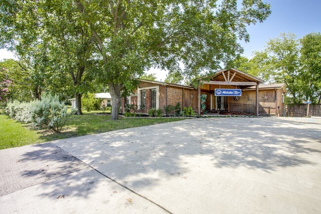
4037 N Goliad St, Rockwall, TX 75087


Property Detail
4037 N Goliad St
12316
A0187, J STRICKLAND, TRACT 21, 0.61 ACRES
Commercialnec
Rockwall
B and X Area of moderate flood hazard, usually the area between the limits of the 100-year and 500-year floods.
Texas
2025
0.61 AC
2025
Rockwall
040103
Dallas/Ft Worth
1,999 SF
Dallas-Fort Worth-Arlington, TX
NEARBY LISTINGS FOR SALE OR LEASE
DEMOGRAPHICS near 4037 N Goliad St
1 mile
3 mile
5 mile
2025 Total Population
4,737
33,251
107,575
2030 Population
5,650
39,570
124,784
Pop Growth 2025-2030
+ 19.27%
+ 19.00%
+ 16.00%
Average Age
38
38
38
2025 Total Households
1,512
10,681
35,933
HH Growth 2025-2030
+ 19.11%
+ 18.90%
+ 16.16%
Median Household Inc
$133,533
$130,711
$122,156
Avg Household Size
3.10
3.10
2.90
2025 Avg HH Vehicles
2.00
2.00
2.00
Median Home Value
$467,230
$447,916
$432,459
Median Year Built
2008
2008
2006
Nearby Places
Map Layers
Map Styles
 Street
 Aerial
Layers
 Traffic
 Biking
Places
Listings with unknown addresses are not visible on the map
- Restaurants
- Banks
- Shops
- Fitness
- Groceries
PUBLIC TRANSPORTATION
AIRPORT
Dallas Love Field
Drive
Walk
Distance
Dallas Love Field
47 min
31.5 mi
Freight Ports
Port of Shreveport
Drive
Walk
Distance
Port of Shreveport
211 min
188.0 mi
SALE & LEASE HISTORY
LISTING DATE
SALE/LEASE

Sep 20, 2017
For Lease
Nov 15, 2021
For Lease
Aug 02, 2017
For Lease
Nearby Properties
Address
Land Use
TOTAL SIZE
Lot Size
Zoning
Address
Land Use
TOTAL SIZE
Lot Size
Zoning
193,393 SF
69.53 AC
Address
Land Use
TOTAL SIZE
Lot Size
Zoning
126,341 SF
18.41 AC
L1
Address
Land Use
TOTAL SIZE
Lot Size
Zoning
91,612 SF
12 AC
Address
Land Use
TOTAL SIZE
Lot Size
Zoning
93,932 SF
11 AC
Address
Land Use
TOTAL SIZE
Lot Size
Zoning
90,751 SF
11.24 AC
Address
Land Use
TOTAL SIZE
Lot Size
Zoning
52,051 SF
6.98 AC
Address
Land Use
TOTAL SIZE
Lot Size
Zoning
69.92 AC
Address
Land Use
TOTAL SIZE
Lot Size
Zoning
74,900 SF
15.09 AC
Address
Land Use
TOTAL SIZE
Lot Size
Zoning
227.41 AC
PD3
Address
Land Use
TOTAL SIZE
Lot Size
Zoning
59,440 SF
6.81 AC
Address
Land Use
TOTAL SIZE
Lot Size
Zoning
113,398 SF
21.33 AC
Address
Land Use
TOTAL SIZE
Lot Size
Zoning
84,425 SF
4.27 AC
Address
Land Use
TOTAL SIZE
Lot Size
Zoning
79,082 SF
2.08 AC
Address
Land Use
TOTAL SIZE
Lot Size
Zoning
92,265 SF
5.82 AC
Address
Land Use
TOTAL SIZE
Lot Size
Zoning
16,226 SF
2.02 AC
SF2
Address
Land Use
TOTAL SIZE
Lot Size
Zoning
18,322 SF
3.54 AC
Address
Land Use
TOTAL SIZE
Lot Size
Zoning
41,158 SF
5.19 AC
Address
Land Use
TOTAL SIZE
Lot Size
Zoning
38,481 SF
21.38 AC
Address
Land Use
TOTAL SIZE
Lot Size
Zoning
23,026 SF
7.05 AC
Address
Land Use
TOTAL SIZE
Lot Size
Zoning
13,516 SF
2.33 AC
Address
Land Use
TOTAL SIZE
Lot Size
Zoning
11,335 SF
1.35 AC
Address
Land Use
TOTAL SIZE
Lot Size
Zoning
13,306 SF
2.04 AC
Address
Land Use
TOTAL SIZE
Lot Size
Zoning
10,800 SF
1.47 AC
Address
Land Use
TOTAL SIZE
Lot Size
Zoning
9,035 SF
23.82 AC
Address
Land Use
TOTAL SIZE
Lot Size
Zoning
14,732 SF
2.52 AC
Address
Land Use
TOTAL SIZE
Lot Size
Zoning
14,736 SF
1.99 AC
Address
Land Use
TOTAL SIZE
Lot Size
Zoning
11,477 SF
1.35 AC
Address
Land Use
TOTAL SIZE
Lot Size
Zoning
13,157 SF
1.81 AC
Address
Land Use
TOTAL SIZE
Lot Size
Zoning
10,913 SF
2 AC
Address
Land Use
TOTAL SIZE
Lot Size
Zoning
12,864 SF
3.52 AC
The World's #1 Commercial Real Estate Marketplace
Connect with us
© 2026 CoStar Group
The information above has been obtained from sources believed reliable. While we do not doubt its accuracy we have not verified it and make no guarantee, warranty or representation about it. It is your responsibility to independently confirm its accuracy and completeness. Any projections, opinions, assumptions, or estimates used are for example only and do not represent the current or future performance of the property. The value of this transaction to you depends on tax and other factors which should be evaluated by your tax, financial, and legal advisors. You and your advisors should conduct a careful, independent investigation of the property to determine to your satisfaction the suitability of the property for your needs.