Property Record
4037 Taylor Rd, Chesapeake, VA 23321


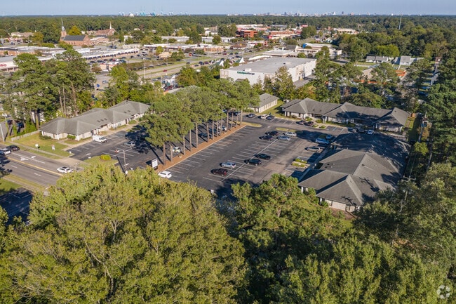

Property Detail
4037 Taylor Rd
0050000000500
PT POPLAR HILL FARM 1.9223 AC
Medicalbuilding
CHESAPEAKE
O-I: OFFIC
Virginia
B and X Area of moderate flood hazard, usually the area between the limits of the 100-year and 500-year floods.
1.92 AC
2024
Western Branch
2025
Hampton Roads
021602
Virginia Beach-Chesapeake-Norfolk, VA-NC
11,410 SF
NEARBY LISTINGS FOR SALE OR LEASE
DEMOGRAPHICS near 4037 Taylor Rd
1 mile
3 mile
5 mile
2024 Total Population
14,470
65,236
124,386
2029 Population
14,435
66,304
126,321
Pop Growth 2024-2029
(0.24%)
+ 1.64%
+ 1.56%
Average Age
37
39
39
2024 Total Households
5,745
25,618
48,427
HH Growth 2024-2029
(0.23%)
+ 1.77%
+ 1.53%
Median Household Inc
$76,197
$85,782
$80,025
Avg Household Size
2.50
2.50
2.50
2024 Avg HH Vehicles
2.00
2.00
2.00
Median Home Value
$278,232
$327,823
$316,281
Median Year Built
1977
1985
1980
Nearby Places
Map Layers
Map Styles
 Street
 Aerial
Transit
 Traffic
 Biking
Places
Listings with unknown addresses are not visible on the map
- Restaurants
- Banks
- Shops
- Fitness
- Groceries
PUBLIC TRANSPORTATION
COMMUTER RAIL
Norfolk (Northeast Regional - Amtrak)
Drive
Walk
Distance
Norfolk (Northeast Regional - Amtrak)
16 min
9.8 mi
AIRPORT
Norfolk International
Drive
Walk
Distance
Norfolk International
27 min
14.3 mi
Newport News/Williamsburg International
Drive
Walk
Distance
Newport News/Williamsburg International
36 min
25.6 mi
Freight Ports
Virginia Port Authority - Portsmouth
Drive
Walk
Distance
Virginia Port Authority - Portsmouth
13 min
6.5 mi
SALE & LEASE HISTORY
LISTING DATE
SALE/LEASE

Sep 25, 2016
For Lease
May 10, 2017
For Lease
Jun 08, 2022
For Lease
Jan 31, 2017
For Lease
Nearby Properties
Address
Land Use
TOTAL SIZE
Lot Size
Zoning
Address
Land Use
TOTAL SIZE
Lot Size
Zoning
453,332 SF
44 SF
IN
Address
Land Use
TOTAL SIZE
Lot Size
Zoning
579.33 AC
IN
Address
Land Use
TOTAL SIZE
Lot Size
Zoning
187.26 AC
C
Address
Land Use
TOTAL SIZE
Lot Size
Zoning
2,400 SF
125.24 AC
HEAVY INDU
Address
Land Use
TOTAL SIZE
Lot Size
Zoning
285,162 SF
101.91 AC
R10S: RESI
Address
Land Use
TOTAL SIZE
Lot Size
Zoning
13.52 AC
MIXED USE
Address
Land Use
TOTAL SIZE
Lot Size
Zoning
203,610 SF
89.39 AC
GR
Address
Land Use
TOTAL SIZE
Lot Size
Zoning
4,080 SF
41.46 AC
LIGHT INDU
Address
Land Use
TOTAL SIZE
Lot Size
Zoning
30.85 AC
PLANNED DE
Address
Land Use
TOTAL SIZE
Lot Size
Zoning
31,635 SF
10.36 AC
MIXED USE
Address
Land Use
TOTAL SIZE
Lot Size
Zoning
6,446 SF
8.76 AC
MIXED USE
Address
Land Use
TOTAL SIZE
Lot Size
Zoning
278,978 SF
26.63 AC
LIGHT INDU
Address
Land Use
TOTAL SIZE
Lot Size
Zoning
97,411 SF
17.90 AC
GENERAL CO
Address
Land Use
TOTAL SIZE
Lot Size
Zoning
22,723 SF
10.97 AC
GENERAL CO
Address
Land Use
TOTAL SIZE
Lot Size
Zoning
166,481 SF
11.15 AC
OFFICE-INS
Address
Land Use
TOTAL SIZE
Lot Size
Zoning
287,348 SF
20.21 AC
URM
Address
Land Use
TOTAL SIZE
Lot Size
Zoning
43,917 SF
5.72 AC
MIXED USE
Address
Land Use
TOTAL SIZE
Lot Size
Zoning
15,746 SF
24.70 AC
GENERAL CO
Address
Land Use
TOTAL SIZE
Lot Size
Zoning
101,959 SF
12.65 AC
LIGHT INDU
Address
Land Use
TOTAL SIZE
Lot Size
Zoning
73,039 SF
11.68 AC
RMF1: MULT
Address
Land Use
TOTAL SIZE
Lot Size
Zoning
126,000 SF
21.51 AC
LIGHT INDU
Address
Land Use
TOTAL SIZE
Lot Size
Zoning
41,440 SF
6.60 AC
LIGHT INDU
Address
Land Use
TOTAL SIZE
Lot Size
Zoning
183,100 SF
25.30 AC
GR
Address
Land Use
TOTAL SIZE
Lot Size
Zoning
121,200 SF
9.81 AC
PUD: PLANN
Address
Land Use
TOTAL SIZE
Lot Size
Zoning
235,968 SF
13.25 AC
RMF1: MULT
Address
Land Use
TOTAL SIZE
Lot Size
Zoning
222,810 SF
42.16 AC
MULTI: MUL
The World's #1 Commercial Real Estate Marketplace
Connect with us
© 2026 CoStar Group
The information above has been obtained from sources believed reliable. While we do not doubt its accuracy we have not verified it and make no guarantee, warranty or representation about it. It is your responsibility to independently confirm its accuracy and completeness. Any projections, opinions, assumptions, or estimates used are for example only and do not represent the current or future performance of the property. The value of this transaction to you depends on tax and other factors which should be evaluated by your tax, financial, and legal advisors. You and your advisors should conduct a careful, independent investigation of the property to determine to your satisfaction the suitability of the property for your needs.