Property Record
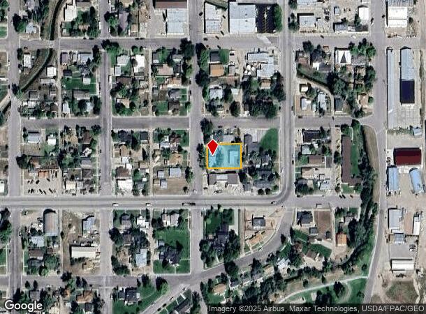
404 10Th St, Wheatland, WY 82201
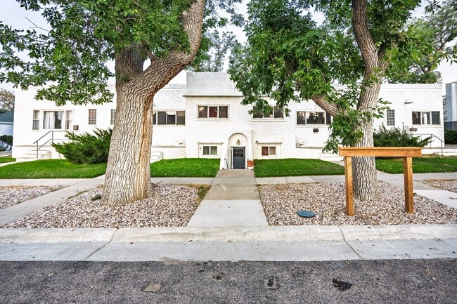
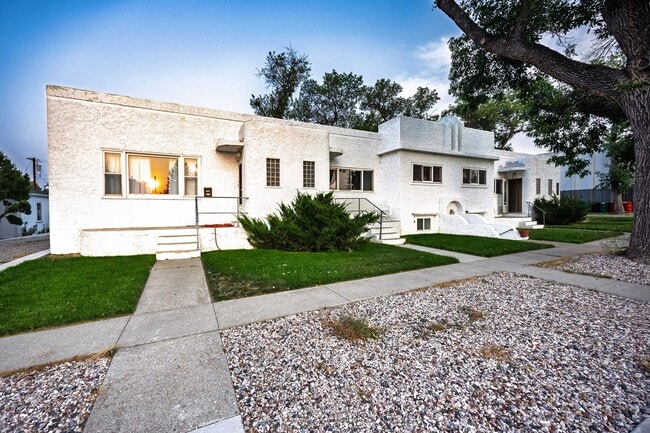
This Property Is For Sale
Property Detail
404 10Th St
Other Market Areas
Wheatland
R0002910
NORTH HALF OF LOT 9
Townhouserowhouse
Platte
2025
Wyoming
2025
7,8,p9
959401
0.40 AC
3,074 SF
I-25 Corridor/Casper
NEARBY LISTINGS FOR SALE OR LEASE
-
-
View all Wheatland listings for sale on LoopNet.com
DEMOGRAPHICS near 404 10Th St
1 mile
3 mile
5 mile
2024 Total Population
3,333
5,090
5,563
2029 Population
3,348
5,098
5,562
Pop Growth 2024-2029
+ 0.45%
+ 0.16%
(0.02%)
Average Age
44
44
44
2024 Total Households
1,469
2,220
2,425
HH Growth 2024-2029
+ 0.54%
+ 0.23%
0.00%
Median Household Inc
$57,420
$59,676
$61,199
Avg Household Size
2.20
2.20
2.20
2024 Avg HH Vehicles
2.00
2.00
2.00
Median Home Value
$244,901
$270,551
$275,611
Median Year Built
1973
1975
1975
Nearby Places
Map Layers
Map Styles
 Street
 Aerial
Transit
 Traffic
 Biking
Places
Listings with unknown addresses are not visible on the map
- Restaurants
- Banks
- Shops
- Fitness
- Groceries
Nearby Properties
Address
Land Use
TOTAL SIZE
Lot Size
Zoning
Address
Land Use
TOTAL SIZE
Lot Size
Zoning
37,368 SF
2.43 AC
Address
Land Use
TOTAL SIZE
Lot Size
Zoning
1,884 SF
2,289 AC
Address
Land Use
TOTAL SIZE
Lot Size
Zoning
28,254 SF
1.85 AC
Address
Land Use
TOTAL SIZE
Lot Size
Zoning
19,248 SF
2.54 AC
Address
Land Use
TOTAL SIZE
Lot Size
Zoning
51,771 SF
3.65 AC
Address
Land Use
TOTAL SIZE
Lot Size
Zoning
3,228 SF
2.12 AC
Address
Land Use
TOTAL SIZE
Lot Size
Zoning
4,288 SF
3.63 AC
Address
Land Use
TOTAL SIZE
Lot Size
Zoning
5,933 SF
0.70 AC
Address
Land Use
TOTAL SIZE
Lot Size
Zoning
26,242 SF
3.39 AC
Address
Land Use
TOTAL SIZE
Lot Size
Zoning
12,673 SF
2.46 AC
Address
Land Use
TOTAL SIZE
Lot Size
Zoning
1,262 SF
119 AC
Address
Land Use
TOTAL SIZE
Lot Size
Zoning
12,856 SF
1.34 AC
Address
Land Use
TOTAL SIZE
Lot Size
Zoning
2,216 SF
240 AC
Address
Land Use
TOTAL SIZE
Lot Size
Zoning
14,382 SF
2.33 AC
Address
Land Use
TOTAL SIZE
Lot Size
Zoning
35,197 SF
3.22 AC
Address
Land Use
TOTAL SIZE
Lot Size
Zoning
18,300 SF
3.85 AC
Address
Land Use
TOTAL SIZE
Lot Size
Zoning
6,944 SF
1.09 AC
Address
Land Use
TOTAL SIZE
Lot Size
Zoning
2,190 SF
3 AC
Address
Land Use
TOTAL SIZE
Lot Size
Zoning
6,407 SF
0.80 AC
Address
Land Use
TOTAL SIZE
Lot Size
Zoning
2,351 SF
249.98 AC
Address
Land Use
TOTAL SIZE
Lot Size
Zoning
1,802 SF
320 AC
Address
Land Use
TOTAL SIZE
Lot Size
Zoning
8,400 SF
4.50 AC
Address
Land Use
TOTAL SIZE
Lot Size
Zoning
6,782 SF
1.66 AC
Address
Land Use
TOTAL SIZE
Lot Size
Zoning
1,176 SF
337 AC
Address
Land Use
TOTAL SIZE
Lot Size
Zoning
1,132 SF
251 AC
Address
Land Use
TOTAL SIZE
Lot Size
Zoning
4,334 SF
0.57 AC
Address
Land Use
TOTAL SIZE
Lot Size
Zoning
3,109 SF
7.53 AC
Address
Land Use
TOTAL SIZE
Lot Size
Zoning
10,032 SF
0.48 AC
Address
Land Use
TOTAL SIZE
Lot Size
Zoning
20,210 SF
8.06 AC
Address
Land Use
TOTAL SIZE
Lot Size
Zoning
1,654 SF
357.94 AC
The World's #1 Commercial Real Estate Marketplace
Connect with us
© 2026 CoStar Group
The information above has been obtained from sources believed reliable. While we do not doubt its accuracy we have not verified it and make no guarantee, warranty or representation about it. It is your responsibility to independently confirm its accuracy and completeness. Any projections, opinions, assumptions, or estimates used are for example only and do not represent the current or future performance of the property. The value of this transaction to you depends on tax and other factors which should be evaluated by your tax, financial, and legal advisors. You and your advisors should conduct a careful, independent investigation of the property to determine to your satisfaction the suitability of the property for your needs.