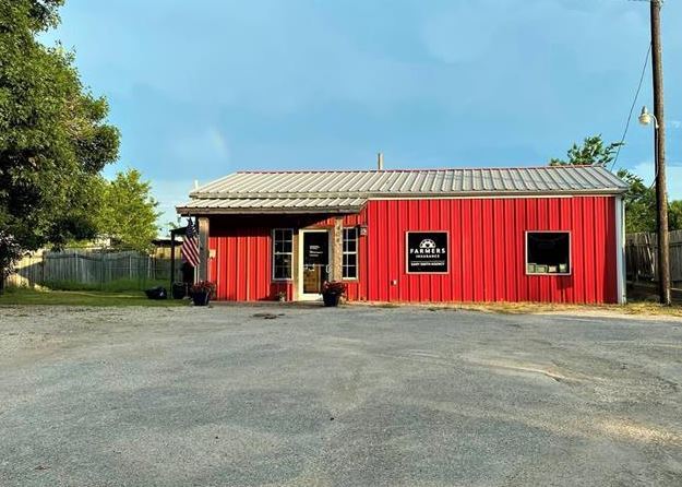
Property Record
404 Blackjack St, Lockhart, TX 78644


NEARBY LISTINGS FOR SALE OR LEASE
Property Detail
404 Blackjack St
Austin-Round Rock-San Marcos, TX
George, James
17534
A009 GEORGE, JAMES, ACRES .246
Commercialnec
Caldwell
X
Texas
48055C0235E
19-g
2025
0.25 AC
2025
Caldwell County
960200
Austin
1,200 SF
DEMOGRAPHICS near 404 Blackjack St
1 Mile
3 Mile
5 Mile
2024 Total Population
6,570
17,010
18,792
2029 Population
7,198
18,729
20,653
Pop Growth 2024-2029
+ 9.56%
+ 10.11%
+ 9.90%
Average Age
40
39
39
2024 Total Households
2,020
5,768
6,327
HH Growth 2024-2029
+ 10.45%
+ 10.73%
+ 10.51%
Median Household Inc
$59,237
$66,220
$66,433
Avg Household Size
2.60
2.60
2.70
2024 Avg HH Vehicles
2.00
2.00
2.00
Median Home Value
$166,450
$188,841
$190,232
Median Year Built
1982
1986
1986
Nearby Places
Map Layers
Map Styles
 Street
 Aerial
- Restaurants
- Banks
- Shops
- Fitness
- Groceries
PUBLIC TRANSPORTATION
AIRPORT
Austin-Bergstrom International
DRIVE
WALK
Distance
Austin-Bergstrom International
34 min
24.8 mi
SALE & LEASE HISTORY
LISTING DATE
SALE/LEASE

Sep 09, 2021
For Sale
May 10, 2017
For Sale
Jun 15, 2017
For Sale
Jan 31, 2017
For Sale
Apr 07, 2017
For Sale
Nearby Properties
Address
Land Use
TOTAL SIZE
Lot Size
Zoning
Address
Land Use
TOTAL SIZE
Lot Size
Zoning
46,884 SF
31.13 AC
Address
Land Use
TOTAL SIZE
Lot Size
Zoning
206,310 SF
7.50 AC
Address
Land Use
TOTAL SIZE
Lot Size
Zoning
3,307 SF
16.31 AC
Address
Land Use
TOTAL SIZE
Lot Size
Zoning
115,669 SF
21.70 AC
Address
Land Use
TOTAL SIZE
Lot Size
Zoning
4,716 SF
8.97 AC
Address
Land Use
TOTAL SIZE
Lot Size
Zoning
3,193 SF
7.62 AC
Address
Land Use
TOTAL SIZE
Lot Size
Zoning
152,063 SF
73.48 AC
Address
Land Use
TOTAL SIZE
Lot Size
Zoning
175,590 SF
30.47 AC
Address
Land Use
TOTAL SIZE
Lot Size
Zoning
83,362 SF
10.87 AC
Address
Land Use
TOTAL SIZE
Lot Size
Zoning
2,226 SF
8.61 AC
Address
Land Use
TOTAL SIZE
Lot Size
Zoning
7,000 SF
8.81 AC
Address
Land Use
TOTAL SIZE
Lot Size
Zoning
58,369 SF
20.20 AC
Address
Land Use
TOTAL SIZE
Lot Size
Zoning
1,489 SF
105.83 AC
Address
Land Use
TOTAL SIZE
Lot Size
Zoning
52,582 SF
7.89 AC
Address
Land Use
TOTAL SIZE
Lot Size
Zoning
49,000 SF
24.58 AC
Address
Land Use
TOTAL SIZE
Lot Size
Zoning
271.12 AC
Address
Land Use
TOTAL SIZE
Lot Size
Zoning
2,758 SF
6.94 AC
Address
Land Use
TOTAL SIZE
Lot Size
Zoning
43,248 SF
5.85 AC
Address
Land Use
TOTAL SIZE
Lot Size
Zoning
2,700 SF
29.22 AC
Address
Land Use
TOTAL SIZE
Lot Size
Zoning
69,127 SF
14.23 AC
Address
Land Use
TOTAL SIZE
Lot Size
Zoning
55,946 SF
7.86 AC
Address
Land Use
TOTAL SIZE
Lot Size
Zoning
19,005 SF
7.54 AC
Address
Land Use
TOTAL SIZE
Lot Size
Zoning
38,420 SF
4.37 AC
Address
Land Use
TOTAL SIZE
Lot Size
Zoning
2,500 SF
268.41 AC
Address
Land Use
TOTAL SIZE
Lot Size
Zoning
1,388 SF
6 AC
Address
Land Use
TOTAL SIZE
Lot Size
Zoning
25,742 SF
7.36 AC
Address
Land Use
TOTAL SIZE
Lot Size
Zoning
40,514 SF
5 AC
Address
Land Use
TOTAL SIZE
Lot Size
Zoning
1,950 SF
6 AC
Address
Land Use
TOTAL SIZE
Lot Size
Zoning
8,417 SF
7.62 AC
Address
Land Use
TOTAL SIZE
Lot Size
Zoning
55,860 SF
19.80 AC
The World's #1 Commercial Real Estate Marketplace
Connect with us
© 2026 CoStar Group
The information above has been obtained from sources believed reliable. While we do not doubt its accuracy we have not verified it and make no guarantee, warranty or representation about it. It is your responsibility to independently confirm its accuracy and completeness. Any projections, opinions, assumptions, or estimates used are for example only and do not represent the current or future performance of the property. The value of this transaction to you depends on tax and other factors which should be evaluated by your tax, financial, and legal advisors. You and your advisors should conduct a careful, independent investigation of the property to determine to your satisfaction the suitability of the property for your needs.