Property Record
4040 Highway 17, Murrells Inlet, SC 29576
NEARBY LISTINGS FOR SALE OR LEASE
-
-
View all Murrells Inlet listings for sale on LoopNet.com
Property Detail
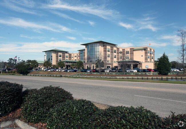
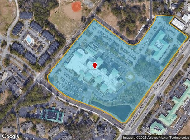
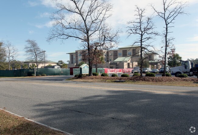
4040 Highway 17
Georgetown, SC
Ho
41-0108-013-01-00
PT TR I, US 17 BYPASS; SLD 742-9 (HOSPITAL)
Hospitalpublic
Georgetown
X
South Carolina
45043C0241G
20.55 AC
2025
Myrtle Beach South
2024
Other Market Areas
920511
DEMOGRAPHICS near 4040 Highway 17
1 Mile
3 Mile
5 Mile
2024 Total Population
4,336
25,513
48,387
2029 Population
4,576
29,234
57,294
Pop Growth 2024-2029
+ 5.54%
+ 14.58%
+ 18.41%
Average Age
52
53
52
2024 Total Households
2,052
12,100
22,693
HH Growth 2024-2029
+ 5.17%
+ 13.61%
+ 17.34%
Median Household Inc
$64,775
$61,322
$62,729
Avg Household Size
2.10
2.10
2.10
2024 Avg HH Vehicles
2.00
2.00
2.00
Median Home Value
$317,143
$271,676
$258,357
Median Year Built
2000
2000
1997
Nearby Places
Map Layers
Map Styles
 Street
 Aerial
- Restaurants
- Banks
- Shops
- Fitness
- Groceries
PUBLIC TRANSPORTATION
AIRPORT
Myrtle Beach International
DRIVE
WALK
Distance
Myrtle Beach International
24 min
15.0 mi
Freight Ports
Wando Welch Terminal
DRIVE
WALK
Distance
Wando Welch Terminal
101 min
76.1 mi
Nearby Properties
Address
Land Use
TOTAL SIZE
Lot Size
Zoning
Address
Land Use
TOTAL SIZE
Lot Size
Zoning
8,169 SF
2.70 AC
Address
Land Use
TOTAL SIZE
Lot Size
Zoning
37,976 SF
3.76 AC
Address
Land Use
TOTAL SIZE
Lot Size
Zoning
Address
Land Use
TOTAL SIZE
Lot Size
Zoning
13,244 SF
3.50 AC
Address
Land Use
TOTAL SIZE
Lot Size
Zoning
Address
Land Use
TOTAL SIZE
Lot Size
Zoning
3,696 SF
55.20 AC
Address
Land Use
TOTAL SIZE
Lot Size
Zoning
15,704 SF
1.97 AC
Address
Land Use
TOTAL SIZE
Lot Size
Zoning
7,144 SF
187.64 AC
Address
Land Use
TOTAL SIZE
Lot Size
Zoning
4.60 AC
Address
Land Use
TOTAL SIZE
Lot Size
Zoning
151,727 SF
21.25 AC
Address
Land Use
TOTAL SIZE
Lot Size
Zoning
10,532 SF
2.90 AC
Address
Land Use
TOTAL SIZE
Lot Size
Zoning
2,510 SF
43.14 AC
Address
Land Use
TOTAL SIZE
Lot Size
Zoning
5,570 SF
21.44 AC
Address
Land Use
TOTAL SIZE
Lot Size
Zoning
Address
Land Use
TOTAL SIZE
Lot Size
Zoning
6,170 SF
2.50 AC
Address
Land Use
TOTAL SIZE
Lot Size
Zoning
Address
Land Use
TOTAL SIZE
Lot Size
Zoning
Address
Land Use
TOTAL SIZE
Lot Size
Zoning
Address
Land Use
TOTAL SIZE
Lot Size
Zoning
Address
Land Use
TOTAL SIZE
Lot Size
Zoning
4,800 SF
75.54 AC
Address
Land Use
TOTAL SIZE
Lot Size
Zoning
5,230 SF
19.39 AC
Address
Land Use
TOTAL SIZE
Lot Size
Zoning
65,578 SF
12.12 AC
Address
Land Use
TOTAL SIZE
Lot Size
Zoning
Address
Land Use
TOTAL SIZE
Lot Size
Zoning
64,620 SF
7.90 AC
Address
Land Use
TOTAL SIZE
Lot Size
Zoning
3,450 SF
5.28 AC
RMM1*
Address
Land Use
TOTAL SIZE
Lot Size
Zoning
3,052 SF
1 AC
Address
Land Use
TOTAL SIZE
Lot Size
Zoning
Address
Land Use
TOTAL SIZE
Lot Size
Zoning
108,250 SF
14.53 AC
The World's #1 Commercial Real Estate Marketplace
Connect with us
© 2025 CoStar Group
The information above has been obtained from sources believed reliable. While we do not doubt its accuracy we have not verified it and make no guarantee, warranty or representation about it. It is your responsibility to independently confirm its accuracy and completeness. Any projections, opinions, assumptions, or estimates used are for example only and do not represent the current or future performance of the property. The value of this transaction to you depends on tax and other factors which should be evaluated by your tax, financial, and legal advisors. You and your advisors should conduct a careful, independent investigation of the property to determine to your satisfaction the suitability of the property for your needs.