Property Record
4040 Range Line St, Columbia, MO 65202


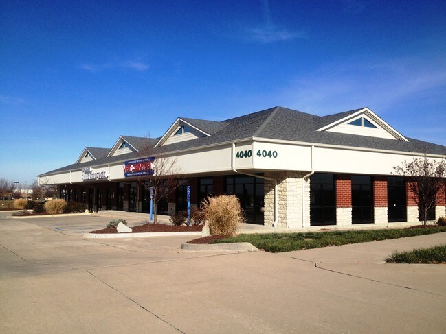
Property Detail
4040 Range Line St
12-703-00-07-007-00-01
THE NORTH WOODS PLAT 1 ADMINISTRATIVE PLAT LOT 7A AND PT VAC STREET
Storebuilding
Boone
CP
Missouri
B and X Area of moderate flood hazard, usually the area between the limits of the 100-year and 500-year floods.
7a
2025
1.41 AC
2025
Columbia/Jefferson City
001508
Other Market Areas
10,400 SF
Columbia, MO
NEARBY LISTINGS FOR SALE OR LEASE
DEMOGRAPHICS near 4040 Range Line St
1 mile
3 mile
5 mile
2025 Total Population
7,782
44,535
104,708
2030 Population
8,018
46,422
108,975
Pop Growth 2025-2030
+ 3.03%
+ 4.24%
+ 4.08%
Average Age
36
36
35
2025 Total Households
2,971
18,829
42,562
HH Growth 2025-2030
+ 3.23%
+ 4.48%
+ 4.41%
Median Household Inc
$92,613
$58,427
$61,992
Avg Household Size
2.50
2.20
2.20
2025 Avg HH Vehicles
2.00
2.00
2.00
Median Home Value
$237,109
$192,705
$229,022
Median Year Built
2000
1988
1987
Nearby Places
Map Layers
Map Styles
 Street
 Aerial
Layers
 Traffic
 Biking
Places
Listings with unknown addresses are not visible on the map
- Restaurants
- Banks
- Shops
- Fitness
- Groceries
PUBLIC TRANSPORTATION
AIRPORT
Columbia Regional
Drive
Walk
Distance
Columbia Regional
22 min
16.0 mi
SALE & LEASE HISTORY
LISTING DATE
SALE/LEASE

Oct 25, 2017
For Sale
Feb 28, 2021
For Lease
Feb 10, 2023
For Lease
Aug 22, 2017
For Lease
Nearby Properties
Address
Land Use
TOTAL SIZE
Lot Size
Zoning
Address
Land Use
TOTAL SIZE
Lot Size
Zoning
321,295 SF
79.83 AC
Address
Land Use
TOTAL SIZE
Lot Size
Zoning
171,157 SF
5.60 AC
O1
Address
Land Use
TOTAL SIZE
Lot Size
Zoning
40,016 SF
2.13 AC
O1
Address
Land Use
TOTAL SIZE
Lot Size
Zoning
3,808 SF
0.39 AC
C2
Address
Land Use
TOTAL SIZE
Lot Size
Zoning
134,625 SF
0.79 AC
C2
Address
Land Use
TOTAL SIZE
Lot Size
Zoning
45,750 SF
0.66 AC
R3
Address
Land Use
TOTAL SIZE
Lot Size
Zoning
38,500 SF
3.10 AC
O1
Address
Land Use
TOTAL SIZE
Lot Size
Zoning
87,060 SF
0.37 AC
R3
Address
Land Use
TOTAL SIZE
Lot Size
Zoning
125,487 SF
3.36 AC
Address
Land Use
TOTAL SIZE
Lot Size
Zoning
136,448 SF
0.78 AC
C2
Address
Land Use
TOTAL SIZE
Lot Size
Zoning
68,408 SF
4.38 AC
O1
Address
Land Use
TOTAL SIZE
Lot Size
Zoning
184,413 SF
17.63 AC
CP
Address
Land Use
TOTAL SIZE
Lot Size
Zoning
17,589 SF
0.52 AC
C2
Address
Land Use
TOTAL SIZE
Lot Size
Zoning
125,907 SF
22.59 AC
C3
Address
Land Use
TOTAL SIZE
Lot Size
Zoning
56,305 SF
12 AC
CP
Address
Land Use
TOTAL SIZE
Lot Size
Zoning
34,707 SF
0.41 AC
R3
Address
Land Use
TOTAL SIZE
Lot Size
Zoning
35,436 SF
19.09 AC
Address
Land Use
TOTAL SIZE
Lot Size
Zoning
93,320 SF
0.50 AC
C2
Address
Land Use
TOTAL SIZE
Lot Size
Zoning
32,686 SF
3.20 AC
O1
Address
Land Use
TOTAL SIZE
Lot Size
Zoning
83,978 SF
8.60 AC
C3
Address
Land Use
TOTAL SIZE
Lot Size
Zoning
115,194 SF
8.10 AC
C3
Address
Land Use
TOTAL SIZE
Lot Size
Zoning
25,578 SF
0.43 AC
C2
Address
Land Use
TOTAL SIZE
Lot Size
Zoning
167,255 SF
14.14 AC
Address
Land Use
TOTAL SIZE
Lot Size
Zoning
137,347 SF
16.53 AC
C3
Address
Land Use
TOTAL SIZE
Lot Size
Zoning
122,680 SF
1.19 AC
Address
Land Use
TOTAL SIZE
Lot Size
Zoning
63,121 SF
11.28 AC
Address
Land Use
TOTAL SIZE
Lot Size
Zoning
41,600 SF
5.42 AC
Address
Land Use
TOTAL SIZE
Lot Size
Zoning
30,872 SF
4.70 AC
Address
Land Use
TOTAL SIZE
Lot Size
Zoning
109,620 SF
0.90 AC
Address
Land Use
TOTAL SIZE
Lot Size
Zoning
108,632 SF
0.93 AC
The World's #1 Commercial Real Estate Marketplace
Connect with us
© 2026 CoStar Group
The information above has been obtained from sources believed reliable. While we do not doubt its accuracy we have not verified it and make no guarantee, warranty or representation about it. It is your responsibility to independently confirm its accuracy and completeness. Any projections, opinions, assumptions, or estimates used are for example only and do not represent the current or future performance of the property. The value of this transaction to you depends on tax and other factors which should be evaluated by your tax, financial, and legal advisors. You and your advisors should conduct a careful, independent investigation of the property to determine to your satisfaction the suitability of the property for your needs.