Property Record
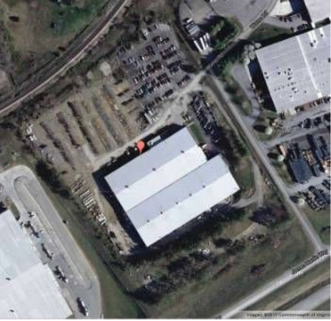
4041 Wurno Rd, Pulaski, VA 24301


Property Detail
4041 Wurno Rd
09189
NEAR NEWBERN
Commercialnec
Pulaski
PI2
Virginia
A Areas with a 1% annual chance of flooding and a 26% chance of flooding over the life of a 30-year mortgage.
13.53 AC
2025
Blacksburg & Wytheville
2025
Other Market Areas
210202
Blacksburg-Christiansburg-Radford, VA
NEARBY LISTINGS FOR SALE OR LEASE
DEMOGRAPHICS near 4041 Wurno Rd
1 mile
3 mile
5 mile
2025 Total Population
695
9,637
20,581
2030 Population
684
9,553
20,475
Pop Growth 2025-2030
(1.58%)
(0.87%)
(0.52%)
Average Age
47
44
44
2025 Total Households
322
4,159
8,836
HH Growth 2025-2030
(1.55%)
(0.87%)
(0.54%)
Median Household Inc
$47,500
$52,735
$57,022
Avg Household Size
2.10
2.20
2.20
2025 Avg HH Vehicles
2.00
2.00
2.00
Median Home Value
$235,326
$193,999
$187,859
Median Year Built
1975
1970
1970
Nearby Places
Map Layers
Map Styles
 Street
 Aerial
Transit
 Traffic
 Biking
Places
Listings with unknown addresses are not visible on the map
- Restaurants
- Banks
- Shops
- Fitness
- Groceries
SALE & LEASE HISTORY
LISTING DATE
SALE/LEASE

Sep 24, 2016
For Sale
Nearby Properties
Address
Land Use
TOTAL SIZE
Lot Size
Zoning
Address
Land Use
TOTAL SIZE
Lot Size
Zoning
311.77 AC
I1
Address
Land Use
TOTAL SIZE
Lot Size
Zoning
96.26 AC
R1
Address
Land Use
TOTAL SIZE
Lot Size
Zoning
59.03 AC
CM1
Address
Land Use
TOTAL SIZE
Lot Size
Zoning
51.77 AC
I2
Address
Land Use
TOTAL SIZE
Lot Size
Zoning
270.75 AC
I1
Address
Land Use
TOTAL SIZE
Lot Size
Zoning
39.42 AC
I1
Address
Land Use
TOTAL SIZE
Lot Size
Zoning
22.28 AC
R
Address
Land Use
TOTAL SIZE
Lot Size
Zoning
17.08 AC
R1
Address
Land Use
TOTAL SIZE
Lot Size
Zoning
2.72 AC
I1
Address
Land Use
TOTAL SIZE
Lot Size
Zoning
21.57 AC
CM1
Address
Land Use
TOTAL SIZE
Lot Size
Zoning
35.80 AC
R
Address
Land Use
TOTAL SIZE
Lot Size
Zoning
46.90 AC
I1
Address
Land Use
TOTAL SIZE
Lot Size
Zoning
30 AC
I1
Address
Land Use
TOTAL SIZE
Lot Size
Zoning
10.12 AC
PI2
Address
Land Use
TOTAL SIZE
Lot Size
Zoning
8.76 AC
I1
Address
Land Use
TOTAL SIZE
Lot Size
Zoning
8.92 AC
I1
Address
Land Use
TOTAL SIZE
Lot Size
Zoning
Address
Land Use
TOTAL SIZE
Lot Size
Zoning
3.02 AC
R
Address
Land Use
TOTAL SIZE
Lot Size
Zoning
7.22 AC
R
Address
Land Use
TOTAL SIZE
Lot Size
Zoning
16.74 AC
I1
Address
Land Use
TOTAL SIZE
Lot Size
Zoning
6.11 AC
R
Address
Land Use
TOTAL SIZE
Lot Size
Zoning
3.96 AC
PB2
Address
Land Use
TOTAL SIZE
Lot Size
Zoning
6.95 AC
R
Address
Land Use
TOTAL SIZE
Lot Size
Zoning
20.71 AC
0059
Address
Land Use
TOTAL SIZE
Lot Size
Zoning
Address
Land Use
TOTAL SIZE
Lot Size
Zoning
8.46 AC
R
Address
Land Use
TOTAL SIZE
Lot Size
Zoning
7.32 AC
CM1
Address
Land Use
TOTAL SIZE
Lot Size
Zoning
81.48 AC
C1
Address
Land Use
TOTAL SIZE
Lot Size
Zoning
6.20 AC
PB2
The World's #1 Commercial Real Estate Marketplace
Connect with us
© 2026 CoStar Group
The information above has been obtained from sources believed reliable. While we do not doubt its accuracy we have not verified it and make no guarantee, warranty or representation about it. It is your responsibility to independently confirm its accuracy and completeness. Any projections, opinions, assumptions, or estimates used are for example only and do not represent the current or future performance of the property. The value of this transaction to you depends on tax and other factors which should be evaluated by your tax, financial, and legal advisors. You and your advisors should conduct a careful, independent investigation of the property to determine to your satisfaction the suitability of the property for your needs.