Property Record
4045 Orchard Rd Se, Smyrna, GA 30080

NEARBY LISTINGS FOR SALE OR LEASE
Property Detail
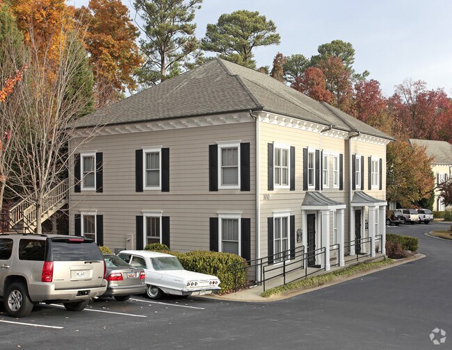
4045 Orchard Rd Se
17-0817-0-158-0
Orchard Office Park Condominium
Officecondo
Cobb
X
Georgia
13067C0226G
3
2025
0.02 AC
2025
Cumberland/Galleria
031209
Atlanta
961 SF
Atlanta-Sandy Springs-Roswell, GA
DEMOGRAPHICS near 4045 Orchard Rd Se
1 Mile
3 Mile
5 Mile
2024 Total Population
14,700
87,096
205,685
2029 Population
15,135
89,013
210,317
Pop Growth 2024-2029
+ 2.96%
+ 2.20%
+ 2.25%
Average Age
39
38
37
2024 Total Households
7,344
42,800
93,147
HH Growth 2024-2029
+ 3.17%
+ 2.21%
+ 2.26%
Median Household Inc
$100,257
$94,558
$91,090
Avg Household Size
2.00
2.00
2.20
2024 Avg HH Vehicles
2.00
2.00
2.00
Median Home Value
$513,645
$423,489
$403,702
Median Year Built
1998
1993
1988
Nearby Places
Map Layers
Map Styles
 Street
 Aerial
- Restaurants
- Banks
- Shops
- Fitness
- Groceries
PUBLIC TRANSPORTATION
AIRPORT
Hartsfield - Jackson Atlanta International
DRIVE
WALK
Distance
Hartsfield - Jackson Atlanta International
34 min
23.0 mi
Nearby Properties
Address
Land Use
TOTAL SIZE
Lot Size
Zoning
Address
Land Use
TOTAL SIZE
Lot Size
Zoning
41,500 SF
15.61 AC
RRC
Address
Land Use
TOTAL SIZE
Lot Size
Zoning
3,929,999 SF
32.70 AC
OHR
Address
Land Use
TOTAL SIZE
Lot Size
Zoning
649,754 SF
20.73 AC
PSC/CRC
Address
Land Use
TOTAL SIZE
Lot Size
Zoning
1,116,209 SF
5.05 AC
OHR
Address
Land Use
TOTAL SIZE
Lot Size
Zoning
417,453 SF
21.94 AC
RMR
Address
Land Use
TOTAL SIZE
Lot Size
Zoning
173,430 SF
13.83 AC
PVC
Address
Land Use
TOTAL SIZE
Lot Size
Zoning
789,925 SF
3.77 AC
GC
Address
Land Use
TOTAL SIZE
Lot Size
Zoning
394,294 SF
21.56 AC
OHR
Address
Land Use
TOTAL SIZE
Lot Size
Zoning
5.36 AC
RRC
Address
Land Use
TOTAL SIZE
Lot Size
Zoning
968,384 SF
4.93 AC
GC
Address
Land Use
TOTAL SIZE
Lot Size
Zoning
468,079 SF
31.79 AC
RMR
Address
Land Use
TOTAL SIZE
Lot Size
Zoning
583,570 SF
4.56 AC
PVC/OI
Address
Land Use
TOTAL SIZE
Lot Size
Zoning
403,545 SF
6.33 AC
RRC
Address
Land Use
TOTAL SIZE
Lot Size
Zoning
883,054 SF
3 AC
GC
Address
Land Use
TOTAL SIZE
Lot Size
Zoning
16,408 SF
8.97 AC
PVC
Address
Land Use
TOTAL SIZE
Lot Size
Zoning
480,544 SF
2.36 AC
RRC
Address
Land Use
TOTAL SIZE
Lot Size
Zoning
483,147 SF
29.70 AC
RM-16
Address
Land Use
TOTAL SIZE
Lot Size
Zoning
482,016 SF
50.92 AC
RM-8
Address
Land Use
TOTAL SIZE
Lot Size
Zoning
3.51 AC
RRC
Address
Land Use
TOTAL SIZE
Lot Size
Zoning
914,424 SF
56.61 AC
OI
Address
Land Use
TOTAL SIZE
Lot Size
Zoning
550,043 SF
26.83 AC
OI
Address
Land Use
TOTAL SIZE
Lot Size
Zoning
2.81 AC
RRC
Address
Land Use
TOTAL SIZE
Lot Size
Zoning
389,428 SF
22.50 AC
RM12
Address
Land Use
TOTAL SIZE
Lot Size
Zoning
550,144 SF
4.70 AC
RRC
Address
Land Use
TOTAL SIZE
Lot Size
Zoning
560,836 SF
60.28 AC
RM-8
Address
Land Use
TOTAL SIZE
Lot Size
Zoning
787,804 SF
5.64 AC
GC
Address
Land Use
TOTAL SIZE
Lot Size
Zoning
606,936 SF
7.92 AC
GC
Address
Land Use
TOTAL SIZE
Lot Size
Zoning
509,000 SF
4.36 AC
CRC
Address
Land Use
TOTAL SIZE
Lot Size
Zoning
605,670 SF
4.10 AC
GC
Address
Land Use
TOTAL SIZE
Lot Size
Zoning
258,674 SF
1.81 AC
RRC
The World's #1 Commercial Real Estate Marketplace
Connect with us
© 2025 CoStar Group
The information above has been obtained from sources believed reliable. While we do not doubt its accuracy we have not verified it and make no guarantee, warranty or representation about it. It is your responsibility to independently confirm its accuracy and completeness. Any projections, opinions, assumptions, or estimates used are for example only and do not represent the current or future performance of the property. The value of this transaction to you depends on tax and other factors which should be evaluated by your tax, financial, and legal advisors. You and your advisors should conduct a careful, independent investigation of the property to determine to your satisfaction the suitability of the property for your needs.